


Refine your search for walks in Plainfaing
Plainfaing walks


 The memorial walls of Fraize
 Visorando Member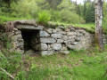
 2.31 mi
 +318 ft
 -318 ft
 1h 20
1h 20
 Easy
Easy
 Departure from Fraize (Vosges)
The La Costelle heritage conservation association, volunteers from the Haute-Meurthe branch of the Club Vosgien, the tourist development organisation (ATEHM) and the municipality of Fraize have joined forces to breathe new life into this heritage site. The route has been redesigned, the site cleared and the walls showcased. The information board at the start provides all the details on the history of these walls (see QR code) and on walks in the area.
Walk to the Roche du Sphinx in Anould
 1.21 mi
+135 ft
-148 ft
0h 40
Easy
Departure from Anould (Vosges)
1.21 mi
+135 ft
-148 ft
0h 40
Easy
Departure from Anould (Vosges)
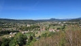
A very easy little walk that takes you along a fully shaded forest path to the Roche du Sphinx, a natural site situated at an altitude of around 560 m above Anould. As an added bonus, there’s a lovely picnic area where you can relax and enjoy the surroundings.
Circular walk starting from the Col du Bonhomme
5.97 mi
+938 ft
-968 ft
3h 35
 Moderate
Departure from Le Bonhomme (Haut-Rhin)
Moderate
Departure from Le Bonhomme (Haut-Rhin)
A pleasant walk for the whole family, with a lovely climb at the end.
Recommended in good weather; otherwise, the start of the path is muddy.
Rudlin Waterfall
 1.47 mi
+404 ft
-404 ft
1h 00
Easy
Departure from Plainfaing (Vosges)
1.47 mi
+404 ft
-404 ft
1h 00
Easy
Departure from Plainfaing (Vosges)
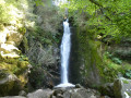
By making a loop from the Étang des Dames, you can quickly reach the Rudlin Waterfall. This is a pretty waterfall about ten metres high, accessible via a path through the woods from the bottom of the valley.
Le Gazon du Faing from Rudlin
 7.61 mi
+2,008 ft
-1,982 ft
5h 15
Moderate
Departure from Plainfaing (Vosges)
7.61 mi
+2,008 ft
-1,982 ft
5h 15
Moderate
Departure from Plainfaing (Vosges)
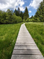
This hike takes you to the Hautes Chaumes in the Tanet-Gazon du Faing Nature Reserve, starting on the Vosges side via the Ruhlock trail along a stream and returning via the Rudlin waterfall.There are beautiful views from the ridges over Lac Blanc and Lac des Truites or Lac du Forlet.
Around the Tête des Faux from the Col du Calvaire via the Étang du Devin
 7.87 mi
+928 ft
-928 ft
4h 25
Moderate
Departure from Le Bonhomme (Haut-Rhin)
7.87 mi
+928 ft
-928 ft
4h 25
Moderate
Departure from Le Bonhomme (Haut-Rhin)
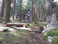
An easy hike through pine and blueberry forests, allowing you to discover relics from the 1914-1918 war and offering wide views of the Orbey valley and the Vosges mountain ranges in the first part of the hike.
L'Étang du Devin via the Tête des Faux
 6.38 mi
+1,447 ft
-1,470 ft
4h 10
Moderate
Departure from Le Bonhomme (Haut-Rhin)
6.38 mi
+1,447 ft
-1,470 ft
4h 10
Moderate
Departure from Le Bonhomme (Haut-Rhin)
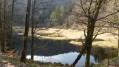
A lovely walk through the woods starting from the Lac Blanc winter sports resort.The Étang du Devin is the main attraction of this hike, offering beautiful views of the Béhtine Valley.Memories of the First World War hang over the first part of the walk.A hike best undertaken in fine weather or in winter when there is a lack of snow.
Tour of Lac Blanc via the Ferme-auberge du Pré Bracot
 Tourism professional6.61 mi
+1,732 ft
-1,759 ft
4h 35
Moderate
Departure from Le Bonhomme (Haut-Rhin)
Tourism professional6.61 mi
+1,732 ft
-1,759 ft
4h 35
Moderate
Departure from Le Bonhomme (Haut-Rhin)
This circular route, starting from the Lac Blanc resort, takes in some of the most beautiful sites in the Hautes Vosges (Gazon du Faing, Château Hans) and ends at the Ferme-auberge du Pré Bracot.
Tête des Faux and Duchesne Cemetery from Col du Calvaire
 4.50 mi
+525 ft
-538 ft
2h 30
Moderate
Departure from Le Bonhomme (Haut-Rhin)
4.50 mi
+525 ft
-538 ft
2h 30
Moderate
Departure from Le Bonhomme (Haut-Rhin)
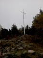
A memorial hike to a small peak that was the scene of violent clashes in 1914-1915, traces of which are still visible on the ground. Along the way, you will pass the very moving Duchesne Cemetery located in the middle of the forest.
The Lac Blanc viewpoints
 2.45 mi
+390 ft
-407 ft
1h 30
Easy
Departure from Orbey (Haut-Rhin)
2.45 mi
+390 ft
-407 ft
1h 30
Easy
Departure from Orbey (Haut-Rhin)
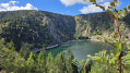
After a wide, tree-lined path, the view suddenly opens up onto the lake and its turquoise hues.You can admire the Rocher Hans and the rocky cliffs surrounding the lake. Continue downhill to the Lac Blanc dam, then head back up towards the Auberge du Blancrupt, where you’ll enjoy a panoramic view of the Alsace plain.
Col des Bagenelles and Grand Brezouard from Le Bonhomme
 10.33 mi
+2,211 ft
-2,185 ft
6h 40
10.33 mi
+2,211 ft
-2,185 ft
6h 40
 Difficult
Departure from Le Bonhomme (Haut-Rhin)
Difficult
Departure from Le Bonhomme (Haut-Rhin)
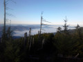
A very beautiful circular hike from Le Bonhomme, which is not too busy. We were lucky enough to pass through areas filled with flowering foxgloves... magnificent.A varied route through forests and pastures.
The Tête des Faux and the Étang du Devin from Le Bonhomme
 5.77 mi
+1,906 ft
-1,929 ft
4h 20
Moderate
Departure from Le Bonhomme (Haut-Rhin)
5.77 mi
+1,906 ft
-1,929 ft
4h 20
Moderate
Departure from Le Bonhomme (Haut-Rhin)
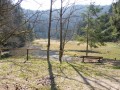
This circular hike starts in the village of Le Bonhomme and follows the "Circuit de la Grande Guerre sur le massif de la Tête des Faux" (Great War Trail on the Tête des Faux massif), which was a fierce battlefield between 1914 and 1915.
Here you will find remnants of the 1914-18 war, two imposing cemeteries, as well as fortifications and technical installations erected by the Germans.
The Étang du Devin and its bucolic setting offer a place to rest.
Gerbepal-Boslimpré-Osseux-Roche des Chiens-Gerbepal
 12.59 mi
+1,604 ft
-1,578 ft
7h 10
Difficult
Departure from Gerbépal (Vosges)
12.59 mi
+1,604 ft
-1,578 ft
7h 10
Difficult
Departure from Gerbépal (Vosges)
This route was chosen for the Popular Walk on 18 June 2017 in Gerbepal.
 From Bonhomme to Calvaire
 8.80 mi
+1,850 ft
-1,837 ft
6 hrs
Moderate
Departure from Le Bonhomme (Haut-Rhin)
8.80 mi
+1,850 ft
-1,837 ft
6 hrs
Moderate
Departure from Le Bonhomme (Haut-Rhin)
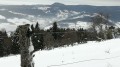
A lovely snowshoe walk in a place steeped in legends and the history of the 1914-1918 war.
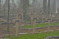
From Bonhomme to Lac Blanc towards Tête des Faux and Étang du Devin
 Association / Club / Walk leader
 9.35 mi
+2,536 ft
-2,526 ft
6h 30
Difficult
Departure from Le Bonhomme (Haut-Rhin)
9.35 mi
+2,536 ft
-2,526 ft
6h 30
Difficult
Departure from Le Bonhomme (Haut-Rhin)
A circular hike starting from Le Bonhomme. It takes us through the forest to Lac Blanc.
The return journey crosses a small section of the battlefields of theFirst World War. There are numerous military structures, as well as a national necropolis and a German military cemetery.
An important place of remembrance in the history of the Alsace region.
Le Bonhomme, the three passes and the battlefields of 1914-1918
 11.31 mi
+2,539 ft
-2,559 ft
7h 25
Difficult
Departure from Le Bonhomme (Haut-Rhin)
11.31 mi
+2,539 ft
-2,559 ft
7h 25
Difficult
Departure from Le Bonhomme (Haut-Rhin)
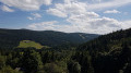
This hike will take you from Le Bonhomme to the 1914-1918 battlefields of Tête des Faux, then to the three passes of Calvaire, Louschbach and Bonhomme. Along the way, depending on the season, you can enjoy the abundance of blueberry bushes along the path.
The Sagard Trail in the Straiture Gorge
 2.88 mi
+545 ft
-518 ft
1h 50
Easy
Departure from Ban-sur-Meurthe-Clefcy (Vosges)
2.88 mi
+545 ft
-518 ft
1h 50
Easy
Departure from Ban-sur-Meurthe-Clefcy (Vosges)
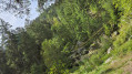
A very pleasant family trail that winds its way between the river and stands of beech and fir trees, taking you on a journey of discovery through this ancient glacial valley. Enjoy the surprisingly cool atmosphere of the area; head up the Route Forestière Louis François to admire a majestic scree slope before a final descent down the mountainside to reach the Lançoir sawmill.
Grand Brézouard
 8.82 mi
+2,238 ft
-2,211 ft
6h 00
Moderate
Departure from Le Bonhomme (Haut-Rhin)
8.82 mi
+2,238 ft
-2,211 ft
6h 00
Moderate
Departure from Le Bonhomme (Haut-Rhin)
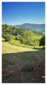
A hike that circles the Grand Brézouard, one of the peaks over 1,200 m located furthest north in the Vosges massif. A fairly demanding route with the main ascent taking place right from the start. Varied terrain and landscapes (woodland, rocky ridge, high-altitude meadows).Please note: at (6) => The quiet zone, in force from 1 December to 1 July, is primarily aimed at preserving habitats favourable to the wildlife of old-growth forests. Furthermore, conditions of silence and tranquillity must be strictly maintained, particularly during the winter and breeding seasons. (INPN - ZNIEFF).
20/08/2024: Route modified to avoid the Grand Brézouard, which has been cleared of signposts to reinforce the quiet zone.
From the Col des Bagenelles to the Mines d'Échery
 11.82 mi
+3,143 ft
-3,136 ft
8h 10
Difficult
Departure from Le Bonhomme (Haut-Rhin)
11.82 mi
+3,143 ft
-3,136 ft
8h 10
Difficult
Departure from Le Bonhomme (Haut-Rhin)
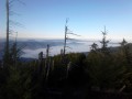
Beautiful hike in the Val d'Argent, via the Tree of Liberty, to discover the old mines of the village of Échery and its clock tower.
Climb to the summit of Grand Brézouard and enjoy a 360° panorama of the Sainte-Marie-aux-Mines valley and the Vosges mountain ranges.
Les Brézouard
 7.56 mi
+1,194 ft
-1,191 ft
4h 30
Moderate
Departure from Le Bonhomme (Haut-Rhin)
7.56 mi
+1,194 ft
-1,191 ft
4h 30
Moderate
Departure from Le Bonhomme (Haut-Rhin)
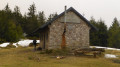
If you want to go on a beautiful hike starting from the Col des Bagenelles, between the valleys of Sainte-Marie-aux-Mines and Kaysersberg, the Petit and Grand Brezouard tour is for you. Here is the Tour des Petit and Grand Brezouard, which offers views of these two valleys, the Alsace plain and, in the distance, the Black Forest. Very well marked by the Club Vosgien, it is suitable for all types of hikers, including children.
20/08/2024: Hike modified to avoid the Grand Brézouard, which has been unmarked to reinforce the quiet zone.
The Three Lakes Route via the Gazon du Faing
9.53 mi
+1,896 ft
-1,900 ft
6h 00
Difficult
Departure from Le Valtin (Vosges)
Starting from the car park at the Auberge du Gazon du Faing, this circular route links three glacial lakes, each with its own distinct character: Lac Blanc, the largest, dominated by the Rocher du Hans and the Belmont Observatory; Lac Noir, wilder and more enclosed; and Lac du Forlet (or Lac des Truites), nestled in a spectacular glacial cirque at an altitude of over 1,060 metres, the highest lake in the Vosges. Between the three lakes, the trail crosses the Gazon du Faing, a nature reserve of tall grasslands and peat bogs, offering breathtaking panoramic views of the Vosges ridges. Around ten kilometres of varied trails, through woodland, along ridges and over rocky outcrops, making for one of the most beautiful hikes in the region.
The Lac Blanc Circuit
 2.71 mi
+791 ft
-784 ft
1h 55
Moderate
Departure from Orbey (Haut-Rhin)
2.71 mi
+791 ft
-784 ft
1h 55
Moderate
Departure from Orbey (Haut-Rhin)
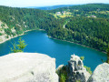
Although the climb up to Rocher Hans and the statue of the Virgin Mary at its summit may not look easy, it isn’t as difficult as it seems, even for little ones. After the effort (all the same), the reward!Of course, Rocher Hans itself is inaccessible, but the various viewpoints overlooking the lake are truly magnificent.Be careful, though – the descent is a bit trickier: less steep, but more slippery in places.The final few hundred metres, along the road, are safe: the path is separated and protected by a metal and wooden guardrail.
Four Lakes Circuit in the Vosges
 10.93 mi
+2,073 ft
-2,103 ft
6h 50
Difficult
Departure from Orbey (Haut-Rhin)
10.93 mi
+2,073 ft
-2,103 ft
6h 50
Difficult
Departure from Orbey (Haut-Rhin)
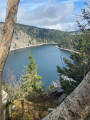
A walk in the Alsatian Vosges from Lac Blanc to Lac Vert and back via Lac des Truites and Lac Noir. These are three circular routes that follow on from one another, so much so that there are two points where you can shorten the route.
- Note added following a comment on 19 August 2026.>Please note : the route passes through an area where access is prohibited; the path between Gazon du Faing (14) and Lac Noir (15) is closed.- Updated by the author on 21 August 2026
Lac Blanc - Tête des Faux circular loop
 6.96 mi
+968 ft
-961 ft
4 hrs
Moderate
Departure from Orbey (Haut-Rhin)
6.96 mi
+968 ft
-961 ft
4 hrs
Moderate
Departure from Orbey (Haut-Rhin)
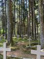
Five routes are marked out in the Lac Blanc 1200 ski resort, offering several levels of difficulty, with distances ranging from 3 to 14 km. This route is a compilation of sections from three of these routes, forming a circular route of approximately 11 km, taking into account the passages closed due to the marking of quiet zones. The route mainly follows forest paths through a forest of tall fir trees. It includes a beautiful but physically demanding climb on a path winding between the trees, a passage near a First World War necropolis, a short descent through the undergrowth, and then an arrival on a stubble field offering a superb view: first of the Alsace plain and the Black Forest in the distance, then of the Lac Blanc glacial cirque. The route continues through the Lac Blanc Adventure Park before returning to the car park.
From Lac Blanc to Gazon de Faing via the Hisrchsteine and the lakes
15.99 mi
+3,222 ft
-3,196 ft
10h 10
 Very difficult
Departure from Orbey (Haut-Rhin)
Very difficult
Departure from Orbey (Haut-Rhin)
A long, challenging hike with a series of ups and downs: it goes up and down. Starting from Lac Blanc, the hike climbs quite steeply towards the Rocher du Hans, offering views over Lac Blanc. This is followed by a descent to Lac Noir, which adds to the beauty of the landscape. Next comes an ascent, then a flat section leading to Lac du Forlet. The hike climbs again and descends to the final lake: Lac Vert. Heading towards the Col de la Schlucht, the route takes you past the Hirschsteine steps and their viewpoint over the Munster valley, followed by a dizzying and somewhat technical section along the cliff face. The return journey then follows the ridge, offering numerous views, along a slightly flatter path that passes through the Tanet and the Gazon du Faing.
Tour of four Alsatian lakes
 10.19 mi
+2,438 ft
-2,434 ft
6h 50
Difficult
Departure from Orbey (Haut-Rhin)
10.19 mi
+2,438 ft
-2,434 ft
6h 50
Difficult
Departure from Orbey (Haut-Rhin)
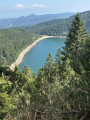
An exceptional hike offering panoramic views of successive lakes. There are a few challenging climbs, but it's well worth the effort. Best done in good weather to fully enjoy the views available to hikers.
The four lakes from Lac Blanc
 9.19 mi
+1,713 ft
-1,706 ft
5h 45
Moderate
Departure from Orbey (Haut-Rhin)
9.19 mi
+1,713 ft
-1,706 ft
5h 45
Moderate
Departure from Orbey (Haut-Rhin)
A magnificent hike with trails that are sometimes alpine in character.
Tour around Blanc and Noir lakes
 5.61 mi
+1,834 ft
-1,808 ft
4h 10
Difficult
Departure from Orbey (Haut-Rhin)
5.61 mi
+1,834 ft
-1,808 ft
4h 10
Difficult
Departure from Orbey (Haut-Rhin)
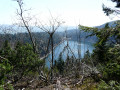
A pretty walk, alternating between rises and descents following sinuous winds and paths over ridges with magnificent views. ‘’The’’ meeting place for local chamois.
Circular Bonhomme, Belvédère Haute Pierre - Faurupt - Haicot - Col Bagenelles
 10.77 mi
+1,650 ft
-1,627 ft
6h 25
Moderate
Departure from Le Bonhomme (Haut-Rhin)
10.77 mi
+1,650 ft
-1,627 ft
6h 25
Moderate
Departure from Le Bonhomme (Haut-Rhin)
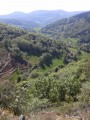
This easy circular route, on small mountain roads and very passable paths, will take you to the heights of Le Bonhomme towards the Col des Bagenelles, offering you beautiful postcard views of the Vosges mountain pastures.
Taken in May, this walk can also be done in summer to escape the heatwave in the Alsace plain.
The Club Vosgien markings are provided for information purposes only, as they may change over time.
Route panoramique autour du Valtin
 3.91 mi
+1,109 ft
-1,122 ft
2h 45
Moderate
Departure from Le Valtin (Vosges)
3.91 mi
+1,109 ft
-1,122 ft
2h 45
Moderate
Departure from Le Valtin (Vosges)
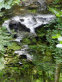
Start by walking through this typical Vosges village. Continue up a challenging climb which, once reached the top, offers a breathtaking panorama of the Valtin glacial valley. Next, literature takes centre stage with over a dozen information panels featuring quotations from great authors: Hugo, Baudelaire, Chateaubriand, Musset and others, leading you to the banks of the Meurthe, which, at this point, is a veritable little torrent. Finish with a peaceful return to the town hall and the village church.
A circular route around Tête des Faux starting from the Auberge de l'Étang du Devin
 3.82 mi
+984 ft
-968 ft
2h 35
Moderate
Departure from Lapoutroie (Haut-Rhin)
3.82 mi
+984 ft
-968 ft
2h 35
Moderate
Departure from Lapoutroie (Haut-Rhin)
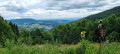
Nestled in the forest at an altitude of 940 m south of the village of Le Bonhomme, the Auberge de l’Étang du Devin is an ideal starting point for the climb up to Tête des Faux (1,208 m). Numerous remnants of the First World War dot the former battlefield, where a magnificent coniferous forest now thrives.
The TGV or Tour du Grand Valtin
 4.51 mi
+794 ft
-794 ft
2h 45
Easy
Departure from Ban-sur-Meurthe-Clefcy (Vosges)
4.51 mi
+794 ft
-794 ft
2h 45
Easy
Departure from Ban-sur-Meurthe-Clefcy (Vosges)
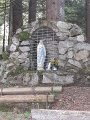
A good climb to get you warmed up as you start this tour in the woods, with several sumptuous panoramic views of the Haute Meurthe woods, before continuing on through the Rupt Frémiat and finishing your route at the Vierge de Haute Suisse.
Lac Noir, Col du Calvaire and Lac Blanc circular
 6.10 mi
+1,102 ft
-1,099 ft
3h 45
Difficult
Departure from Orbey (Haut-Rhin)
6.10 mi
+1,102 ft
-1,099 ft
3h 45
Difficult
Departure from Orbey (Haut-Rhin)
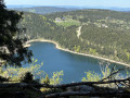
10 km with stunning views of two glacial lakes. The largest and highest, Lac Blanc (depth 72 m) covers 29 ha at an altitude of 1,055 m; Lac Noir (depth 45 m) covers 14 ha at 955 m. Breathtaking views from the Belmont Observatory. Don’t forget your camera.
The three lakes
 7.16 mi
+1,394 ft
-1,394 ft
4h 30
Moderate
Departure from Orbey (Haut-Rhin)
7.16 mi
+1,394 ft
-1,394 ft
4h 30
Moderate
Departure from Orbey (Haut-Rhin)
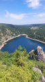
Looking for a varied hike with different terrain? Then look no further than the Three Lakes Hike.
Rooted footpaths, forest tracks, uneven terrain, crossing the Gazon du Faing, Lac Noir, Lac Blanc and Lac des Truites (also known as Lac du Forlet) and, on a clear day, a diversion to the Belmont Rocher observatory or Rocher de Hans.
A lovely hike to do in fine weather. It's better for the scenery.
From Lac Noir to Schupferen
 10.05 mi
+1,470 ft
-1,473 ft
5h 55
Moderate
Departure from Orbey (Haut-Rhin)
10.05 mi
+1,470 ft
-1,473 ft
5h 55
Moderate
Departure from Orbey (Haut-Rhin)
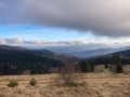
This is a lovely walk with no particular difficulties, offering beautiful views of the Val d’Orbey, the Munster Valley and the Vosges ridges.
Winding through woods and stubble fields, the route takes you from lake to lake to the Schupferen farmhouse inn, where you can enjoy a delicious break with the world’s best Fleischnacka!
The welcome is lovely. Booking is essential, as the inn is small.
The return journey is mainly downhill, which is very pleasant after a meal at the farmhouse inn.
Lac Noir, its source, two viewpoints and the stubble fields.
 4.07 mi
+1,165 ft
-1,152 ft
2h 55
Moderate
Departure from Orbey (Haut-Rhin)
4.07 mi
+1,165 ft
-1,152 ft
2h 55
Moderate
Departure from Orbey (Haut-Rhin)
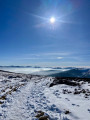
A varied hike starting from Lac Noir, winding through the beautiful Vosges forest and taking you to the Hans rock, which overlooks Lac Blanc. The return route, which is less busy, allows you to discover the lake’s source and the stubble fields near Gazon du Faing.
PLEASE NOTE: The notice dated August 2026 indicates a diversion at the end of the route, adding an extra 2 km.
Circular walk around the three lakes starting from Dreieck
 9.46 mi
+1,617 ft
-1,614 ft
5h 45
Moderate
Departure from Soultzeren (Haut-Rhin)
9.46 mi
+1,617 ft
-1,614 ft
5h 45
Moderate
Departure from Soultzeren (Haut-Rhin)
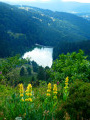
Starting from the Route des Crêtes between the Col du Calvaire and the Col de la Schlucht, this walk begins with a panoramic view of Lac du Forlet from the Crête du Gazon du Faing. The route continues, alternating between woodland and open terrain, taking you to discover Lac Noir, Lac du Forlet (also known as Lac des Truites) and Lac Vert.
The Belmont viewpoint and Lacs Blanc, Noir and Forlet as seen from the Dreieck
8.90 mi
+1,824 ft
-1,827 ft
5h 40
Moderate
Departure from Soultzeren (Haut-Rhin)
A walk along the ridges of the Hautes-Vosges, taking in both well-known and lesser-known paths. The route passes near three lakes and offers magnificent views of the Alsace plain, the Black Forest and the Alps on clear days. Plenty of blueberries in season.
Le Tanet and Lac Vert
 4.55 mi
+902 ft
-912 ft
2h 55
Moderate
Departure from Soultzeren (Haut-Rhin)
4.55 mi
+902 ft
-912 ft
2h 55
Moderate
Departure from Soultzeren (Haut-Rhin)
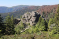
This easy loop allows you to discover Tanet, one of the most beautiful peaks in the Vosges, with stunning views and the Haut-Fourneau stone cairns. In late June or early July, you can also enjoy the mountain flowers. The return journey is sheltered by Lac Vert.
Four Lakes Circuit
 8.94 mi
+1,860 ft
-1,860 ft
5h 45
Moderate
Departure from Soultzeren (Haut-Rhin)
8.94 mi
+1,860 ft
-1,860 ft
5h 45
Moderate
Departure from Soultzeren (Haut-Rhin)
A magnificent circuit on the Vosges ridges with views of the Black Forest and, on clear, dry days, the Alps.
400 m of paved road, the rest on trails or wide paths.
Lac Vert and Lac du Forlet
 Tourist office
 5.24 mi
+1,299 ft
-1,299 ft
3h 35
Moderate
Departure from Soultzeren (Haut-Rhin)
5.24 mi
+1,299 ft
-1,299 ft
3h 35
Moderate
Departure from Soultzeren (Haut-Rhin)
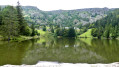
Lac Vert (1,044 m) owes its name to the colour it takes on in summer due to the proliferation of algae. Lac des Truites (or Forlet) is the highest lake in the Vosges mountains at 1,066 m.
Both are located in former glacial cirques dominated by the Hautes Chaumes.
An easy walk along limestone paths starting from Martimpré
 7.31 mi
+738 ft
-741 ft
4h 00
Easy
Departure from Gerbépal (Vosges)
7.31 mi
+738 ft
-741 ft
4h 00
Easy
Departure from Gerbépal (Vosges)
Hello, I’d like to suggest a route that I run during my stays in Martimpré. It takes me about an hour to run, and probably around 2 to 2½ hours to walk. For the more adventurous, this route passes close to the Tête de Nayemont; if you’re curious, you can enjoy a beautiful view from there, but be careful – the path is quite technical and the signposting is poor.
Lac Blanc from Pairis
 6.57 mi
+1,407 ft
-1,421 ft
4h 15
Moderate
Departure from Orbey (Haut-Rhin)
6.57 mi
+1,407 ft
-1,421 ft
4h 15
Moderate
Departure from Orbey (Haut-Rhin)
A lovely, not-too-difficult walk to Lac Blanc from Pairis. Pleasant paths and a few lovely views.
Lac Blanc and Lac Noir, starting from Pairis
11.42 mi
+1,634 ft
-1,634 ft
6h 40
Moderate
Departure from Orbey (Haut-Rhin)
A lovely, relatively easy hike that takes you to Lacs Blancs and Lacs Noirs via the lower route. The route is suitable for winter, when the ridges are too snow-covered to hike easily without snowshoes.
Lakes and pastures
 6.83 mi
+1,421 ft
-1,394 ft
4h 25
Moderate
Departure from Soultzeren (Haut-Rhin)
6.83 mi
+1,421 ft
-1,394 ft
4h 25
Moderate
Departure from Soultzeren (Haut-Rhin)
A beautiful hike that takes you up to the “Gazons”, the famous pastures of the Hautes Vosges, and along the steep slopes overlooking the magnificent cirques where the lakes of Lac Vert and Lac du Forlet lie. All of this is situated at an altitude and in landscapes that are reminiscent of the Alps.
Lake Noir from Pairis
 4.66 mi
+1,063 ft
-1,063 ft
3h 05
Moderate
Departure from Orbey (Haut-Rhin)
4.66 mi
+1,063 ft
-1,063 ft
3h 05
Moderate
Departure from Orbey (Haut-Rhin)
An uphill section towards Lake Noir on the slope of Orbey.
Route du Lac Vert from Tanet station
 1.45 mi
+98 ft
-108 ft
0h 45
Easy
Departure from Soultzeren (Haut-Rhin)
1.45 mi
+98 ft
-108 ft
0h 45
Easy
Departure from Soultzeren (Haut-Rhin)
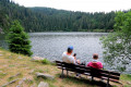
A lovely little family circular path to discover Lac Vert nestled in the heart of the Vosges pine trees.
Lac Vert, Lac du Forlet and return via the ridges
 5.80 mi
+1,224 ft
-1,220 ft
3h 45
Moderate
Departure from Soultzeren (Haut-Rhin)
5.80 mi
+1,224 ft
-1,220 ft
3h 45
Moderate
Departure from Soultzeren (Haut-Rhin)
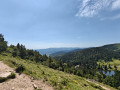
A beautiful hike with views of Lac Vert and Lac du Forlet (Lac des Truites) and a lovely stretch along the ridges.
Lake Forlet and Lac Vert via the ridges
8.17 mi
+1,598 ft
-1,581 ft
5h 10
Moderate
Departure from Soultzeren (Haut-Rhin)
A lovely circular walk across varied terrain – woodland and stubble fields – offering one of the most beautiful views in the Vosges over Lorraine, Alsace and the Swiss Alps.
From Tanet to Lac Vert from altitude 1000
 5.87 mi
+1,276 ft
-1,299 ft
3h 50
Moderate
Departure from Soultzeren (Haut-Rhin)
5.87 mi
+1,276 ft
-1,299 ft
3h 50
Moderate
Departure from Soultzeren (Haut-Rhin)
This hike allows you to discover varied landscapes, access the ridge and enjoy superb views of the entire Vosges mountains and the Alsace plain. It crosses two nature reserves: the Franckenthal-Missheimle Reserve and the Tanet Gazon du Faing Reserve.The hike also passes by the Rocher de Hirchsteine, the summit of Tanet and Lac Vert. The entire climb is through forest.
⚠️ 21/07/2025: starting point of the hike changed.
The beautiful rocks of the Kemberg massif
10.28 mi
+2,238 ft
-2,221 ft
6h 40
Moderate
Departure from Saulcy-sur-Meurthe (Vosges)
Hike in the Kemberg massif and its pink sandstone rocks. Developed by the Club Vosgien, with footbridges and protective railings, these rocks offer magnificent views of Saint-Dié and its surroundings.
The Balveurche stubble fields
 8.90 mi
+1,112 ft
-1,106 ft
5h 05
Moderate
Departure from Xonrupt-Longemer (Vosges)
8.90 mi
+1,112 ft
-1,106 ft
5h 05
Moderate
Departure from Xonrupt-Longemer (Vosges)
A lovely hike with no particular difficulties, suitable for both summer and winter snowshoeing in a forest setting. In winter, you can warm up and enjoy a meal at the Chaumes de Balveurche inn.
Lac du Forlet - Lac Vert
 6.58 mi
+1,637 ft
-1,627 ft
4h 25
Moderate
Departure from Soultzeren (Haut-Rhin)
6.58 mi
+1,637 ft
-1,627 ft
4h 25
Moderate
Departure from Soultzeren (Haut-Rhin)
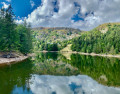
A fairly varied hike starting from Soultzeren, linking Lac du Forlet to Lac Vert.
The route consists of pretty, shaded paths running alongside or through a few meadows.
After afirst climb of 600 m, which is a little challenging, the rest of the hike is very pleasant and does not present any particular difficulties.
Refreshments are available at the Ferme-auberge du Forlet and the Chalet Erichson run by the Club Vosgien (snacks or packed lunches).
Chaume Balveurche
 10.25 mi
+1,660 ft
-1,631 ft
6h 10
Moderate
Departure from Xonrupt-Longemer (Vosges)
10.25 mi
+1,660 ft
-1,631 ft
6h 10
Moderate
Departure from Xonrupt-Longemer (Vosges)
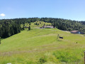
A hike through the forest towards Chaume Balveurche.
Along the way, you can admire the view of the Longemer valley from the Roche Boulard shelter. A short round trip to Belle Roche offers a panoramic view of Lake Retournemer. The Irénée Duvoid crossroads is a nice spot to rest and relax. Finally, you can admire the Belbriette stream in its green setting, which is particularly pretty in autumn.
Rocks and viewpoints in the Kemberg massif
 6.99 mi
+1,227 ft
-1,220 ft
4h 15
Moderate
Departure from Saulcy-sur-Meurthe (Vosges)
6.99 mi
+1,227 ft
-1,220 ft
4h 15
Moderate
Departure from Saulcy-sur-Meurthe (Vosges)
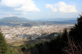
The Kemberg massif offers numerous vantage points: Roche Saint-Martin, Kiosque, Anozel and Enclume; add to these the paragliding launch sites at Col du Kiosque and Kemberg. You will enjoy the panoramic views over Saint-Dié, the Meurthe valley, and the Ormont and Bure massifs.
 The Tour du Kemberg
 8.64 mi
+367 ft
-371 ft
1 hr
Easy
Departure from Saulcy-sur-Meurthe (Vosges)
8.64 mi
+367 ft
-371 ft
1 hr
Easy
Departure from Saulcy-sur-Meurthe (Vosges)
The Kemberg massif is well known to the people who live nearby. The Tour du Kemberg is well shaded with fairly wide paths.
Simply follow the blue circles and signs. Ideal for getting back into shape or for families, with no major difficulties.
Circular route starting from Lac de Longemer via the Tête de Grouvelin
 13.47 mi
+2,900 ft
-2,910 ft
8h 45
Difficult
Departure from Xonrupt-Longemer (Vosges)
13.47 mi
+2,900 ft
-2,910 ft
8h 45
Difficult
Departure from Xonrupt-Longemer (Vosges)
Hike starting from Longemer towards the Géromois peaks, downhill skiing, then descending towards Lac de Lispach and the cross-country ski trails. Climb back up via the Roche des Vieux Chevaux viewpoint, then pass by Lac de Longemer and ascend towards the opposite slope of the Roche de Boulard.
A fairly challenging hike.
Lac de Lispach circuit from Lac de Longemer
 4.87 mi
+991 ft
-978 ft
3h 05
Difficult
Departure from Xonrupt-Longemer (Vosges)
4.87 mi
+991 ft
-978 ft
3h 05
Difficult
Departure from Xonrupt-Longemer (Vosges)
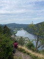
Short hike connecting Lac de Longemer and Lac de Lispach through the forest.
From Wettstein to Glasborn
 7.42 mi
+1,470 ft
-1,480 ft
4h 40
Moderate
Departure from Soultzeren (Haut-Rhin)
7.42 mi
+1,470 ft
-1,480 ft
4h 40
Moderate
Departure from Soultzeren (Haut-Rhin)
Superb panoramic views over the Munster Valley and the Val d'Orbey. The hike follows the historic route of the Col du Wettstein, the Linge Memorial and the Barrenkopf defence line.
From Kaltenborn to Glasborn
8.53 mi
+1,719 ft
-1,732 ft
5h 25
Moderate
Departure from Soultzeren (Haut-Rhin)
This hike offers beautiful views of the Munster Valley and the Val d'Orbey. The return route follows the historic Linge Barrenkopf trail.
Tête du Violu
3.32 mi
+761 ft
-735 ft
2h 10
Easy
Departure from Wisembach (Vosges)
Ascent to the Tête du Violu from the Col de Sainte-Marie-aux-Mines via the Carrefour des Biches and the Labyrinth.
The shelter trail via the Côte d'Échery
 6.02 mi
+984 ft
-965 ft
3h 35
Moderate
Departure from Wisembach (Vosges)
6.02 mi
+984 ft
-965 ft
3h 35
Moderate
Departure from Wisembach (Vosges)
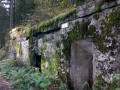
A short circular walk from the Col de Sainte-Marie-aux-Mines, offering the chance to explore the remains of theFirst World War (1914–1918), including the German army’s installations below the Tête du Violu front line.
Wettstein Pass - Lac Noir - Lac des Truites (Forlet)
 6.60 mi
+1,115 ft
-1,119 ft
4h 00
Moderate
Departure from Orbey (Haut-Rhin)
6.60 mi
+1,115 ft
-1,119 ft
4h 00
Moderate
Departure from Orbey (Haut-Rhin)
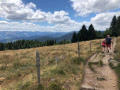
A very pretty, varied walk with scenic views and fairly easy going, I've rated it as moderate as a precaution.
From Wettstein Pass to the Lac des Truites
 6.02 mi
+978 ft
-948 ft
3h 35
Easy
Departure from Orbey (Haut-Rhin)
6.02 mi
+978 ft
-948 ft
3h 35
Easy
Departure from Orbey (Haut-Rhin)
This short hike on trails marked by the Club Vosgien has in the first instance views of the valley of Munster, and also a view of the peaks of the Vosges. The many picnic opportunities around the Lac des Truites or Lac Forlet lakes, the trout spotting opportunities, as well the welcoming farmhouse make for an enjoyable outing.
Lac Vert - Gazon du Faing - Forlet Lake (Lac des Truites)
 10.49 mi
+1,903 ft
-1,873 ft
6h 30
Moderate
Departure from Orbey (Haut-Rhin)
10.49 mi
+1,903 ft
-1,873 ft
6h 30
Moderate
Departure from Orbey (Haut-Rhin)
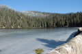
Explore the forest, lakes and the Hautes Chaumes, the highlights of this hike that follows Vosges Club trails.
From the Col de Sainte-Marie-aux-Mines to the Chaume de Lusse
8.51 mi
+1,526 ft
-1,526 ft
5h 15
Difficult
Departure from Wisembach (Vosges)
This circular hike links the Col de Sainte-Marie-aux-Mines to Chaume de Lusse, through typical Vosges forests of beech, fir, blueberry and high-altitude meadows. The forest paths and roads offer beautiful panoramic views of the Val d'Argent and Meurthe valleys. This is a fairly dynamic route that leads to Chaume de Lusse via a varied course, including sustained climbs (which is why we rate it as difficult), forest passages and open ridges. Part of the route runs between Alsace and Lorraine on paths and trails marked by the GR®531, the former border from 1871 to 1918, with boundary stones marked D (Deutschland), often hammered, and F, marking the historic border and named "Chemins de la Grande Guerre" (Paths of the Great War).
Col Sainte-Marie-aux-Mines / Paths of Memory
 6.72 mi
+1,325 ft
-1,329 ft
4h 15
Moderate
Departure from Wisembach (Vosges)
6.72 mi
+1,325 ft
-1,329 ft
4h 15
Moderate
Departure from Wisembach (Vosges)
A beautiful historical hike near the Wisembach National Forest.A reminder of the facts:1871 - Alsace/Moselle are annexed by Germany, which modernises many areas.1914 - The heir to the Austrian throne is assassinated / Germany declares war on Russia, France and Belgium. Soldiers occupy villages and mountains.November 1918: the trenches are filled in, the blockhouses and other structures destroyed, but around a hundred remain visible in the heights of the Val d'Argent.
Circular around the Basses Huttes from the Col du Wettstein
 7.12 mi
+807 ft
-807 ft
4h 00
Moderate
Departure from Orbey (Haut-Rhin)
7.12 mi
+807 ft
-807 ft
4h 00
Moderate
Departure from Orbey (Haut-Rhin)
An easy hike around the Basses Huttes towards the Ferme Auberge du Rain des Chênes on wide, shaded paths offering beautiful views of the Val d'Orbey through the gaps in the forest.
Wettstein, Lac Noir, Lac du Forlet and Musmiss Farm Inn
 7.39 mi
+1,673 ft
-1,663 ft
4h 50
Moderate
Departure from Orbey (Haut-Rhin)
7.39 mi
+1,673 ft
-1,663 ft
4h 50
Moderate
Departure from Orbey (Haut-Rhin)
A beautiful hike starting from the Col du Wettstein, with steep climbs up to the ridge above Lac Noir and Lac Forlet, a descent towards Forlet, where caution is advised, then a gentle stretch to the Musmiss Farm Inn (a gourmet stop) and then, in ten minutes, back to the Col du Wettstein.
Lac Noir and Lac des Truites or Lac du Forlet from the Col du Wettstein
 5.96 mi
+965 ft
-942 ft
3h 35
Easy
Departure from Orbey (Haut-Rhin)
5.96 mi
+965 ft
-942 ft
3h 35
Easy
Departure from Orbey (Haut-Rhin)
This is an easy hike with beautiful views of the Keysersberg valley to the east and the ridges to the west. You will always find a sunny spot for a picnic around Lac des Truites. The Auberge du Lac Noir welcomes you for a break and the Ferme Auberge du Forlet is open at the end of April. You can also eat at the Mussmiss farmhouse inn, which is clearly signposted on arrival at the Col du Wettstein.
Circular route from the Col du Wettstein for Les Basses-Huttes and Glasborn
7.75 mi
+1,568 ft
-1,545 ft
4h 55
Moderate
Departure from Orbey (Haut-Rhin)
An almost perfect circular route, worthy of a postcard. Along the entire route, points of interest follow one after another: military remains, historic sites, impressive rocks with remarkable shapes, magnificent panoramas and breathtaking scenery guaranteed. Between the Col du Wettstein, the Rain des Chênes, the village of Les Basses-Huttes, the small pass of Linge, the Schratzmaennele and the Glasborn, with trails and a few forest tracks, charming villages, authentic farm-inns and magnificent views of the Vosges ridges, every kilometre holds its own share of discoveries. A comprehensive hike that has it all: nature, history, heritage, gastronomy and exceptional scenery, for an experience as varied as it is unforgettable.
The Pearls of Vologne
 11.13 mi
+1,335 ft
-1,325 ft
6h 15
Moderate
Departure from Xonrupt-Longemer (Vosges)
11.13 mi
+1,335 ft
-1,325 ft
6h 15
Moderate
Departure from Xonrupt-Longemer (Vosges)
“Les Perles de Vologne” is a wonderful site on the shaded bank of the Vologne.
You will pass on Pont des Fées and the Marie-Louise islands, before climbing along the torrent in the Roitelets Gorge, to reach the Roche des Bruyères from where you can admire the town of Gerardmer and its lake. Then, at the Gilet Fountain, located in the forest, you can refresh your hands.
Take a break at the Belbriette Pond before descending to Longemer Lake and the Saint Florent chapel.
Tour of Gérardmer from the Saut des Cuves
16.16 mi
+3,100 ft
-3,110 ft
10 hrs
Very difficult
Departure from Xonrupt-Longemer (Vosges)
A long, challenging hike that takes you around a well-known town in the Vosges: Gérardmer. Nestled at an altitude of around 600 m, the town is home to the largest lake in the Vosges: Lake Gérardmer. It is also possible to take side trips to explore the natural scenery. This walk offers a feast of rivers and waterfalls: the Saut des Cuves, the Saut de la Bourrique, the Cascade de Mérelle and other watercourses of varying sizes. It also passes close to several ski resorts, particularly during the first part of the circular route. Mainly through woodland, there are also some rather lovely viewpoints when the weather permits.
In winter, the track between points (6) and (7) is used as a ski run. It is better to take the track leading uphill to the left at (6), then the road to the right which leads to point (9).
Point (13), Saut de la Bourrique, has been closed by municipal order since 15 March 2024 for works; see practical information.
From Saut des Cuves to Roche des Chiens
 12.81 mi
+3,068 ft
-3,045 ft
8h 35
Very difficult
Departure from Xonrupt-Longemer (Vosges)
12.81 mi
+3,068 ft
-3,045 ft
8h 35
Very difficult
Departure from Xonrupt-Longemer (Vosges)
The Gérardmer region offers a wealth of hiking opportunities. This route starts from the Saut des Cuves, one of the best-known natural sites in the Gérardmer region, apart from the lakes. The hike passes various viewpoints, including La Roche des Bruyères, La Roche du Corbeau, La Roche du Chien and La Roche du Page. It follows the beautiful Gorges des Roitelets and passes near the Chapelle Sainte-Anne in Martimpré. The route consists of three major climbs, each with an elevation gain of between 200 and 300 metres.
Around Xonrupt
4.27 mi
+804 ft
-804 ft
3 hrs
Moderate
Departure from Xonrupt-Longemer (Vosges)
A short route, to be done when there is enough snow, allowing you to warm up and get used to snowshoes before a longer hike.
Gérardmer - Les Champis
7.48 mi
+2,480 ft
-915 ft
5h 35
Moderate
Departure from Xonrupt-Longemer (Vosges)
First stage of the Gérardmer Mini-Trek. On this first day, you will discover the aerial landscapes of Le Poli and the heights of Lispach, as well as the isolated stubble fields above the Vologne Valley. This stage allows you to make steady progress towards the Chalet des Champis, where you will spend the night. It is also an opportunity to spend a night in an unguarded cabin that has (almost) everything to please: isolated and at least a 30-minute walk from any built-up area, in the middle of the thatched cottages, accessible to all and all year round...It is a must-see in the area.
Saut des Cuves - Roche des Bruyères - Martimpré - Gorge des Roitelets
 3.10 mi
+945 ft
-961 ft
2h 15
Moderate
Departure from Xonrupt-Longemer (Vosges)
3.10 mi
+945 ft
-961 ft
2h 15
Moderate
Departure from Xonrupt-Longemer (Vosges)
This is a circular in the Gérardmer region. Overall, this hike is easy, but there is a fairly steep climb at the start of the route and a much more challenging section in the Gorge des Roitelets.Most of the route is through forest, which can be pleasant in hot weather. In wet weather, be careful as the rocks can be slippery.
More walks in Plainfaing
Select a point of interest below: