The Three Lakes Route via the Gazon du Faing

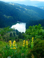
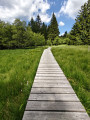
Starting from the car park at the Auberge du Gazon du Faing, this circular route links three glacial lakes, each with its own distinct character: Lac Blanc, the largest, dominated by the Rocher du Hans and the Belmont Observatory; Lac Noir, wilder and more enclosed; and Lac du Forlet (or Lac des Truites), nestled in a spectacular glacial cirque at an altitude of over 1,060 metres, the highest lake in the Vosges. Between the three lakes, the trail crosses the Gazon du Faing, a nature reserve of tall grasslands and peat bogs, offering breathtaking panoramic views of the Vosges ridges. Around ten kilometres of varied trails, through woodland, along ridges and over rocky outcrops, making for one of the most beautiful hikes in the region.

Details

101083316
Creation:
Last update:
Last review:
  • Walking
    Activity: Walking
  • ↔
    Distance: 9.53 mi
  • ◔
    Average duration: 6h 00 
  • ▲
    Difficulty: Difficult

  • ⚐
    Back to start: Yes
  • ↗
    Ascent: + 1,896 ft
  • ↘
    Descent: - 1,900 ft

  • ▲
    Highest point: 4,275 ft
  • ▼
    Lowest point: 3,127 ft

Description of the walk

Park at the Gazon du Faing car park, situated on the Route des Crêtes (D61).

(S/E) Turn your back on the road and follow the wide path for a few dozen metres.

(1) Keep to the right at the three-way junction and head for the ridge.

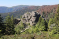
(2) Take the path on the left to reach the Taubenklangfelsen (1,299 m) or Rocher du Cri du Pigeon. This cluster of granite boulders sits on the main Vosges ridge, the famous ‘Terres des hautes limites’. Its name is said to derive from the sound produced by the wind in the rocks, reminiscent of the final cry of a pigeon fatally struck by a falcon – the peregrine falcon, which is very common in the area and finds this rock an ideal vantage point from which to spot its prey. Continue along the ridge to the Soultzeren Eck junction.

(3) Leave the path leading to the Gazon du Faing on your left and take the path almost directly opposite.

(4) Turn sharply right to begin the very steep descent leading to Lac du Forlet or Lac des Truites.

(5) Walk past the Forlet farmhouse inn, following the track; take the bend to the left, then leave the track onto a path on the right which rejoins it further on. Continue to the right until you reach the junction.

(6) Ignore the forest track on the right; walk for about twenty metres, then turn onto the path on the left which runs slightly above the track you have just left. You’ll reach a crossroads of paths.

(7) Head slightly diagonally to the left and reach the Spielmuss junction (elevation 1087).

(8) Continue along the path you have been following and walk a good hundred metres. Turn right onto the path that cuts across a bend, rejoin the path and continue straight ahead to reach Lac Noir.

(9) Cross the small car park, keeping the inn on your left. Follow the access road to the lake for about sixty metres, then turn left off it to follow the path that forms part of the GR®532. Begin a fairly steep climb to reach a forest track, which you should follow in the same direction. Once you are less than 100 metres from the departmental road, turn left to reach Lac Blanc directly.

(10) Cross the car park to reach the departmental road and walk carefully alongside it for about 200 metres. Then turn left onto the Sentier Keppel, which leads, after a short steep climb, to the Lac Blanc ski resort.

(11) Turn left to continue climbing

(12) At the fork, turn left to follow the ridge overlooking the lake and reach the source of Lac Blanc.

(13) Carry on to the left to skirt the Reisberg to the north, then turn sharply right to reach the Belmont Observatory.

(14) Carry on for about a hundred metres, then turn right to follow the path through the Tanet–Gazon du Faing Biological Reserve.

(15) Take the path on the right, pass to the south of the Gazon du Faing and head straight down to the car park where you started (S/E).

Waypoints

  1. S/E : mi 0 - alt. 4,016 ft - Car park
  2. 1 : mi 0.03 - alt. 4,035 ft - Junction of the circular loop
  3. 2 : mi 0.35 - alt. 4,245 ft - Taubenklangfelsen
  4. 3 : mi 0.78 - alt. 4,275 ft - Soultzeren Eck - Gazon du Faing
  5. 4 : mi 1.03 - alt. 4,167 ft - Descend to the right
  6. 5 : mi 1.63 - alt. 3,583 ft - Lac des Truites
  7. 6 : mi 2.03 - alt. 3,494 ft - Crossroads
  8. 7 : mi 2.75 - alt. 3,681 ft - Trail junction
  9. 8 : mi 3.11 - alt. 3,563 ft - Spielmuss
  10. 9 : mi 3.6 - alt. 3,130 ft - Lac Noir
  11. 10 : mi 5.16 - alt. 3,474 ft - Lac Blanc (massif des Vosges)
  12. 11 : mi 5.93 - alt. 3,675 ft - Lac Blanc resort - Col du Calvaire
  13. 12 : mi 6.32 - alt. 4,029 ft - Ridge
  14. 13 : mi 7.05 - alt. 4,199 ft - Source du Lac Blanc (Orbey)
  15. 14 : mi 7.57 - alt. 4,039 ft - Observatoire Belmont
  16. 15 : mi 8.65 - alt. 4,173 ft - Junction
  17. S/E : mi 9.53 - alt. 4,016 ft - Gazon du Faing car park

Notes

This hike is designed for those already accustomed to walking: several hundred metres of cumulative elevation gain, rocky and sometimes steep sections (with guardrails and chains in certain places near Lac Blanc), and you should allow a full day for the walk. Allow for a busy half-day, or even a full day’s outing including breaks. This is not a hike to be undertaken on a whim: good walking shoes, water and clear weather are essential to fully enjoy the views. In return for this effort: undoubtedly one of the most beautiful hikes in the Vosges.

This route passes through a protected area, which may be subject to special regulations:

Worth a visit

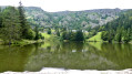
(5) Lac du Forlet: nestled at an altitude of over 1,060 metres in a spectacular glacial cirque, it is the highest lake in the entire Vosges. Its calm waters, surrounded by steep cliffs and peat bogs, give it the feel of an alpine landscape. There is a picnic area by the water’s edge, the perfect spot for a break before the climb up to the Gazon du Faing. The Ferme-Auberge du Forlet, just above the lake, serves traditional mountain dishes, Munster cheese and blueberry tarts all day round; it is open from May to early November, closed on Tuesdays.

(9) Lac Noir: wilder and more confined than its neighbours, this glacial lake nestles at an altitude of 935–955 metres at the foot of the ridge, surrounded by steep slopes. The Auberge du Lac Noir, at the entrance to the cirque, is open daily from 9.00 am to 6.00 pm (lunch served from 12.00 pm to 1.30 pm): closed on Wednesdays in winter.

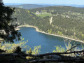
(10) Lac Blanc: the largest and deepest of the three lakes (29 ha, 72 m deep), at an altitude of around 1,055 m. Its name comes from the light-coloured sand covering its bed. For many years, it served as the lower reservoir for a pumped-storage hydroelectric power station, which was permanently decommissioned in 2002. It is dominated by the Rocher du Hans, a fortress-like cliff face crowned by a statue of the Virgin Mary. As for dining, there are several establishments lining the lake and the resort: the Auberge du Blancrupt, the Terrasses du Lac Blanc, and the Ferme-Auberge au Pré Bracot, all specialising in Vosges cuisine (marcaire meals, Munster cheese, tarts).

(11) Lac Blanc resort: this is Alsace’s largest ski resort, straddling altitudes between 900 and 1,200 metres. In winter, it offers 15 downhill ski runs, a vast cross-country skiing area (nearly 70 km of groomed trails, So Nordic-certified), toboggan runs and snowshoe trails. In summer, it transforms into an outdoor playground: mountain biking and a bike park, rail tobogganing, a treetop adventure course and a barefoot trail — an ideal base for exploring the lakes and the ridge all year round.

(14) Belmont Lookout: a rocky promontory offering a superb view of Lac Blanc below. It takes its name from Captain Ferdinand Belmont, an officer in the 11th Battalion of Alpine Hunters, who established an observation post there during the First World War — before dying in action in late 1915 on another section of the Vosges front. A place offering panoramic views whilst being steeped in history.

(15) Continue for about a hundred metres, then turn right to follow the path through the Tanet–Gazon du Faing Biological Reserve.

Always be cautious and plan ahead when you're outdoors. Visorando and the author of this route cannot be held responsible for any accidents occurring on this route.

The GR® and PR® markings are the intellectual property of the Fédération Française de Randonnée Pédestre.

Other walks in the area

For more walks, use our search engine .

The GPS track and description are the property of this route's author. Please do not copy them without permission.