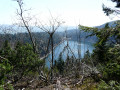
Lac Blanc from Pairis

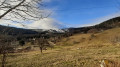
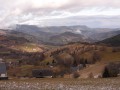
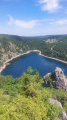
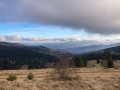
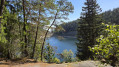
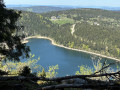
A lovely, not-too-difficult walk to Lac Blanc from Pairis. Pleasant paths and a few lovely views.

Details

19147482
Creation:
Last update:
Last review:
  • Walking
    Activity: Walking
  • ↔
    Distance: 6.57 mi
  • ◔
    Average duration: 4h 15 
  • ▲
    Difficulty: Moderate

  • ⚐
    Back to start: Yes
  • ↗
    Ascent: + 1,407 ft
  • ↘
    Descent: - 1,421 ft

  • ▲
    Highest point: 3,484 ft
  • ▼
    Lowest point: 2,159 ft

Photos

Description of the walk

Car park along the road (Chemin des Machielles) near the campsite.

(S/E) Take the road heading north; you’ll soon come to a three-way junction.

(1) Keep left, towards Les Machielles and Pré Bracot.

(2) Follow the road to the right and pass just above the holiday camp. Once you reach the road leading to Pré Bracot, follow it to the right until you reach the hamlet.

(3) Turn left towards Lac Blanc, following the Yellow Disc markings. Almost directly beneath the power line, veer left whilst keeping to the markings.

(4) At the junction, take the sharp left-hand bend, following the Blue Cross markings. Cross two tracks in succession and continue straight on until you come out onto another track. Follow this to the left for about a hundred metres.

(5) Be careful not to miss the Blue Cross-marked path which climbs up to the right at this point: look up. Further up, cross the road and continue for about 50 metres to the left.

(6) Turn right twice to follow the Red Ring-marked path, which takes you to Lac Blanc whilst avoiding the road, which can be very busy at times.

(7) After admiring the lake, walk past the restaurant and begin the descent along the Blue Ring-marked path, heading towards Blancrupt.

(8) Near Bocheney, leave the ‘Blue Ring’ markings and take the path leading down towards Blancrupt (Blue Rectangle). Cross the ‘Blue Cross’ path and carry on straight ahead.

(9) Turn left towards Neuf Pré: follow the Yellow Disc markings, which change further on to Red Ring markings. Walk down to the cemetery at Pairis.

(10) Turn right at the corner for one last short (but steep) climb and avoid going along the road.

(1) Turn left to reach the car park (S/E).

Waypoints

  1. S/E : mi 0 - alt. 2,267 ft - Chemin des Machielles car park
  2. 1 : mi 0.16 - alt. 2,274 ft - Junction of the circular loop
  3. 2 : mi 0.97 - alt. 2,694 ft - Summer camp
  4. 3 : mi 1.73 - alt. 2,743 ft - Le Pré Bracot
  5. 4 : mi 2.19 - alt. 2,887 ft - Turn left at the fork
  6. 5 : mi 2.75 - alt. 3,261 ft - Path on the right
  7. 6 : mi 2.87 - alt. 3,363 ft - At the junction, turn right twice
  8. 7 : mi 3.18 - alt. 3,458 ft - Lac Blanc (massif des Vosges)
  9. 8 : mi 3.71 - alt. 3,264 ft - Bocheney
  10. 9 : mi 4.77 - alt. 2,533 ft - Le Creux d’Argent
  11. 10 : mi 6.2 - alt. 2,159 ft - Cemetery
  12. S/E : mi 6.57 - alt. 2,264 ft - Chemin des Machielles car park

Notes

You can have lunch at the “Le Mille Mètres” restaurant.

Don’t forget your IGN map, as the climb up to the lake via this path isn’t very well signposted.
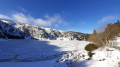
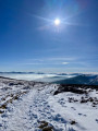
We did this walk in early February 2021 and found quite a lot of icy snow; we would have appreciated crampon soles, but it went well.
Good footwear is essential in all weathers anyway.

Reviews and comments

4 / 5
Based on 3 reviews

Reliability of the description
4 / 5
Ease of following the route
3.3 / 5
Route interest
4.7 / 5
MARTMICH
MARTMICH

Overall rating : 4 / 5

Date of your route : Sep 01, 2025
Reliability of the description : ★★★★☆ Good
Ease of following the route : ★★★★☆ Good
Route interest : ★★★★☆ Good
Very busy route : No

In good weather, the paths through the forest are very pleasant.
The scree just before reaching the lake is quite technical.
There is a noticeable lack of hydrometry when arriving at the lake, which is quite low.
You have to walk along the lake and return via the Blancrupt inn and the GR 532 trail. I can confirm that the scenery is magnificent, so it would be a shame to miss it.

Machine-translated

Solognots
Solognots
• Edited:

Overall rating : 4 / 5

Date of your route : Apr 09, 2023
Reliability of the description : ★★★★☆ Good
Ease of following the route : ★★★☆☆ Average
Route interest : ★★★★★ Very good
Very busy route : No

Very pleasant forest trails; a lack of signposting at the start in Pairis – follow the Visorando GPS –
as well as the main route, we walked along the lake and returned via the Blancrupt inn and the GR 532,
which adds one to two kilometres to the walk. Beautiful views –

Machine-translated

Darco
Darco

Overall rating : 4 / 5

Date of your route : Feb 13, 2023
Reliability of the description : ★★★★☆ Good
Ease of following the route : ★★★☆☆ Average
Route interest : ★★★★★ Very good
Very busy route : No

A lovely walk, though the start is a bit tricky to find

Machine-translated

Other walks in the area

For more walks, use our search engine .

The GPS track and description are the property of this route's author. Please do not copy them without permission.