Country:

 City:
City:


Parking is available at the Tanet – Lac Vert car park, accessible via the Route de la Schlurcht (D417); at the junction, follow signs for ‘Le Tanet’.
(S/E) From the car park, head up the road towards the start of the ski lift. Take the path marked with a Blue Rectangle and a White Rectangle, which passes above the Seestaettle hostel. After passing under two ski lifts, continue until you reach the top of a ski lift.
(1) Turn right onto the forest track (marked with a Red Saltire) then, at the “Schupf” ski lift, let the track branch off to the left towards the Schupferen refuge; continue towards Le Tanet until you reach a fork.
(2) Turn right, following the same markings, and reach the ridge and theGR®5marked with a Red Rectangle.
(3) Follow it to the right, heading north-east (red circular posts). Reach Le Tanet (1,292 m) and then the Dreieck car park (1,230 m) on the edge of the Route des Crêtes.
(4) Continue along theGR®5to reach the Gazon du Faîte (elevation 1,299 m) at the junction with the Green Ring-marked path. Beautiful view of Lac Forlet.
(5) Head down to the left towards the Auberge du Gazon du Faing, following the Green Ring signposting. Before reaching the inn, note the extension of the Green Ring trail to the right, heading east.
(6) After a possible stop, head back up towards the eastern extension of the Green Ring trail and follow it. It leads to the Gazon du Faing ridge at a viewpoint.
(7) Turn right to rejoin theGR®5, then turn left to reach the summit of the Gazon du Faing (elevation 1302).
(8) Leave theGR®5, which continues towards Lac Blanc, and carry on eastwards towards Lac Noir, following the Yellow Triangle markings. After about 350 m, you’ll reach a junction.
(9) Carry on straight ahead (Yellow Triangle). Reach the Altenkraehkopf viewpoint, then continue to the junction (elevation 1122) with the Red Disc-marked path.
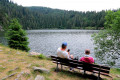
(10) Turn right towards Lac du Forlet and head for a crossroads at the lake’s dam.
(11) Cross the dam; at the far end, leave the path along the shore on your right and take the path marked with a Yellow Disc, which climbs towards Lac Vert. This path winds through the forest on a gentle ascent to the Chalet Erichson.
(12) This is where the descent begins; continue to follow the Yellow Disc markings towards the Gaertlesrain inn and then Lac Vert. The path reaches the lakeshore; turn left and head towards the dam.
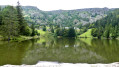
(13) With your back to the lake, you can return to the car park either by road or via the Blue and White Rectangle-marked trail, which runs along a ridge to the car park (S/E).

 Visorando Member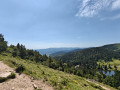

 Easy
Easy 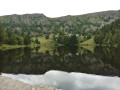
 Tourist office