Country:

 City:
City:


(S/E) From the Dreieck car park on the Route des Crêtes between the Col du Calvaire and the Col de la Schlucht, head north through the woodland, following the GR®5 towards the Gazon du Faing.
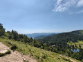
(1) Turn right onto the panoramic alternative route of the GR®5 and follow the path that runs as close as possible to the ridge to enjoy the many views. Stay on the ridge, ignoring all paths that branch off to the left or descend to the right. You’ll reach a stile at the edge of the forest. Perhaps you’ll be lucky enough to spot a chamois or two amongst the boulders overlooking Lac du Forlet?
(2) Cross the stilt bridge and take the path to the right. Ignore the paths to the left and right at the first junction and continue straight on to the next junction.
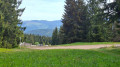
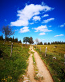
(3) Walk a few dozen metres to the summit of the Altenkraehkopf. Take in the view. Turn back and head right (left if coming from (2)). The path leads into the woodland. At the end of the descent, the path returns to the edge of the woodland and runs alongside a pasture. Follow it to the first crossroads.
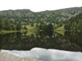
(4) Take the path on the left towards Lac Noir; further on, ignore the path coming from the right.
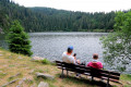
(5) Turn onto the path that descends to the right and continue straight on at the junction with the wide track you left earlier. You will arrive at the Lac Noir dam.
(6) Follow the first road (tarmac) to the right towards Maison Oberlin, ignoring the paths branching off on either side.
(7) At the Fork in the road after Maison Oberlin, take the track that climbs to the right towards the Col du Wettstein and continue straight on to the Carrefour des Hautes Huttes.
(8) Head all the way to the right and you’ll reach a crossroads a few hundred metres further on.
(9) Take the path on the left towards Altenkraeh.
(10) Carry on straight ahead to the Lac du Forlet dam.
(11) Follow the road across the dam, ignore the path branching off to the right immediately afterwards and, 100 m further on, look out for the signposted path branching off to the right towards Lac Vert.
(12) Follow this path, which leads to the hamlet of Tiefenbrunnen (chalet).
(13) Walk past the chalet and continue straight on, ignoring the path that branches off to the right towards Alterwasen.
(14) Walk past the back of the Erichson Chalet (a picnic is welcome if you’re having a drink or two there) and carry on straight ahead along the wide path that descends towards Lac Vert. Look out for the path branching off to the left.
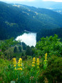
(15) Head down the path on the left and turn right at the next Fork in the road until you reach a crossroads where you can see the lake on your right.
(16) Turn right onto the path that circles Lac Vert from the north and leads to the dam.
(17) Take the path branching off to the right towards the ridges via Lybruck.
(18) At the ridge, follow the GR®5 to the right. The car park (S/E) is now only a few hundred metres away.
 Visorando Member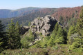

 Tourist office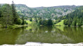
 Easy
Easy