A short circular forest loop starting from the Col de Mandray

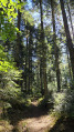
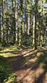
Starting from the Col de Mandray, this pleasant and easy circular walk takes you through the region’s typical forests, made up of tall firs and beech trees. A very enjoyable walk on hot days.

Details

105358760
Creation:
Last update:
Last review:
  • Walking
    Activity: Walking
  • ↔
    Distance: 2.85 mi
  • ◔
    Average duration: 1h 35 
  • ▲
    Difficulty: Easy

  • ⚐
    Back to start: Yes
  • ↗
    Ascent: + 276 ft
  • ↘
    Descent: - 269 ft

  • ▲
    Highest point: 2,421 ft
  • ▼
    Lowest point: 2,247 ft

Photos

Description of the walk

Car park at the Col de Mandray.

(S/E) Start along the wide forest track that runs from the car park.

(1) Leave the wide path just as it is about to turn right, and follow a track that runs straight on and enters the forest. You’ll soon reach a junction (note the return route on the left).

(2) Carry on straight ahead for about 2 km.

(3) Take the Route Forestière du Lange on the left and follow it for 1.7 km until you reach the small tarmac road at the Col de Mandray. Keep going in the same direction for about a hundred metres.

(4) Turn sharply left and head uphill until you reach a junction further up that you passed on the way there.

(2) Turn right and carry on straight ahead until you reach the car park (S/E).

Waypoints

  1. S/E : mi 0 - alt. 2,277 ft - Car park - Col de Mandray (696 m)
  2. 1 : mi 0.09 - alt. 2,283 ft - Crossroads
  3. 2 : mi 0.28 - alt. 2,343 ft - Junction of the circular loop
  4. 3 : mi 1.28 - alt. 2,320 ft - Junction – Route Forestière du Lange
  5. 4 : mi 2.43 - alt. 2,257 ft - Start of the trail
  6. S/E : mi 2.85 - alt. 2,277 ft - Car park - Col de Mandray (696 m)

Other walks in the area

For more walks, use our search engine .

The GPS track and description are the property of this route's author. Please do not copy them without permission.