


 Country:

 City:
City:


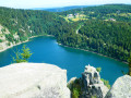
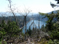
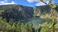
This walk around the lake is fully signposted with a Red Ring.
(S/E) Head south from the car park and climb through the forest, following the markings. The path zigzags between the trees and rocks to reach the point closest to Rocher Hans and its statue of the Virgin Mary, which is inaccessible to walkers.
(1) Continue along the path, taking in the various views.
(2) Continue along the signposted path, ignoring the path that branches off to the left towards the Belmont Observatory. Reach the Source du Lac Blanc, the highest point of the walk, where there is a picnic table.
(3) Turn right and follow the ridge path, which offers a lovely panoramic view to the east. It begins to descend gently, then more steeply from the top of the ski runs. Take care: the stones and gravel pose a hazard at every step. You’ll reach a cross-country path.
(4) This is the end of the path. Take the track to the left for about a hundred metres.
(5) At the end of the track, follow the path branching off to the right. This section is a bit more of a struggle than the previous descent, as there are a few streams that don’t make things any easier. The walk to the foot of the lake isn’t long, but progress is very slow. Then continue along the (easier) path that climbs back up towards the road.
(6) Stay on the marked path alongside the road and you’ll soon reach the Lac Blanc car park (S/E).

 Visorando Member
 Difficult
 Very difficult
 Association / Club / Walk leader
 Easy
Easy 
 Tourism professional
