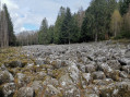
Walk to the Roche du Sphinx in Anould

A very easy little walk that takes you along a fully shaded forest path to the Roche du Sphinx, a natural site situated at an altitude of around 560 m above Anould. As an added bonus, there’s a lovely picnic area where you can relax and enjoy the surroundings.

Details

105470510
Creation:
Last update:
Last review:
  • Walking
    Activity: Walking
  • ↔
    Distance: 1.21 mi
  • ◔
    Average duration: 0h 40 
  • ▲
    Difficulty: Easy

  • ⚐
    Back to start: Yes
  • ↗
    Ascent: + 135 ft
  • ↘
    Descent: - 148 ft

  • ▲
    Highest point: 1,952 ft
  • ▼
    Lowest point: 1,788 ft

Photos

Description of the walk

Car park: 342 Route du Faing, Anould.

(S/E) On leaving the car park, turn right towards the forest and walk for about a hundred metres until you reach a junction with a track. From here, you can head directly to the Roche du Sphinx by turning left and then continuing straight on along the wide, ascending path.

(1) To extend the walk a little, turn right onto a gently sloping path that winds through the forest (marked with Yellow Discs). After a wide bend to the left, the path reaches a Fork in the road.

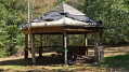
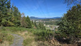
(2) Turn left (a lovely view over Fraize). The path alternates between gentle ascents and descents until you reach a lovely picnic area, equipped with two tables (one in the shade, one in the sun) and a sheltered spot.

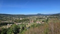
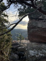
(3) Continue to the right along “the Botanical Trail”, which quickly leads to the Roche du Sphinx promontory. Enjoy a sweeping view over the town of Anould and the Meurthe Valley. (There is a bench here.) Continue downhill to the Sentier de la Roche.

(4) Turn left and carry on straight ahead (ignore the path branching off to the left signposted “sentier botanique”). Walk past the Chalets Lodges and Spa, which are available to rent, then along the edge of the meadow to return to the car park (S/E).

Waypoints

  1. S/E : mi 0 - alt. 1,913 ft - Car park at a place called Le Faing
  2. 1 : mi 0.05 - alt. 1,916 ft - Junction – Path and track
  3. 2 : mi 0.24 - alt. 1,867 ft - Y-junction
  4. 3 : mi 0.79 - alt. 1,900 ft - Picnic area - La Roche du Sphinx
  5. 4 : mi 0.96 - alt. 1,788 ft - Junction with the Roche trail
  6. S/E : mi 1.21 - alt. 1,916 ft - Car park

Notes

Club Vosgien signposts

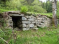
A lovely picnic area at (3) with two tables (one in the shade and one in the sun) and a shelter.
Bench on the Roche du Sphinx promontory.

Worth a visit

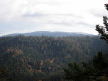
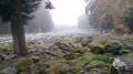
The Sphinx Rock is a natural site situated at an altitude of around 560 m, on a hilltop overlooking the small town of Anould and the Meurthe valley. Its name derives from the shape of the rock, which, in the past, when viewed from a distance, resembled a human head and, from even further away, a stone colossus. The site is covered in heather and scattered rocks, and the rock itself consists of fine-grained feldspathic granite. See Destination Vosges

Other walks in the area

For more walks, use our search engine .

The GPS track and description are the property of this route's author. Please do not copy them without permission.