


 Country:

 City:
City:


Access: head to Xonrupt-Longemer via the D417 and turn left onto the D23 towards Le Valtin. Shortly after the Col du Surceneux, take the D73 on the left and descend into the Straiture valley as far as the Lançoir sawmill. Car park on the left.
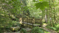
(S/E) At the far end of the car park, take the path specifically signposted “Sentier du Sagard”, marked with a little man. Cross the Petite Meurthe via a wooden footbridge and climb up to reach the small tarmac road, the Route Forestière des Blanches Fontaines.
(1) Walk up the road to the right for about thirty metres, then follow the path on the right, which winds its way through the vegetation on a short, circular loop. (Please note that this 600-metre section can be avoided if you wish to shorten the walk. In that case, head straight down the road to the left.)
(2) Head down the road to the left, until you reach the Route Forestière des Blanches Fontaines a little further down.
(1) Continue down towards the D73.
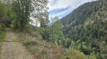
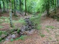
(3) Before reaching this road, turn right to follow the pleasant Sentier du Sagard. You’ll soon feel the cool breeze and walk alongside the Ruisseau de la Petite Meurthe, which dries up during heatwaves.
(4)In a lovely open space, discover the Glacière site with its piles of large, moss-covered granite boulders. You can really feel the coolness of the spot (a sign explains this surprising phenomenon). Why not stop for a break here when it’s hot? Continue uphill along the path beside the Petite Meurthe (some sections may be slippery at certain times of year), cross the stream via a footbridge and join the D73. There’s a lovely picnic area here.
(5) Cross it carefully and head up the tarmac-surfaced Louis François Forest Road opposite.
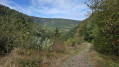
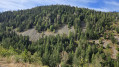
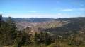
(6) A viewpoint (information board) offers a view of the scree on the left bank of the Straiture Gorge. Leave the road and head down to the left along another grassy forest track (marked with a Yellow Saltire). There are some lovely views over the valley, and a photo exhibition (Sept. 2026) adds to the enjoyment of the descent. Join the D73 and head towards the Scierie du Lançoir. Turn right to return to the Scierie du Lançoir car park (S/E).
 Visorando Member

 Moderate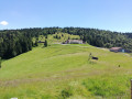
 Difficult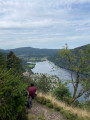
 Very difficult
