Country:

 City:
City:


Shooting range car park, 20 Chemin de Ribeaupierre, Fraiz.
(S/E) Walk past the shooting range, keeping to its left. Enter the forest via a path that begins with a short, steep climb before levelling out into a slight descent. The Yellow Ring markings are not very visible here, but don’t worry – you’ll find them again soon. The path joins a wide track coming from Clefcy.
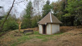
(1) Continue to the left, up steep inclines interspersed with false flats, to reach the Chapelle du Suisse.
(2) Carry on until you come out onto a wider track.
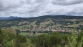
(3) Turn right, continuing to follow the Yellow Ring markings as you climb up to the Roche des Fées. The vegetation now seems to block the view of the pile of very large granite boulders. There is a picnic table here. View of Fraize.
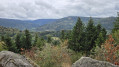
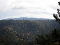
(4) Head steeply uphill to the right to reach, in 10 mins (not 5 mins as stated), the Roche de Rovemont (altitude 754 m), near the television relay station. A very beautiful view over the valleys of the Petite and Haute Meurthe.
(5) You then begin a descent along a path that quickly leads onto a wider track.
(6) Turn left (Yellow Triangle) and follow it for 400 m to reach a three-way junction.
(7) Turn right before the house onto a small, barely visible path which descends and runs alongside the goat pasture: signposted as a shortcut to Fraize, Yellow Triangle. Enter the forest to join, further down, the Chemin de la Roche (a small tarmac road) which passes through the hamlet of La Graine, before reaching the shooting range car park further down (E).
 Visorando Member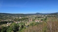

 Difficult
  Moderate