Col de Bagenelles – Schupferen

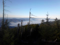
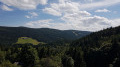
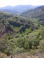
This third day follows the Sentier des Crêtes for the most part, passing through the burnt-out fields with beautiful panoramic views. A walk of moderate difficulty with several opportunities to stop and enjoy a blueberry tart

Details

n°103363865
Creation:
Last update:
Last review:
–
  • Walking
    Activity: Walking
  • ↔
    Distance: 10.77 mi
  • ◔
    Average duration: 7h 20 
  • ▲
    Difficulty: Moderate

  • ⚐
    Back to start: No
  • ↗
    Ascent: + 2,694 ft
  • ↘
    Descent: - 1,847 ft

  • ▲
    Highest point: 4,281 ft
  • ▼
    Lowest point: 2,254 ft
  • ⚐ Country: France
  • ⚐
  • ⚐ City: Le Bonhomme (68650)
  • ⚑
    Start: N 48.192622° / E 7.114619°
  • ⚑
    End: N 48.077049° / E 7.05033°
  • ❏
    IGN map(s): Ref. 3617ET, 3617ETR, 3618OT, 3618OTR, 3718OT, 3718OTR
  • Hour-by-hour weather

Photos

Description of the walk

(S) Follow the GR®5, marked with a Red Rectangle, on a very pleasant descent to the village of Le Bonhomme.

(1) Continue along this GR® (marked with a Red Rectangle), which climbs opposite the bakery to the junction with the GR®52 in the Bois Brûlé.

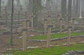
(2) Turn right onto the GR®532, marked with a Yellow Rectangle. Continue along this beautiful, gently ascending path until you reach the junction at the Capitaine Duchêne Necropolis. This was a key battleground during the Battle of Tête des Faux in the First World War.

(3) Turn right, staying on the GR®532, and further on, go round the Tête des Immerlins. Continue via the Petite Tête des Immerlins along a wooded path to reach the Col du Calvaire.

(4) Cross the pass on the left to rejoin the GR®5, marked with Red Rectangles. After a stretch through the forest, the path emerges onto the Hautes Chaumes before reaching the Gazon du Faing.

(5) Continue to the right on the GR®, pass the Gazon de Faîte, and reach the Dreieck car park.

(6) Carry on straight ahead, passing the Chaume du Tanet on your right. Complete the ascent to the summit of the Tanet, then descend to the Col du Tanet.

(7) Leave the GR® here and take the path marked ‘Red Saltire’ on the left to reach the Schupferen Refuge (E) quickly, today’s stop.

Waypoints

  1. S : mi 0 - alt. 2,976 ft - Schupferen Mountain Hut - Col des Bagenelles
  2. 1 : mi 1.86 - alt. 2,260 ft - Le Bonhomme
  3. 2 : mi 2.29 - alt. 2,635 ft - GR junction
  4. 3 : mi 3.92 - alt. 3,684 ft - Nécropole nationale du Carrefour Duchesne
  5. 4 : mi 5.29 - alt. 3,753 ft - Col du Calvaire
  6. 5 : mi 7.58 - alt. 4,272 ft - Gazon du Faing
  7. 6 : mi 9.01 - alt. 4,026 ft - Dreieck
  8. 7 : mi 9.99 - alt. 4,144 ft - Col du Tanet - Tanet (le)
  9. E : mi 10.77 - alt. 3,822 ft - Schupferen Mountain Hut

Notes

Between (3) and (4): quiet area around the Tête des Immerlins.
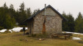
(E) Schupferen mountain hut
Farm inns nearby or along the GR®.
Sun-exposed section along the ridges.
Possible detours at (5) to reach Lac du Forlet, and at (6) to reach Chalet Erichson.

This route passes through multiple protected areas, which may be subject to special regulations:

Worth a visit

(3) Captain Duchêne’s Necropolis: a memorial site highlighting the significance of the fighting on this front during the First World War.
(4) Col du Calvaire: a few terraces where you can have a drink, but no takeaway picnic food available.
(5) Le Gazon du Faing: an orientation table, lovely views; look down to see Lac du Forlet or Lac des Truites.
Views of the lakes.
Note: for your evening meal, book a table at the Auberge du Schupferen, which is situated below the ski club’s mountain hut.

Always be cautious and plan ahead when you're outdoors. Visorando and the author of this route cannot be held responsible for any accidents occurring on this route.

The GR® and PR® markings are the intellectual property of the Fédération Française de Randonnée Pédestre.

Other walks in the area

For more walks, use our search engine .

The GPS track and description are the property of this route's author. Please do not copy them without permission.