Country:

 City:
City:


This walk is a variation on the Dreieck, Lac Blanc, Lac du Forlet route.
Park at the car park at the spot known as “Dreieck” on the Route des Crêtes (D 61). Please note that this is a very popular spot and the car park is often full during the season. It is possible to park along the Route des Crêtes on the left-hand side after the car park.
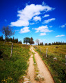
(S/E) From the car park, take the path marked with red and white Rectangles to quickly reach the ridge. Follow it northwards. Look out for granite boundary stones with two markings: ‘D’ on the east side and ‘F’ on the west side. These are the markers of the old border dating from the 1870 war.
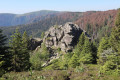
Continue along this path until you reach the path marked with a Red Rectangle on the GR®5. You’ll come to a flat rock perched on the edge of the cliff known as “Taubenklang Felsen”.
(1) The path descends slightly but stays on the ridge and reaches a junction (elevation 1302) at Gazon du Faing. Leave the GR®5, which heads off to the left, and continue along the path marked with a Yellow Triangle until you reach the junction with the Red Triangle path leading up from Lac Forlet.
(2) Turn left onto this path for about 150 m and, at the junction, take the second path on the left (Green Disc) then left again for 150 m. At the Fork in the road, turn right (Green Disc signpost). The path remains in the forest and overlooks Lac Noir. You will reach a crossroads of paths.
(3) Take the path on the left towards the Belmont observatory (marked with a Yellow Cross). When you reach the observatory, take the path on the left; after about 200 metres, you’ll arrive below Château Hans and join a path marked with a Red Ring. Follow it to the right to descend to Lac Blanc.
(4) On arrival, before the car park, take the path on the right, the GR®532 (Yellow Rectangle), which runs above the D48.2, and follow it until it joins a wide track. Follow this track to the right; it curves sharply to the left, and in the right-hand bend that follows, an unmarked path climbs up to the right.
(5) Follow this, then at the junction keep to the left, pass under a high-voltage power line and cross the main track. Join the Green Disc-marked path at a hairpin bend to the left.
(6) Take the Yellow Saltire marked trail on the left to descend to the Lac Noir dam. Cross the roundabout, follow the road for a few metres and rejoin the trail.
(7) Leave the path about 30 m further on, after the bridge over the stream from the lake, and turn left onto the Red Rectangle and White Rectangle-marked path which climbs into the State Biological Reserve. Further on, cut across a track with a right-left turn, then rejoin it for a steep climb (Red Disc markings) up to a plateau with a multi-path junction.
(8) Continue straight on towards Lac Forlet, first through mountain pastures and then through woodland, initially on level ground and then downhill, until you reach the lake’s dam. Cross it and take the track along the lake, passing the Ruisseau de Soultzeren.
(9) Continue to the right towards the Forlet farmhouse inn (catering, cheese on sale).
(10) Retrace your steps.
(9) Carry on straight ahead, and after passing a large boulder on the right, look out for an unmarked and barely visible path on the right . See Practical Information.
This path winds down into the valley towards a chalet, which you leave on your right to follow a track, choosing your route somewhat by eye depending on the water level. __Caution__: watch your step (the path is often waterlogged) and choose your route carefully to cross this wet area. Continue climbing, following the path as best you can; higher up, the path becomes more visible and follows the valley floor – follow it, keeping the Altenwasen Refuge at the top of the slope in sight.
(11) At the refuge, after crossing a meadow, climb the three steps leading up to the landing in front of the building and take the vaguely passable track to the left. Head down towards a crossroads and look for the path marked with a Yellow Disc near a building (Schoch chalet). Turn right onto a steep climb and emerge from the forest at the top of a meadow onto an easier track to reach the Erichson Chalet (Club Vosgien). On a clear day, there are lovely views of the mountain pastures, the Munster Valley, the Black Forest and the Alps.
(12) Walk behind the chalet. You’ll reach a hairpin bend on the wide track leading up from Lac Vert, marked with a Red Disc. Follow it to the right to return to the starting car park (S/E).
 Visorando Member

 Tourist office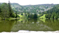
 Easy
Easy