Schupferen – Hahnenbrunnen

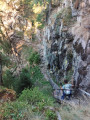
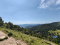
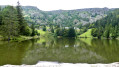
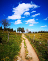
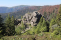
A stage of around twenty kilometres that begins in the shade of the forest, then runs alongside the Hirschsteine and Spitzenfels rocks, with a few sections secured by metal steps and fixed handrails, before continuing along the ridges after the Col de la Schlucht and passing beneath thethird-highest peak in the Vosges, the Hohneck.

This walk is part of a multi-day hike: Traversée des Vosges du Sud de Kintzheim à Willer-sur-Thur

Details

n°103365254
Creation:
Last update:
Last review:
–
  • Walking
    Activity: Walking
  • ↔
    Distance: 12.27 mi
  • ◔
    Average duration: 7h 15 
  • ▲
    Difficulty: Moderate

  • ⚐
    Back to start: No
  • ↗
    Ascent: + 1,798 ft
  • ↘
    Descent: - 1,762 ft

  • ▲
    Highest point: 4,281 ft
  • ▼
    Lowest point: 3,576 ft
  • ⚐ Country: France
  • ⚐
  • ⚐ City: Stosswihr (68140)
  • ⚑
    Start: N 48.077078° / E 7.050369°
  • ⚑
    End: N 47.951847° / E 7.019311°
  • ❏
    IGN map(s): Ref. 3618OT, 3618OTR, 3619OT, 3619OTR
  • Hour-by-hour weather

Photos

Description of the walk

(S) Take the Blue-White-Blue marked downhill path behind the refuge to reach the junction with the GR®531.

(1) Now follow this GR® route, marked with a Blue Rectangle, straight ahead and uphill; after a series of ascents and descents, you’ll reach the Col de la Schlucht. Take care on this section, which starts on a wide track and then continues along a secured path passing through the Hirschsteine Rocks and then the Spitzenfels.

(2) Here, join the GR®5 (marked with a Red Rectangle) and head towards the junction at the CAF des Trois Fours mountain refuge.

(3) Leave this refuge on your left, continue along the GR® and, after an easy climb, reach the Col de Falimont.

(4) Carry on straight ahead along the Red-White-Red signposted path to reach the Hohneck. Continue along a virtually level section, then head downhill to reach the Firstmiss junction.

(5) Carry on, passing close to the farmhouse inn and then beneath the three peaks: Rainkopf, Rothenbachkopf and Batteriekopf, before reaching the Col du Herrenberg, where you rejoin the GR®5 once again.

(6) Take the path straight ahead and follow it for a long descent to the Hahnenbrunnen Refuge (E), today’s destination.

Waypoints

  1. S : mi 0 - alt. 3,822 ft - Schupferen mountain hut
  2. 1 : mi 0.65 - alt. 3,589 ft - GR531 - Belvédère de Hirschteine
  3. 2 : mi 2.34 - alt. 3,737 ft - Col de la Schlucht
  4. 3 : mi 3.28 - alt. 4,032 ft - Crossroads - Trois-Fours
  5. 4 : mi 4.31 - alt. 4,245 ft - Col de Falimont (1295m)
  6. 5 : mi 6.36 - alt. 4,068 ft - Firstmiss
  7. 6 : mi 9.55 - alt. 3,907 ft - Col du Herrenberg (1191m)
  8. E : mi 12.27 - alt. 3,885 ft - Refuge du Hannenbrunnen

Notes

(E) Please ensure you book the Touring Club refuge at Hahnenbrunnen.
(E) You can have an evening meal at the Hahnenbrunnen Farm Inn on the other side of the road.

There are inns and farmhouse inns not far from the GR®.
Viewpoints, peat bog, climbing site.
Route exposed to sun or wind.
Option to increase the elevation gain by climbing each peak (Kopf) crossed by the GR®, or at least to the summit of the Hohneck.

This route passes through a protected area, which may be subject to special regulations:

Worth a visit

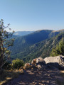
Before reaching ‘4 ’ on the left, admire the Martinswand climbing crags.
In good weather and depending on the season, you may be able to see the Bernese Alps.

Always be cautious and plan ahead when you're outdoors. Visorando and the author of this route cannot be held responsible for any accidents occurring on this route.

The GR® and PR® markings are the intellectual property of the Fédération Française de Randonnée Pédestre.

Other walks in the area

For more walks, use our search engine .

The GPS track and description are the property of this route's author. Please do not copy them without permission.