Country:

 City:
City:


Park at the Lac Blanc car park (arrive early in the morning to find a space).
Red Ring markings
(S/E) With your back to Lac Blanc, cross the road and, after a few metres, turn right onto a winding path with a steep gradient heading towards the Rocher du Hans. As you approach the Rocher du Hans, the path becomes more technical and even vertiginous, but is secured by handrails.
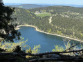
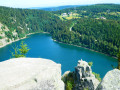
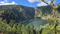
(1) At the Rocher du Hans, take in the view of Lac Blanc. Then continue along a steep path with steps. Next, climb up a large scree slope to reach a fork in the path.
Marked with Yellow Crosses
(2) Turn left towards the Belmont Observatory.
(3) Take in the view and continue along the path which descends to the right until you reach the next junction.
Blue Disc markings
Turn left when you reach the track heading towards Lac Noir. Take one bend, then a second, and carry on straight ahead until you reach a wide track on the left. Continue downhill, turn right and then, at the hairpin bend, turn left towards Lac Noir.
(4) Cross the dam and, at the bend, take the Lac du Forlet path straight ahead. At the first track, turn right, cut across the second, then turn right at the third to reach a hairpin bend. Head up to the left and follow the track straight ahead until it ends at the junction of four paths.
Red Disc markings
(5) Continue straight ahead – there are lovely views from this point – towards Lac du Forlet. The path is flat before widening, entering the forest and becoming rockier.
(6) Cross the Lac du Forlet dam.
Yellow Disc Markings
Head straight ahead, then turn right onto the path towards Lac Vert. After a climb, keep left to follow the path to a hut. Continue along the track to Chalet Erichson.
Red Disc markings
(7) Turn right towards the chalet, onto the track, and head downhill to reach a junction (you can turn right here to cut the circular route short).
Unmarked
Take the track leading down opposite, make a sharp left-hand bend and ignore the Red Disc-marked paths on the left and then on the right. At the Fork in the road after the second one, head down to reach a hairpin bend.
Yellow Disc markings
Follow the track to the right until you reach the access road to Lac Vert.
Blue Rectangle with a white cross
(8) Head up the path that runs alongside the road towards the Col de la Schlucht. Continue along this path until you reach the vicinity of the Seestaettle farmhouse inn.
(9) Keep climbing to the right. After a flat section, ignore a path on the right. After a climb, go through a fence and then turn right onto the track.
(10) Follow it to the right down a gentle slope. At the crossroads, head down to the left towards a farm.
(11) Ignore the track to the left and carry on to the next junction.
Blue Rectangle signpost
(12) Keep heading towards the Hirschsteine steps to reach another Fork in the road.
No signposting: head towards the Hirschsteine steps and its viewpoint
(13) Continue along the path on the left to reach the Hirschsteine viewpoint.
Yellow Triangle signpost
(14) Enjoy the view over the Munster Valley, then continue along the path. Go down the stairs and begin a technical and rather vertiginous section. It doesn’t last long but may be daunting for those prone to vertigo. The end of this technical section is marked by a passage beneath a boulder wedged between two cliffs. The path is then stony but safe. When you reach the track, head up to the hairpin bend.
Signposting: Red Rectangle with a white cross
(15) Turn left towards the Col de la Schlucht. The path winds upwards in hairpin bends and rejoins the track: follow it to the left to rejoin the path further on, leading to a viewpoint.
(16) Here, a panoramic view opens up over the pass and the Honneck. Then continue the ascent, keeping to the left at the first junction, until you reach a point almost on the ridge and theGR®5.
Red Rectangle Markings
(17) Turn right towards Le Tanet. Most of the ascent is now behind you. You’ll reach a first junction.
(18) Head straight on along a path that gradually gains height. Ignore a Red Saltire signpost that leads down to the right towards Le Tanet.
(19) There’s a 360° view: make the most of it before continuing along the path towards the Col du Calvaire. Keep going straight ahead until you reach a track.
(20) This is where the shortcut mentioned earlier ends. Cut across it , then keep to the left to tackle the day’s final major climb towards the Gazon de Faîte.
(21) This marks the start of a long, completely open stretch with numerous views. Continue straight on along the ridge. Pass a path that descends to the left and go past an orientation table to reach the Gazon du Faing.
(22) Carry on to the left towards the Col du Calvaire. Pass a junction to reach a second one, just after the second rise.
(23) Carry on straight ahead across open ground to the edge of the forest.
(24) Turn right until you reach a crossroads.
No signposting
Follow the wide path on the left until you reach the first ski lifts on the right: take the path leading to them, go round the back of them and rejoin the Red Rectangle-marked trail.
Red Rectangle markings
Head down to the left along a winding path until you reach a wide white track.
Yellow Rectangle markings
(25) Head down towards Lac Blanc. Once you reach the lake, follow the path to the left, then carry on straight ahead to the car park (S/E).


 Association / Club / Walk leader
 Difficult
 Visorando Member
 Moderate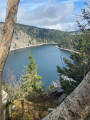
 Easy
Easy