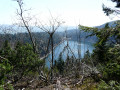
Lac Noir, Col du Calvaire and Lac Blanc circular

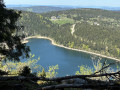
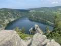
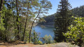
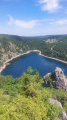
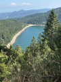
10 km with beautiful views of two glacial lakes. The largest and highest, Lac Blanc (depth 72 m), covers 29 ha at an altitude of 1,055 m, while Lac Noir (depth 45 m) covers 14 ha at 955 m. Breathtaking views from the Belmont Observatory. Don't forget your camera.

Details

10704643
Creation:
Last update:
Last review:
  • Walking
    Activity: Walking
  • ↔
    Distance: 6.10 mi
  • ◔
    Average duration: 3h 45 
  • ▲
    Difficulty: Difficult

  • ⚐
    Back to start: Yes
  • ↗
    Ascent: + 1,102 ft
  • ↘
    Descent: - 1,099 ft

  • ▲
    Highest point: 4,209 ft
  • ▼
    Lowest point: 3,130 ft

Photos

Description of the walk

Departure from the Lac Noir dyke car park.

(S/E) Take the tarmac path on the right, facing the lake, and pass in front of the Auberge du Lac Noir. Very quickly, 70 m from the start, you will come to a barrier.

(1) Go up the path on the right and follow the blue disc markings (for about 2 km) to the path that climbs diagonally to the right, marked with a yellow cross.

(2) Follow this path marked with yellow crosses to the Belmont Observatory viewpoint. Be careful, especially with children, as there is loose rock that can be dangerous.
You will have a panoramic view of impressive rocky peaks with the lake below (in short, a real picture-postcard view).

(3) Go back a few metres and continue along the yellow-marked trail until you reach the junction with the Tour du Lac Blanc trail, marked with a red ring.
Alternative: turn right and walk back to see the Rocher du Hans.

(4) Take the path on the left marked with a red ring and continue to the Source du Lac Blanc (table and benches for six people).

(5) Pass the source of Lac Blanc and continue north, still following the red ring markings for about 500 metres until you find a path on the left that joins theGR®5and the stubble fields.

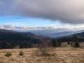
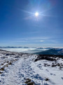
(6) Change of view. From the stubble fields of Gazon du Faing, there is a view of the Vosges mountainside (you can see Saint-Dié to the north-east).
Take one of the small unmarked paths that climb northwards parallel tothe GR®5marked with a red rectangle, then continue through a beautiful forest to the Col du Calvaire.

(7) Cross the road (with caution), turning right and leaving the Route des Crêtes on your left. Descend the path on theGR®531marked with a blue rectangle, which is on the left of the Route du Lac Blanc (in the direction of descent) towards the Auberge du Blanrupt (restaurant with terrace and beautiful view). Pass several residences and hotels on your left.

(8) From the restaurant, turn right and head uphill for about 100 metres. Pass a small DDE building on your left.

(9) Opposite, on the left, take the path marked Anneau Bleu to the Lac Blanc car park and the Auberge-Bar: Le Mille Mètres.

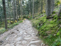
(10) When you reach the car park at the southern end of the lake, on the left as you look at the lake from the car park, climb the Sentier Cornelius trail. It leads through a pile of rocks and large roots to Lac Noir and is marked with yellow rectangles forthe GR®532. Follow it downhill until you reach the car park at the start (S/E).

Waypoints

  1. S/E : mi 0 - alt. 3,130 ft - La Digue car park - Lac Noir
  2. 1 : mi 0.04 - alt. 3,136 ft - Barrier - Blue Disc
  3. 2 : mi 1.19 - alt. 3,976 ft - Path on the right, diagonally, Yellow Cross
  4. 3 : mi 1.26 - alt. 4,039 ft - Belmont Observatory
  5. 4 : mi 1.42 - alt. 4,058 ft - Crossroads - Rocher Hans
  6. 5 : mi 1.79 - alt. 4,206 ft - Source du Lac Blanc
  7. 6 : mi 2.13 - alt. 4,131 ft - Small path on the left (not marked).
  8. 7 : mi 3.06 - alt. 3,753 ft - Col du Calvaire
  9. 8 : mi 3.39 - alt. 3,632 ft - Auberge le Blanrupt
  10. 9 : mi 3.47 - alt. 3,632 ft - Path on the left going downhill - Blue Ring
  11. 10 : mi 4.55 - alt. 3,468 ft - Cornelius Trail - Lac Blanc (massif des Vosges)
  12. S/E : mi 6.1 - alt. 3,130 ft - Lac Noir dam car park

Notes

Classified as difficult, mainly due to the sustained uphill start and numerous rocky paths. Good shoes and walking sticks are essential, as there are large stones and rocks and the paths are uneven. Allow around 5½ hours including breaks.

Restaurants and inns along the route, at the start at the Lac Noir car park (S/E), halfway at the Col du Calvaire (S/E) and nearby at the Lac Blanc car park (10).

Two benches and one table for six people at the Source du Lac Blanc (5).

No shelter (to my knowledge) apart from the restaurants in the car parks and at Col du Calvaire.

Worth a visit

On the way down, passing through Orbey, you can buy magnificent farmed trout (rainbow, brown and salmon).
Sales points are on the left as you descend.

Auberge des 2 Lacs (restaurant and trout sales)
310 lieu dit noirupt, 68370 Orbey
03 89 71 33 22

Pisciculture Francois Guidat
148 Rue Charles de Gaulle, 68370 Orbey
06 66 65 47 46

Always be cautious and plan ahead when you're outdoors. Visorando and the author of this route cannot be held responsible for any accidents occurring on this route.

The GR® and PR® markings are the intellectual property of the Fédération Française de Randonnée Pédestre.

Reviews and comments

4.7 / 5
Based on 8 reviews

Reliability of the description
4.6 / 5
Ease of following the route
4.6 / 5
Route interest
4.9 / 5
nm66
nm66

Overall rating : 4.3 / 5

Date of your route : Jun 03, 2025
Reliability of the description : ★★★★☆ Good
Ease of following the route : ★★★★☆ Good
Route interest : ★★★★★ Very good
Very busy route : Yes

A beautiful hike, with superb views over the lake. The path is rather steep, with several difficult passages over scree.
Good footwear is essential.

Machine-translated

Sundgau44
Sundgau44

Overall rating : 5 / 5

Date of your route : May 14, 2025
Reliability of the description : ★★★★★ Very good
Ease of following the route : ★★★★★ Very good
Route interest : ★★★★★ Very good
Very busy route : No

Very beautiful route. Stick to the suggested itinerary and avoid trying to shorten the route by going along the Lac Blanc (yellow rectangular marker) as the path is in poor condition. The Cornelius trail is partly rocky.

Machine-translated

herwac
herwac

Overall rating : 5 / 5

Date of your route : May 11, 2024
Reliability of the description : ★★★★★ Very good
Ease of following the route : ★★★★★ Very good
Route interest : ★★★★★ Very good
Very busy route : No

Great hike with a variety of terrain and a fairly steep climb, but the view of Lac Blanc from the summit is well worth the effort.

Machine-translated

Beck Nicolas
Beck Nicolas

Overall rating : 4.7 / 5

Date of your route : Oct 09, 2023
Reliability of the description : ★★★★★ Very good
Ease of following the route : ★★★★★ Very good
Route interest : ★★★★☆ Good
Very busy route : No

Lovely walk, thanks to the tracker.

Machine-translated

Skope
Skope

Overall rating : 4.3 / 5

Date of your route : Jul 24, 2023
Reliability of the description : ★★★★☆ Good
Ease of following the route : ★★★★☆ Good
Route interest : ★★★★★ Very good
Very busy route : Yes

Not a very difficult hike, but the trail is complicated. Be sure to wear good shoes.
Very beautiful lakes and varied landscapes

Machine-translated

Chris579
Chris579

Overall rating : 5 / 5

Date of your route : Jul 11, 2023
Reliability of the description : ★★★★★ Very good
Ease of following the route : ★★★★★ Very good
Route interest : ★★★★★ Very good
Very busy route : Yes

Beautiful route, beautiful scenery, clearly a hike that was enjoyed.

Difficulty at the start: quite a climb and paths made of large stones, etc.

I agree with the review about the orientation near the inn, but with the map and GPS, you can quickly get back on the right track.

Quite a few people on certain parts of the route, which sometimes led to brief exchanges.

I did it without walking poles, but I understand why some people recommend them: an option to consider!

Machine-translated

Dom 55
Dom 55

Overall rating : 4.3 / 5

Date of your route : Oct 31, 2022
Reliability of the description : ★★★★☆ Good
Ease of following the route : ★★★★☆ Good
Route interest : ★★★★★ Very good
Very busy route : Yes

A beautiful route with stunning views. It's a bit of a climb 🥵. Good shoes and walking sticks are recommended. 👍

Machine-translated

Marine FOELL
Marine FOELL

Overall rating : 5 / 5

Date of your route : Oct 28, 2022
Reliability of the description : ★★★★★ Very good
Ease of following the route : ★★★★★ Very good
Route interest : ★★★★★ Very good
Very busy route : Yes

A very beautiful hike!
Right from the start and for a few kilometres, there is a rocky climb, hence the "difficult" rating. The trails are varied (forest paths, flat paths, rocky paths, etc.). Beautiful scenery awaits you at the summit. The route is easy to follow, with a few orientation difficulties at the Blancrupt inn, but with the GPS map I was able to find my way again very quickly.

Machine-translated

Other walks in the area

For more walks, use our search engine .

The GPS track and description are the property of this route's author. Please do not copy them without permission.