


Refine your search for walks in Mellac
Mellac walks


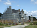
 In the woods around Kernault Manor
 Visorando Member
 3.06 mi
 +72 ft
 -98 ft
 1h 30
 Easy
 Departure from Mellac (Finistère)
Listed as a historic monument, the manor house was a jewel of its era during the 15th and 16th centuries. Its main building and outbuildings, including a chapel and a half-timbered farm building, bear witness to the power of its owners. The Domaine de Kernault is a 30-hectare park owned by the Finistère Departmental Council. The natural environment is preserved through its woods, ponds and meadows. Near the manor house lies an exceptional collection of cider apple orchards.
In the footsteps of the Chouans in Tréméven
 2.61 mi
+305 ft
-305 ft
1h 30
Easy
Departure from Tréméven (Finistère) (Finistère)
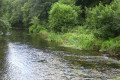
The Roscado-Pontégan route, following in the footsteps of the Chouans. Highlights include the parish enclosure at Tréméven, Roscado Manor, the Chouan Cross, Pontégan Bridge spanning the River Isole, a ruined mill, the Poachers’ Rock, and an ancient Roman road.
Loc Yvi – Saint-Diboan Chapel and fountain – Ellé Valley
 1.97 mi
+240 ft
-240 ft
1h 05
Easy
Departure from Tréméven (Finistère) (Finistère)
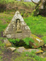
The walk first takes you from the Chapel of Saint-Diboan (in the hamlet of Loc Yvi) to the consecrated fountain of the same name. The shaded path then winds its way into the unspoilt Ellé valley, the natural boundary between the regions of Cornouaille and Vannes, with its striking rocky outcrops and boulder fields shaped by erosion, and its steep-sided valleys carved out by small rapids (known as ‘froud’ in Breton).
Toulfouen, Château de Carnoët and the Bishop’s Chair
 5.17 mi
+207 ft
-236 ft
2h 35
Easy
Departure from Quimperlé (Finistère)
A circular walk on the northern side of the Forest of Toulfoën, offering views of a chapel, the Chemin du Duc, Carnoët Castle and the Bishop’s Chair.
Saint-Thurien Circular
6.09 mi
+705 ft
-696 ft
3h 25
 Moderate
Departure from Saint-Thurien (Finistère) (Finistère)
A walk through the Thuriennoise countryside.
 In the heart of the Carnoët Forest
 3.68 mi
+220 ft
-226 ft
Duration unknown
Easy
Departure from Quimperlé (Finistère)
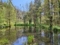
Walk through the heart of the Carnoët Forest, taking in the Tailors’ Pond, the Kerguéguen Stele, the Frout and Fontaine au Loup streams, and the Devil’s Bridge.
Around Saint-Thurien and along the banks of the Isole
 4.31 mi
+459 ft
-479 ft
2h 25
Easy
Departure from Saint-Thurien (Finistère) (Finistère)
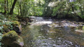
A short hike in the countryside of Saint-Thurien and along the banks of the Isole river, starting from the village of Saint-Thurien.
Loop in the Carnoët National Forest and along the banks of the Laïta
5.30 mi
+433 ft
-433 ft
2h 50
Easy
Departure from Quimperlé (Finistère)
A peaceful walk, part of which is through the heart of the forest and part along the banks of the beautiful Laïta. There are many places with picturesque names (Fontaine aux Loups, Fontaine des Dimanches, Pont du Diable, Pont de Pierre, Port du Passage, Étang de Tailleurs, etc.), which bear witness to the former life of the "forest people".
The Devil’s Rocks on the Ellé
 2.70 mi
+551 ft
-564 ft
1h 45
Moderate
Departure from Querrien (Finistère)
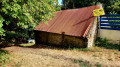
In the heart of Finistère, between Le Faouët and Quimperlé, the River Ellé has carved its way through the Armorican Plateau. Emerging from gorges 80 metres deep, the river rushes for 300 metres between enormous blocks of granite smoothed by millions of years of erosion: this is the Roches du Diable, one of Brittany’s most beautiful rock formations.Its name has ancient origins: the Breton name for the river, Ellez, means ‘hell’. Legend tells of a confrontation between Saint Guénolé, founder of the parish of Locunolé, and the devil, who hurled enormous boulders at him before plunging into a bottomless chasm. The devil’s hand, seat and bed… the rocks still bear the marks.From the footpaths overlooking the valley, a striking panorama opens up onto the rugged landscape and white-water rapids that attract kayakers every winter. The walk follows the river and its mill for nearly 5 km, as far as Locunolé, crosses the Moulin Neuf bridge and reveals some of the many facets of this rural area.
Grand Tour of Rédéné via the fountains
 6.27 mi
+299 ft
-315 ft
3h 10
Moderate
Departure from Rédené (Finistère)
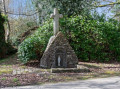
Rédéné is a commune in Finistère. It is situated in the Vannetais region, 8 km from Quimperlé. This grand tour of Rédéné is designed to provide a 10 km route for runners. But it also allows all walkers visiting Rédéné to explore the neighbourhoods of this charming Breton village. Setting out in search of the village’s three fountains adds a little extra interest.
Bois de Kermeur and the banks of the Bélon
 7.46 mi
+266 ft
-295 ft
3h 40
Moderate
Departure from Moëlan-sur-Mer (Finistère)
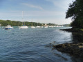
This route combines a countryside section through small villages with the Bois de Kermeur, where you will discover the Fontaine Sainte-Thumette and the long covered walkway of Kermor Bihan.
The return journey follows the left bank of the Bélon, a major oyster farming area.
From Moëlan to the sea and back, via Chef-du-Bois
9.36 mi
+597 ft
-597 ft
4h 50
Moderate
Departure from Moëlan-sur-Mer (Finistère)
This fairly long walk allows you to discover the different aspects of nature in this pretty corner: cliffs overlooking the ocean, streams and green corridors, diverse forests. It also has the advantage of being able to start directly on foot from the village of Moëlan. Another advantage is that there are many variations that allow you to make the walk shorter or longer.
The Scorff at Pont Kerlo
 5.33 mi
+479 ft
-482 ft
2h 50
Easy
Departure from Finistère
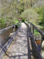
Starting from Kerlo Bridge, a short hike of about 10km will take you along the right bank of the Scorff to the Moulin du Roc'h site and its motte-and-bailey castle. Then, climbing up to the plateau, you will discover the chapels of Locmaria-Grâce and Sainte-Anne, which overlook the valley. The return journey follows the opposite bank of the Scorff.
Kergoulouët and Sainte-Thumette circular loop
 3.90 mi
+135 ft
-135 ft
1h 55
Easy
Departure from Moëlan-sur-Mer (Finistère)
Walk through the fields then return through the undergrowth, along the banks of the Bélon.
Between Scorff and Ellé in Arzano
 11.65 mi
+833 ft
-830 ft
6h 05
Moderate
Departure from Finistère
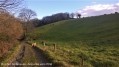
This route will take you on a tour of two beautiful Breton rivers, the Scorff and the Ellé, and three old mills: the Kerlégant, Mohot and Stall mills.
Land and sea via Le Pouldu, departing from Cohars-Carnoët
 12.55 mi
+305 ft
-315 ft
6h 00
 Difficult
Departure from Clohars-Carnoët (Finistère)
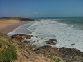
At the end of the 19th century, following Pont-Aven, Le Pouldu in Clohars-Carnoët became a refuge for several painters from the Pont-Aven School, such as Paul Gauguin, Meyer de Haan, Paul Sérusier, Charles Filiger and many others. The seaside and the lush countryside inspired these artists, who captured them in their paintings.The countryside sections have retained many lovely, shaded sunken paths. Three restored chapels and a windmill add a lovely heritage touch to this walk.
Along the Belon and the estuary of the Karstic Cave
 9.03 mi
+433 ft
-456 ft
4h 30
Moderate
Departure from Riec-sur-Belon (Finistère)
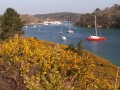
Discover the right bank of the Belon and where it meets the Aven, where these two rivers flow into the sea.
Return via quiet country lanes before reaching another cove on the Belon.
The banks of the Belon and Anse de Penmor
 5.25 mi
+256 ft
-259 ft
2h 40
Easy
Departure from Riec-sur-Belon (Finistère)
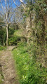
Two coastal rivers, the Aven and the Belon, have the same estuary facing Port Manec'h. This circuit largely follows the edge of the Belon and one of its coves, Penmor. During the walk, you will discover two beautiful fountains and the Saint-Léger Chapel.
Towards the Sainte-Anne-du-Scorff Chapel from Guilligomarc'h
 10.15 mi
+722 ft
-699 ft
5h 20
Moderate
Departure from Guilligomarc'h (Finistère)
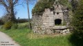
Starting from Guilligomarc'h, this 16km hike follows both banks of the Scorff between Moulin du Stang and Pont Kerlo, passing by the Sainte-Anne-du-Scorff chapel and the old Paou paper mill.
It will allow you to discover a beautiful wild river with cool, fast-flowing waters
From the Saint-Maurice Bridge via the Saint-Michel Chapel
 8.78 mi
+640 ft
-617 ft
4h 35
Moderate
Departure from Guidel (Morbihan)
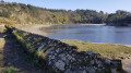
Walk back up along the Laïta, following thePR® trail, and visit the Saint-Michel Chapel.
The valleys north of Lanvenegen
 9.08 mi
+741 ft
-751 ft
4h 50
Moderate
Departure from Lanvénégen (Morbihan)
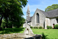
This walk follows sections of the three main routes in the area: the Tour de Locmaria with its chapel and narrow paths, the Circuit des Asphodèles with its ecological and Breton-themed focus, and theGR®38, which crosses the entire region, taking you past the main attractions.
A lovely, mainly wooded, undulating walk, with sunken paths, rivers and unusual spots.
The countryside around Bannalec, starting from the Sainte-Véronique Chapel
7.03 mi
+558 ft
-558 ft
3h 45
Moderate
Departure from Bannalec (Finistère)
A route through the countryside, passing through Rumérou and the Rozhuel mill.
Through the Cascadec Forest and along the left bank of the Isole
 6.26 mi
+384 ft
-377 ft
3h 15
Moderate
Departure from Scaër (Finistère)
This circular route through the Cascadec Forest takes you through old hamlets somewhat lost in the countryside, often undergoing restoration, before returning along the left bank of the River Isole and its granite boulders.
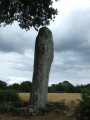
Discover old bread ovens, the imposing Saint-Jean menhir and the chapel of the same name, as well as the former Bolloré paper mills, one of the two sites where the famous ‘OCB’ cigarette paper was manufactured.
NB: The chapel was demolished in 2020.
From Bélon Castle to Anse de Goulet, Riec
5.41 mi
+289 ft
-289 ft
2h 45
Easy
Departure from Riec-sur-Belon (Finistère)
Explore the banks of the Belon and the karstic cave along the GR®34. If you love coastal walks, you’ll be spoilt for choice. Take the time to admire the panoramic view at Pointe de Penquernèo. Lush vegetation, turquoise water and a breathtaking viewpoint. Ideal for a picnic break.
Countryside and banks of the Aven and Belon rivers via the Port de Rosbraz
 6.66 mi
+446 ft
-472 ft
3h 25
Moderate
Departure from Riec-sur-Belon (Finistère)
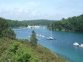
After a peaceful walk along small country roads to discover the Allée Couverte Arc Boutée de Kerantiec, this circuit joins the karstic cave at the Rosbraz marina. The return via the GR®34 overlooks the left bank of the Aven and then the right bank of the Belon, offering views of the opposite bank of each river.
Route de Saint-Fiacre à Le Faouët
 3.55 mi
+203 ft
-180 ft
1h 50
Easy
Departure from Le Faouët (Morbihan) (Morbihan)
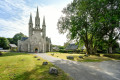
This short circular loop starts at the Saint-Fiacre Chapel. A 15th-century building in the Flamboyant Gothic style, it boasts the oldest and most famous polychrome wooden rood screen in Brittany. On the way back, walkers will discover its fountain, whose water, according to legend, cures skin diseases.
Walk in the Belon region
 5.00 mi
+269 ft
-256 ft
2h 30
Easy
Departure from Moëlan-sur-Mer (Finistère)
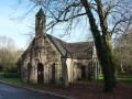
The banks of the Belon and its oysters, chapel, fountains and covered walkway are all part of this very easy hike. You will walk through the Kermeur woods and along the river on a coastal path that offers beautiful panoramic views.
Circular starting from Port du Belon via Kermeur Bihan and Kerfany
 7.18 mi
+348 ft
-344 ft
3h 35
Moderate
Departure from Moëlan-sur-Mer (Finistère)
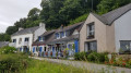
Hiking tour to discover the banks of the Belon and the surrounding heritage: Lanriot and Saint-Guinal chapels, fountains, covered walkway, coastal path and oyster beds.
Around the Belon, a microcosm of Brittany
 4.05 mi
+174 ft
-151 ft
2h 00
Easy
Departure from Moëlan-sur-Mer (Finistère)
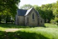
A taste of Brittany! Fishing villages, chapels, rivers, beaches, oyster farming and sunken lanes... the whole of Brittany in a single walk.
A circular route between Merrien and Saint-Thamec, Portec and Porz Bali
2.77 mi
+108 ft
-115 ft
1h 20
Easy
Departure from Moëlan-sur-Mer (Finistère)
A lovely little route through wild valleys, woods and cliffs.
From Pont-Aven to Hénan Castle
 4.37 mi
+233 ft
-230 ft
2h 15
Easy
Departure from Pont-Aven (Finistère)
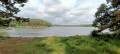
The city of painters is nestled at the bottom of an aber, where the sea becomes a torrential river.
Downstream, the tides create a landscape that varies according to the tidal range. At low tide, mudflats cover a large part of the foreshore, while at high tide, the sea creeps into the heart of the woods, which form a green backdrop to the sea tongues overlooked by ancient pollarded trees. What a pleasure it is to walk here!
A rollercoaster ride around Brigneau
7.78 mi
+220 ft
-213 ft
3h 45
Moderate
Departure from Moëlan-sur-Mer (Finistère)
This route allows you to explore both banks of the Ria de Brigneau, including its small harbour of ‘heritage interest’, with beautiful stretches of coastal path on either side, and, tying it all together, a network of very varied trails.
Walk along the Ria de Merrien in the Pays de Quimperlé
 2.54 mi
+115 ft
-112 ft
1h 15
Easy
Departure from Moëlan-sur-Mer (Finistère)
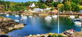
Set off for the Ria de Merrien, this unassuming gem of southern Finistère where the tides, capricious and bountiful, have danced to the rhythm of the centuries. Its turquoise waters, sheltered by lush green woodland, have been home to oysters farmed by oyster growers for over a century. Between the Bois de Plaçamen and the oyster ports, thisnatural site – protected by the Conservatoire du Littoral – invitesyou to enjoy a fun orienteering walk. The Merrien Lighthouse, one of a string of four lighthouses in the area, which you’ll come across right at the end of the route, watches over this haven where tradition and nature blend together between land and sea.
A loop on the right bank of the River Merrien
 5.87 mi
+203 ft
-217 ft
2h 55
Moderate
Departure from Moëlan-sur-Mer (Finistère)
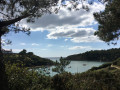
From Merrien on the right bank to Moulin L'Abbé via Brigneau. You can start this hike at point (3) (Brigneau cove car park)
Departure to Merrien
 6.19 mi
+246 ft
-243 ft
3h 05
Moderate
Departure from Moëlan-sur-Mer (Finistère)
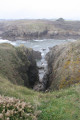
Leaving the small port of Merrien, you follow the seafront. After returning via small grassy paths, you'll make your way up the entire ria.
Tro kreiz ker Gwidel
 3.52 mi
+174 ft
-180 ft
1h 45
Easy
Departure from Guidel (Morbihan)
This route, also known as the “pedestrian ring road”, was initiated by the town of Guidel.
It allows you to walk around the town centre (kreiz ker in Breton) via wooded paths, lovely lanes bordering meadows and routes through residential neighbourhoods.
The pleasant route, mostly through woodland, is clearly signposted with posts bearing a green arrow and the words "périphérique pédestre".
A lovely way to discover another side of Guidel.
Saudraye circular in Guidel
3.05 mi
+43 ft
-49 ft
1h 25
Moderate
Departure from Guidel (Morbihan)
A rolling route suitable for trail running. The series of ascents and descents on technical terrain is a real pleasure in this peaceful valley along the Saudraye, which feeds into the Loch pond. Depending on the season, the terrain can be muddy and slippery.
Circular Pont-Scorff: the Scorff Valley, Sainte-Flamine and the greenway
 12.06 mi
+561 ft
-571 ft
6h 00
Difficult
Departure from Pont-Scorff (Morbihan)
From the charming village of Pont-Scorff, the walk descends through the Scorff valley and its highlights (Saint-Urchaud, Rocher du Corbeau), then winds through varied landscapes punctuated by the many chapels marking the various hamlets along the way.
Route from Saint-Urchaut to Pont-Scorff
 Local authority
 8.17 mi
+371 ft
-377 ft
4h 05
Moderate
Departure from Pont-Scorff (Morbihan)
From the Scorff estuary to the Scave.
Starting from the historic town of Pont-Scorff, explore the Scorff and Scave valleys with their wild and unspoilt landscapes, home to protected species such as salmon. On your return, stroll through the narrow streets, discover the Cour des Métiers d’Art and its artisans, the contemporary art spaces, and the landscaped gardens of this town, which has been awarded the ‘Petite Cité de Caractère’ label.
Chef du Bois – Kersecol Circular Loop
 3.41 mi
+223 ft
-230 ft
1h 45
Easy
Departure from Moëlan-sur-Mer (Finistère)
Following the coastal path, strolling through the woodland and countryside, and walking alongside the River Merrien are all part of this short circular route.
From Brigneau Port via Île Percée
 6.08 mi
+220 ft
-194 ft
3h 00
Easy
Departure from Moëlan-sur-Mer (Finistère)
Starting from the little harbour of Brigneau, nestled in a magnificent ria, follow theGR®®34, which will take you to Île Percée, a small islet where blockhouses were used to defend the coast and, above all, the Lorient submarine base.The return journey, via country lanes and woodland, takes you back to the head of the ria, where old sardine fishing boats are spending their final days, dismantled and silted up.
La Roche Percée in Clohars-Carnoët
 1.51 mi
+69 ft
-69 ft
0h 45
Easy
Departure from Clohars-Carnoët (Finistère)
A walk through the countryside, following part of the coastline along theGR® 34 coastal path.
Things to see: white sandy coves, the sea, cliffs, thatched cottages, a fountain, a wash house, old stones, a sunken path.
From Kerfany-les-Pins to Brigneau via the GR® 34 and back via the inland route
 9.45 mi
+335 ft
-312 ft
4h 40
Moderate
Departure from Moëlan-sur-Mer (Finistère)
This fairly easy circular walk allows you to enjoy a very beautiful section of the Customs Officers’ Path in southern Finistère. The return route passes through villages and hamlets with chapels and typical traditional houses.
 Guidel - Riantec
27.31 mi
+144 ft
-98 ft
5 hrs
Difficult
Departure from Guidel (Morbihan)
Pass through the towns of Guidel, Ploemeur, Larmor, Lorient, Locmiquelic, Port-Louis and Riantec on a route marked with cycle route signs. Enjoy the coastal landscapes and town centres along the way.
Circular from Le Pouldu to Saint-Michel via Saint-Maurice
 11.44 mi
+840 ft
-837 ft
6h 00
Moderate
Departure from Guidel (Morbihan)
The River Laïta winds its way from Quimperlé to Le Pouldu. Its banks are steep and it is bordered by a state-owned forest which is home to the ruins of Saint-Maurice Abbey. The coastal path (GR®®34) allows you to reach the abbey site from the mouth of the river via either bank. The extension towards the chapel and the Saint-Michel fountain takes you through a wilder area. The walk can be done as a circular route during the high season by using the Pouldu ferry.
Loop between land and sea around Porsac'h
4.03 mi
+131 ft
-128 ft
2h 00
Easy
Departure from Clohars-Carnoët (Finistère)
A lovely, easy route through woodland, sunken lanes and coastal paths. However, avoid during wet weather as there is a very muddy section between (3) and (6). A break at point (10) (Roche Percée) is highly recommended.
Going up the Laïta from Guidel-Plages
 4.34 mi
+148 ft
-141 ft
2h 05
Easy
Departure from Guidel (Morbihan)
From Guidel-Plages, this route follows the Laïta, a coastal river, up the coastal path to the old Beg Nénez tide mill.
The return journey takes you through the countryside along small roads and wide wooded paths.
At the end of the route, you will pass by the Notre-Dame de la Pitié Chapel and its votive fountain.
The ‘Du Lain au Verger’ Route in Gestel
 4.06 mi
+102 ft
-102 ft
1h 55
Easy
Departure from Gestel (Morbihan)
From the Domaine du Lain to the Étang du Verger, along the Scave and the Ruisseau du Moulin de Kerrousseau, wander through the woods and shaded paths. Discover the natural and historical heritage of these protected areas. On your return, take a leisurely stroll through the estate’s park and admire its variety of trees, including remarkable specimens over a century old.
Grand Tour of Le Pouldu
8.34 mi
+479 ft
-469 ft
4h 15
Moderate
Departure from Clohars-Carnoët (Finistère)
This very varied route takes you in turn along the lower reaches of the River Laïta, along a wide variety of paths through woods, valleys and hamlets, and along a beautiful stretch of coastline with cliffs and beaches.
 Beg Nénez Mill – La Saudraye – Guidel Plages
 7.98 mi
+384 ft
-358 ft
1 hr
Moderate
Departure from Guidel (Morbihan)
A short circular mountain bike route, mostly in the shade of the trees. A varied route with a few technical sections and two sections where you’ll need to carry your bike for about ten metres each time.
Le Pouldu to the port
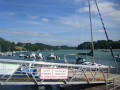 3.70 mi
+112 ft
-108 ft
1h 50
Easy
Departure from Clohars-Carnoët (Finistère)
Walk from Le Pouldu to the port, via the footpath and inland.
From Le Pouldu to the port of Dolëan
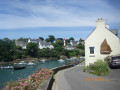 7.03 mi
+354 ft
-358 ft
3h 35
Moderate
Departure from Clohars-Carnoët (Finistère)
Hike from Le Pouldu to the port of Dolëan along the coastal path, with superb panoramic views.
Trémor Chapel from Rosbraz
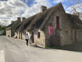 3.59 mi
+207 ft
-177 ft
1h 50
Easy
Departure from Riec-sur-Belon (Finistère)
A walk between land and sea, along the karstic cave with views of the Château du Hénan and the Chapel of Trémor.
Kerzellec, Le Bas-Pouldu, the painters’ trail
 1.67 mi
+79 ft
-79 ft
0h 50
Easy
Departure from Clohars-Carnoët (Finistère)
A short walk from the Laïta estuary (the ‘Éllé maritime’), following the coastal path opposite the Île de Groix, as far as the outskirts of Le Pouldu, in the footsteps of the painters of the Pont-Aven School who set up shop at the Buvette de la Plage (Marie Henry’s inn) or stayed in the surrounding farms of Keranquernat or Kerzellec, such as Gauguin, Filiger, Sérusier, de Haan, Makowski, Slewinski and Seligmann.
Take in the rich heritage of civil and military architecture, as well as the unspoilt wildlife and vegetation.
From Le Pouldu to Port de Merrien following the GR®34
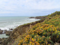 8.87 mi
+249 ft
-282 ft
4h 20
Moderate
Departure from Clohars-Carnoët (Finistère)
This path, overlooking the ocean, will take you through several coves or rias. It will lead you from Le Pouldu to the port of Merrien, after passing through various sites with remarkable habitats. Splendid, breathtaking views in this marvellous region of Brittany.
You will need at least two vehicles.
Discover the Ria de Pouldu
 4.50 mi
+305 ft
-312 ft
2h 20
Easy
Departure from Guidel (Morbihan)
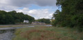
This route opposite the Pouldu marina is a simple, pleasant and varied circular route, touching on theGR®34, which remains one of the most scenic trails in the area. An easy walk along sunken paths at first, then following the Laita river estuary.
Cycling between Le Faouët and Priziac
22.38 mi
+1,142 ft
-1,142 ft
2.5 hrs
Moderate
Departure from Le Faouët (Morbihan) (Morbihan)
This loop allows you to discover the varied heritage and landscapes of the communes of Le Faouët and Priziac. It is both pleasant and interesting, with many tourist attractions, such as the 16th-century market halls and the Faouët museum, the ecomuseum and the covered alleyway of Botquenven, and the courtroom in Priziac. Punctuated by magnificent panoramic views throughout the route, you will also discover religious heritage, including the famous St Fiacre chapel and its rood screen. An ideal route for an outing with family or friends.
Cycling between the chapels of Sainte-Barbe and Saint-Fiacre in Le Faouët
6.94 mi
+679 ft
-692 ft
1 hr
Easy
Departure from Le Faouët (Morbihan) (Morbihan)
This loop, suitable for all ages, invites you to discover the history and religious architecture of Le Faouët, with visits to the iconic Sainte-Barbe Chapel and Saint-Fiacre Chapel. A stop in the village allows you to stroll under the market halls and visit the museum, or simply enjoy a gourmet break in one of the shops or restaurants available.
Bélon estuary, countryside and coastline starting from Kerfany Beach
 9.24 mi
+436 ft
-420 ft
4h 40
Moderate
Departure from Moëlan-sur-Mer (Finistère)
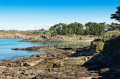
Three complementary yet very different settings for this walk:- The Bélon estuary via Beg Porz, Port du Bélon and the coves of Lanriot and Sainte-Thumette,- The countryside, its picturesque villages and the tranquillity of the Kerfany Stream valley,- The cliffs, small beaches and viewpoints along the Customs Officers’ Path.
Le bras de mer de Moëlan-sur-Mer
 3.84 mi
+236 ft
-233 ft
2h 00
Moderate
Departure from Moëlan-sur-Mer (Finistère)
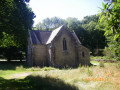
Randonnée sur le sentier côtier bordant le bras de mer de Moëlan-sur-Mer.
Kerfany-Bélon circular
3.68 mi
+138 ft
-135 ft
1h 50
Easy
Departure from Moëlan-sur-Mer (Finistère)
Of the rias around Moëlan-sur-Mer, the Bélon is undoubtedly one of the most beautiful. Starting from Anse de Kerfany, the suggested route first heads up the dark, damp valley that leads to this beach. At Blorimond, head due north to reach Anse du Lanriot. When you reach Bélon, the river of the same name unfolds in all its majesty. From there, simply follow the GR®34 signposts to return to the starting point, walking as close as possible to this magnificent inlet.
Please note: the coastal path, from (6) to the road, is closed until further notice.Temporary closure of the coastal path between Kerfany and Beg Porz.
Route of Sainte-Barbe and Saint-Fiacre chapels in Le Faouët
6.67 mi
+522 ft
-535 ft
3h 30
Moderate
Departure from Le Faouët (Morbihan) (Morbihan)
Starting from the 16th-century market halls of Le Faouët, this route climbs up a very pretty rocky path to the Sainte-Barbe plateau, where you can discover the site of the Sainte Barbe Chapel, built between 1489 and 1512. The site is known for its pardon. The path descends towards the fountain and the banks of the Ellé, a fast-flowing river winding between two steep banks. The path follows the river, then heads through the woods towards the Saint-Fiacre Chapel. Built between 1450 and 1480 in a flamboyant Gothic style, it has a splendid polychrome wooden rood screen. The climb back up to the village is through the woods, passing through the beautiful hamlet of Kerly.
The Golf Course Route in Quéven
 3.69 mi
+230 ft
-226 ft
1h 55
Easy
Departure from Quéven (Morbihan)
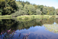
Close to the town of Quéven, this walk takes you along paths around the Val Quéven Golf Course, through woods and fields and alongside streams. You’ll be able to explore the former seigneury of Kerrousseau, situated on a promontory overlooking the lush Scave Valley.
Circular route following the Scave stream and the Scorff river
8.53 mi
+325 ft
-328 ft
4h 10
Moderate
Departure from Quéven (Morbihan)
A beautiful hike through the woods in the communes of Quéven and Gestel, following the course of the Scave stream and the Scorff river.
The route has been adapted to take into account sunlight and weather conditions (muddy valley floors).
It is advisable to do this hike when the tide is high in the Scorff river (beautiful scenery), avoiding spring tides with a coefficient > 95.
Between Pont-Scorff and Quéven on the banks of the Scave and the Scorff
 6.22 mi
+266 ft
-276 ft
3h 05
Moderate
Departure from Pont-Scorff (Morbihan)
Between Pont-Scorff and Quéven, in the heart of the countryside, alongside the Scave and Scorff rivers and a stream. Sheltered by trees for most of the route, with minimal elevation gain.A shorter version of the Saint-Urchaut to Pont-Scorff route.
Greenway, Roman road, the Kerzonas hills and the Coatloc’h Forest
 10.90 mi
+577 ft
-561 ft
5h 30
Moderate
Departure from Scaër (Finistère)
This route begins near the arboretum before heading up to the heights of Scaër, which offer beautiful panoramic views of the countryside and the Montagnes Noires. It continues along the remains of a Roman road and then crosses the Coatloc’h State Forest. The return journey follows a greenway, a former railway line between Rosporden and Carhaix.
Anse de Poulguin and coastal path via Port Manec'h
 7.76 mi
+410 ft
-420 ft
3h 55
Moderate
Departure from Névez (Finistère)
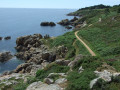
There are three distinct sections to this route.At the start, there is a shaded path along the Anse du Poulguin on the karstic cave, followed by a passage through the countryside along small paths and little-used roads to reach the steep coastal path that leads to Port Manec'h, at the mouth of the Aven and Bélon rivers.Return along the banks of the karstic cave.Wooded landscape along the riverbank, which is flooded at high tide.Discover the seaside resort of Port Manec'h, a popular holiday destination since the 1930s.
Around Port Manec'h
 4.46 mi
+184 ft
-157 ft
2h 15
Easy
Departure from Névez (Finistère)
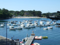
From the Saint-Nicolas Chapel in the heart of the seaside town of Port Mananec'h, this route descends to the beach, running alongside it at a height before joining the coastal path followed by the GR® 34. After a slightly steep section, the hike continues inland to reach a cove of the Karstic Cave and then the river, which you follow to Port Manec'h.
The Ellé Valley around Sainte-Barbe
 3.76 mi
+430 ft
-410 ft
2h 05
Easy
Departure from Le Faouët (Morbihan) (Morbihan)
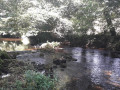
Another walk to recharge your batteries in the heart of nature for hikers who are not afraid of having to bend down to avoid fallen trees and springs that wet the paths.
To the west of Le Faouët, the Ellé flows through a fairly narrow, wooded valley with rocks on either side and in the riverbed. At the top, along the valley, are picturesque hamlets and, above all, the Sainte-Barbe Chapel.
Coastal path, countryside and karstic cave estuary starting from Port Manec'h
 7.26 mi
+338 ft
-325 ft
3h 40
Moderate
Departure from Névez (Finistère)
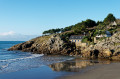
Three very different but perfectly complementary views of Névez:
The cliffs via the customs officers’ path between Port Manec’h and Rospico; the countryside through the villages and thatched cottages between Kerascoët and Kervren; the banks of the Aven from Anse de Poulguin to its estuary where it joins the Bélon.
From Port Manec’h to Trévignon via the coast, the countryside and the banks of the Aven
 18.94 mi
+423 ft
-404 ft
8 hrs
 Very difficult
Departure from Névez (Finistère)
A long walk along the customs officers’ path, through the countryside, past villages with thatched-roof houses and along the banks of the Aven between Port Manec’h and Trévignon. This can be done as a single walk or as three complementary circular loops of around ten kilometres each (see Practical Information).
The Loc'h ponds
5.07 mi
+197 ft
-197 ft
2h 30
Easy
Departure from Guidel (Morbihan)
A stone’s throw from the Laïta estuary, the Loc’h ponds are a former ria that has been separated from the ocean by a sandbar. Once reclaimed, this area has regained a very natural appearance, and the path that winds around it allows you to discover this little gem.
Loch trail in Guidel (Sentier des Loch)
 6.08 mi
+236 ft
-236 ft
3h 00
Easy
Departure from Guidel (Morbihan)
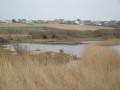
This route takes in the Loch Reserve. A former arm of the sea that has been reclaimed and transformed into marshland.It's home to many species of flora and fauna. You'll cross reedy wetlands and enjoy birdwatching.
Around the Val Quéven Golf Course
 4.12 mi
+141 ft
-154 ft
2h 00
Easy
Departure from Quéven (Morbihan)
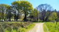
A short, easy walk with no significant elevation gain, suitable for everyone, around the Val Quéven Golf Course.
Le Pont du Verger via Kerousseau
 6.99 mi
+243 ft
-269 ft
3h 25
Moderate
Departure from Quéven (Morbihan)
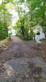
A beautiful walk through the woods along a stream and around a small pond, with no particular difficulties.
The Scave to Scorff Route in Quéven
 6.68 mi
+312 ft
-312 ft
3h 20
Moderate
Departure from Quéven (Morbihan)
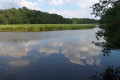
A Natura 2000 site, the Scorff estuary is a haven of peace just a stone’s throw from Lorient. Through woods, salt marshes and reed beds, let yourself be guided between fresh and salt water along the unspoilt banks of the Scorff and Scave. A walk in the heart of nature amidst enchanting landscapes.