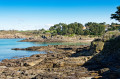
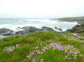
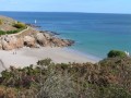
From Port Manec’h to Trévignon via the coast, the countryside and the banks of the Aven

A long walk along the customs officers’ path, through the countryside, past villages with thatched-roof houses and along the banks of the Aven between Port Manec’h and Trévignon. This can be done as a single walk or as three complementary circular loops of around ten kilometres each (see Practical Information).

Details

27917385
Creation:
Last update:
Last review:
  • Walking
    Activity: Walking
  • ↔
    Distance: 18.94 mi
  • ◔
    Duration according to the author: 8 hrs 
  • ▲
    Difficulty: Very difficult

  • ⚐
    Back to start: Yes
  • ↗
    Ascent: + 423 ft
  • ↘
    Descent: - 404 ft

  • ▲
    Highest point: 138 ft
  • ▼
    Lowest point: 10 ft
  • ⚐ Country: France
  • ⚐ City: Névez (29920)
  • ⚑
    Start/End: N 47.801018° / W 3.739463°
  • ❏
    IGN map(s): Ref. 0519ET, 0620ET
  • Hour-by-hour weather

Photos

Description of the walk

Start at the car park at Port Manec’h harbour.

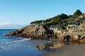
(S/E) Head to the far end of the car park and climb the steps to join the coastal path (GR®34). Follow it, past the lighthouse, until you reach the ‘Doigt de Dieu’ rock.

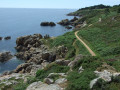
(1) Continue along theGR®34, past the ‘Roche Madame’ and ‘An Goërled’ rocks – where cormorants like to dry their wings – until you reach Anse de Rospico.

(2) Walk past the Rospico car park and turn left onto a fairly steep path. Continue along theGR®34, passing the beaches of Tahiti and Raguénez and its navigation mark.

(3) Continue along the coastal path, past the beaches of Dourveil and Kersidan, until you reach Pointe de Kerjean. Take a moment to admire the view of Raguénez Island, Île Verte and Pointe de Trévignon. In the distance to the south-west lies the Glénan Archipelago.

(4) Carry on along theGR®34, passing the beaches of Le Don and Trez Cao before reaching the car park at Pointe de Trévignon.

(5) Walk up the Route de la Pointe for a few dozen metres, then turn left onto the coastal path. Walk past Plage de la Baleine and continue to the Maison du Littoral car park.

(6) Turn right onto a small gravel road which becomes a footpath before crossing the Route des Étangs near the village of Kerlin.

(7) Take the small road opposite . You’ll notice a stone house on your left. As you leave the village, the road turns into a footpath. Follow this path until you come to a small road near the hamlet of Kerléo.

(8) Follow it to the right for a few metres, then turn left onto a path that gradually descends towards a stream. Cross the stream and continue to the Route de Kerléo. Follow it to the right until you reach the D1.

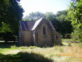
(9) Turn right onto the D1 and follow it for a few dozen metres along a designated path. Cross the road carefully near a chemist’s and continue along a small road towards the village of Saint-Philibert to reach the chapel of the same name.
Note the two protohistoric stelae and the fountain.

(10) Walk past the chapel, take the street immediately on the right, turn left after a few metres onto a path behind a restaurant and follow it to the hamlet of Penanroz.

(11) Turn left at the junction and continue straight on, ignoring all the paths branching off to the left or right, until you reach the Route de Kersidan.

(12) Turn left onto this road, follow it for a few dozen metres, then turn right towards the village of Tréhubert (Tréhuber on the IGN map). Follow this road until you reach a Y-junction.

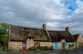
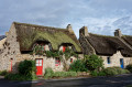
(13) Turn left onto a small road called Hent Laez Dachenn and continue until you reach a cluster of beautiful thatched cottages.

(14) Retrace your steps for a few metres and turn left onto a fairly inconspicuous path. Continue along this gently sloping path, passing behind a group of houses, and carry on until you reach a junction not shown on the 1:25,000 IGN maps.

(15) Take the path on the left to cross the Ruisseau de Dourveil via a footbridge, then head uphill along a track that continues to the right and then to the left along the edge of the fields until you reach the junction with a stony track. Turn right onto this track, which becomes a small road leading up towards the village of Kercanic.

(16) Continue straight on through a beautiful cluster of perfectly restored thatched cottages. Turn left onto a path next to a thatched cottage with a red door and shutters – undoubtedly the most photographed in Kercanic. Turn left at the next junction and continue along a stony path which joins Rue des Pommiers. Follow this road, then turn right onto a small road. Continue along this road until you reach a picnic area.

(17) Take the path on the right after the picnic area and follow it along the edge of the fields to Impasse de Mouettes. Continue to the left until you reach the junction with Rue des Îles.

(18) Cross the road carefully, turn left for a few metres until you reach a crossroads marked by a cross, then turn right and continue towards Kerstalen. Carry on along this small street, ignoring a road on the right before reaching a footpath on the left. Follow it to reach the junction with Rue de Iris.

(19) Turn right onto this street, then right again at the first path you come to. Follow it, then turn left onto a path which becomes a small road before reaching the village of Trémorvézen.

(20) Turn left for a detour via the Trémorvézen Chapel before retracing your steps and continuing towards the village of Kerliou. Carry on along the street and turn left, then left again into a cul-de-sac which continues as a footpath and leads right into the centre of the village of Kerascoët.

(21) Turn left and walk through the village until you reach a junction. Turn left, then right; pass a campsite, and continue along the path which veers to the left and joins the Route de Kerascoët. Follow this road to the next crossroads.

(22) Take the small road on the right and continue along a path that gradually descends towards a fountain and a stream. Cross the stream via a footbridge and follow the path back up; it turns left then right at a riding centre. Continue along the path until it meets a road.

(23) Follow it to the left and turn right at the village of Kermem. Follow this road until it meets the Route de Port Manec’h. Cross it carefully, take the road opposite and pass the Kervren nursery. Note a lovely cluster of old houses on the left.
Continue along this small road to a car park just before Poulguin Castle. You’ll see a fountain on the left.

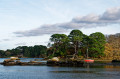
(24) Turn right onto the path which joins theGR®34on the banks of the Aven. Do pop down to the beach for a lovely view of Poulguin Castle. Continue to the right on theGR®34, go round Anse de Poul Don and reach a small landing stage.

(25) Head up the small road to the right, turn left at the next junction, carry on straight ahead and reach Port Manec’h Beach. Note the imposing Manoir Dalmore on your right.

(26) Walk along the beach and turn left onto a path that joins Rue de l’Aven. Follow it to the left to return to the car park where you started. (S/E)

Waypoints

  1. S/E : mi 0 - alt. 13 ft - Port Manec’h Harbour
  2. 1 : mi 0.37 - alt. 46 ft - The ‘Doigt de Dieu’ rock
  3. 2 : mi 1.84 - alt. 13 ft - Rospico Cove
  4. 3 : mi 3.83 - alt. 26 ft - Raguénez Island
  5. 4 : mi 5.79 - alt. 30 ft - Pointe de Kerjean
  6. 5 : mi 7.53 - alt. 13 ft - Pointe de Trévignon
  7. 6 : mi 8.43 - alt. 20 ft - Maison du Littoral
  8. 7 : mi 8.92 - alt. 59 ft - The village of Kerlin
  9. 8 : mi 9.28 - alt. 62 ft - The hamlet of Kerléo
  10. 9 : mi 9.74 - alt. 66 ft - Junction with the D1
  11. 10 : mi 10.09 - alt. 46 ft - Chapelle Saint-Philibert (Saint-Philibert)
  12. 11 : mi 10.22 - alt. 66 ft - The hamlet of Penanroz
  13. 12 : mi 10.78 - alt. 62 ft - Kersidan Road
  14. 13 : mi 11.15 - alt. 82 ft - The village of Tréhubert
  15. 14 : mi 11.27 - alt. 82 ft - Beautiful thatched cottages
  16. 15 : mi 11.68 - alt. 26 ft - Trail not shown on IGN maps
  17. 16 : mi 12.34 - alt. 85 ft - The village of Kercanic
  18. 17 : mi 12.88 - alt. 105 ft - Picnic area
  19. 18 : mi 13.25 - alt. 118 ft - Rue des Îles
  20. 19 : mi 13.77 - alt. 98 ft - Rue des Iris
  21. 20 : mi 14.31 - alt. 118 ft - The village of Trémorvézen
  22. 21 : mi 14.81 - alt. 115 ft - The village of Kerascoët
  23. 22 : mi 15.34 - alt. 112 ft - Rouz Trémorvézen junction
  24. 23 : mi 16.08 - alt. 125 ft - Kermen Road
  25. 24 : mi 17.42 - alt. 39 ft - Car park at the - Château de Poulguin (Névez)
  26. 25 : mi 18.13 - alt. 16 ft - Poul Don landing stage
  27. 26 : mi 18.58 - alt. 30 ft - Port Manec’h Beach - Aven (fleuve)
  28. S/E : mi 18.94 - alt. 13 ft - Port Manec’h Harbour

Notes

Please note: during the hunting season, driven hunts are sometimes organised in the vicinity of Kercanic.

Between (15) and (16) and between (22) and (23), the paths crossing the streams do not appear on the 1:25,000 IGN map but are shown on OpenStreetMap.

Some country lanes can be very muddy in winter or after heavy rain. Waterproof walking boots are strongly recommended.

The signposting is not described here. It is not particularly useful and can even be confusing or disorientating. It is best to ignore it where it exists, as this route consists of a succession of signposted and unmarked sections where several other walking and cycling routes intersect and criss-cross. Please refer to the map and the description or, more simply, to the Visorando app.

This walk combines three other routes of around ten kilometres described on Visorando:
* Coastal path, countryside and the karstic cave estuary, starting from Port Manec’h
* Coast, countryside and thatched-roof villages between Trégunc and Névez
* Coastal, countryside and thatched-roof villages trail between Trégunc and Névez.

The coastal path can get quite busy in the summer months. It’s much quieter once you head inland into the countryside.

Alternative starting points, picnic tables and toilets are available at the car parks of the main beaches.

At (3), it is possible to reach Raguénez Island without getting your feet wet at low tide when the tidal range is high. Be sure to check the tide times carefully before setting off on your adventure.

Worth a visit

Cliffs and beaches at Port Manec’h, Rospico, Tahiti, Raguénez, Dourveil, Kersidan, Le Don, Trez Cao and La Baleine.

Beautiful views over the banks and estuaries of the Aven and the Bélon, the headlands of Trévignon and Kerjean, Raguénez Island and Île Verte, and, on a clear day, over Concarneau Bay, the Pointe de Mousterlin, the Glénan Archipelago and Groix Island.

Chapel, fountain and stelae of Saint-Philibert.
Trémorvézen Chapel (early 15th century).

The village and thatched cottages of Kerlin.
The village and thatched cottages of Tréhubert.
The village and thatched cottages of Kercanic.
The village and thatched cottages of Kerascoët.
The village and thatched cottages of Trémorvézen.

Poulguin Castle.

Dalmore Manor.

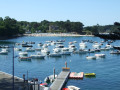
Port Manec’h lighthouse and small harbour.
Fort, lighthouse and small harbour at Pointe de Trévignon.

Loc’h Coziou pond.

A rich architectural heritage (stone ‘men zao’ houses, bread ovens, wells, fountains and wash houses) in the inland villages.

Always be cautious and plan ahead when you're outdoors. Visorando and the author of this route cannot be held responsible for any accidents occurring on this route.

The GR® and PR® markings are the intellectual property of the Fédération Française de Randonnée Pédestre.

Reviews and comments

5 / 5
Based on 2 reviews

Reliability of the description
5 / 5
Ease of following the route
5 / 5
Route interest
5 / 5
Julierose
Julierose
• Edited:

Overall rating : 5 / 5

Date of your route : May 03, 2024
Reliability of the description : ★★★★★ Very good
Ease of following the route : ★★★★★ Very good
Route interest : ★★★★★ Very good
Very busy route : No

A very lovely, well-signposted walk; you follow the red and white markings for almost the entire route. I took a shortcut at the Don Beach car park: take the road on the right, walk a few metres (watch out for cars) and join a path on the right, until you come to a small road; take that and turn left. Carry on straight ahead and you’ll rejoin the route just past marker 11. This ‘shortens’ the walk to 26 km. There are no particular difficulties apart from muddy paths if it has rained recently. The walk is classified as ‘very difficult’ because it’s long, but you can easily shorten the circular route to suit your needs!

Machine-translated

MARIRAD
MARIRAD
• Edited:

Overall rating : 5 / 5

Date of your route : Mar 21, 2024
Reliability of the description : ★★★★★ Very good
Ease of following the route : ★★★★★ Very good
Route interest : ★★★★★ Very good
Very busy route : No

A lovely 13-kilometre walk where there’s no risk of getting lost, as it follows the coastal path. Half the route runs along rocky slopes before continuing along beaches, offering a varied landscape to suit all tastes. It’s a bit tricky with children, as the path is sometimes narrow and the rocks are steep. Make sure you wear suitable footwear, especially in wet weather – which was the case for us.

Machine-translated

Other walks in the area

For more walks, use our search engine .

The GPS track and description are the property of this route's author. Please do not copy them without permission.