From Le Pouldu to Port de Merrien following the GR®34

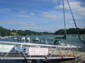
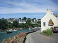
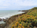
This path, overlooking the ocean, will take you through several coves or rias. It will lead you from Le Pouldu to the port of Merrien, after passing through various sites with remarkable habitats. Splendid, breathtaking views in this marvellous region of Brittany.

You will need at least two vehicles.

Details

n°22237668
Creation:
Last update:
Last review:
  • Walking
    Activity: Walking
  • ↔
    Distance: 8.87 mi
  • ◔
    Average duration: 4h 20 
  • ▲
    Difficulty: Moderate

  • ⚐
    Back to start: No
  • ↗
    Ascent: + 249 ft
  • ↘
    Descent: - 282 ft

  • ▲
    Highest point: 79 ft
  • ▼
    Lowest point: 3 ft
  • ⚐ Country: France
  • ⚐ City: Clohars-Carnoët (29360)
  • ⚑
    Start: N 47.766423° / W 3.549121°
  • ⚑
    End: N 47.782241° / W 3.647293°
  • ❏
    IGN map(s): Ref. 0620ET, 0720ET
  • Hour-by-hour weather

Photos

Description of the walk

Le Pouldu, car parks near Boulevard Charles Filiger.

(S) Make your way to Place de l’Océan, near the Pouldu Inter-municipal Water Sports Centre. Take the Chemin de la Grenouille, ignoring the road on the left that leads down towards the sailing school. Follow theGR® 34 markings (red and white) and head towards the wooden gate at the top of Chemin de la Grenouille. The path veers to the right, passing the first pair of houses on the left, and heads towards a detached villa.

(1) At the villa, turn right to head down towards Bellangenet beach and cross it. Head towards the steps to climb up and take the path on the left, which leads to a sort of chapel perched on the cliff. It is in fact a customs officers’ hut, recognisable by its large chimney.

(2) Walk round it, then head back down to Kerrou Beach. At the end of the beach, follow Rue du Kerrou for a short while.

(3) Take thefirst left to join the path heading towards the sea. Follow theGR® 34 markings (red and white), which run constantly along the coast whilst crossing a few coves (small footbridges). Pass close to the hamlet of La Roche Percée. Reach the Port of Doëlan. First, take Rue de Cayenne and walk past the green lighthouse.

(4) Walk all the way round the cove, via the Quai du Vieux Doëlan, then cross the bridge; at the end of the bridge, the path is on your left. Passing through the splendid ‘back gardens’, the path runs, so to speak, right past the foot of the red lighthouse.

(5) Walk round a small cove and then head for Quai Joseph Sanceo. The path is marked by a post with yellow directional arrows. Then follow theGR® 34 markings (red and white). Pass by Pointe Beg an Tour and continue along the path skirting the coastline to reach Portec Cove. Go round Porz Bali Cove and, before crossing the stream, ignore the first path on the right. Just after the stream, ignore the path on the right again.

(6) At the next fork, turn left. Continue to ignore the paths on the right and always take the path closest to the sea. Reach the headland where the path runs between the sea and several villas on your right. The path turns sharply 90° to the right, running alongside Merrien Bay.

(7) Carry on, once again ignoring the few branches to your right.

(8) At the mouth of the River Merrien, ignore the path on the right leading to Rue de la Digue and carry on straight ahead towards the harbour. You will reach Merrien Harbour (E).


Waypoints

  1. S : mi 0 - alt. 49 ft - Le Pouldu, Place de l’Océan
  2. 1 : mi 0.36 - alt. 46 ft - Secluded villa overlooking the beach
  3. 2 : mi 0.85 - alt. 49 ft - Small structure above the cliff
  4. 3 : mi 1.2 - alt. 39 ft - Junction near Rue du Kerrou
  5. 4 : mi 3.95 - alt. 39 ft - Near the Phare Vert lighthouse in Doëlan
  6. 5 : mi 5.42 - alt. 26 ft - Walk around the small cove
  7. 6 : mi 7.76 - alt. 52 ft - Junction
  8. 7 : mi 8.15 - alt. 46 ft - 90° bend near the villas at La Pointe
  9. 8 : mi 8.68 - alt. 72 ft - Merrien River
  10. E : mi 8.87 - alt. 10 ft - Port de Merrien

Notes

Although theGR® 34 route is very well signposted, it’s always reassuring to view a detailed hike on Visorando in the region you’re visiting.
An onlinehike following theGR® 34 route, requiring a car to be left at the finish.
The route was completed on 18 May 2022 in dry, sunny weather in 3 hours 35 minutes without a break (apart from numerous short stops to take photos).
There are plenty of benches and a few picnic tables dotted along the route.
Slightly physically demanding given the duration and the few descents, detours and ascents around the inlets (rias).
However, this route remains easy (IBP index = 35; easy for a hiker of average fitness). The total elevation gain is unlikely to be just 6 m, as suggested by the Visorando software, but rather in the region of 140 m.
A circular version, turning back at Doëlan instead of continuing to Merrien, is suggested by a Visorando creator: hike no. 1259552

Worth a visit

Along the route: Doëlan harbour (bars, restaurants, crêperies, etc.).
Oysters at Merrien harbour, on arrival (at Pascal Kermagoret’s).
16 km from Merrien: Pont-Aven.
18 km from Pont-Aven: Concarneau and its medieval town (shops, restaurants, etc.).

Always be cautious and plan ahead when you're outdoors. Visorando and the author of this route cannot be held responsible for any accidents occurring on this route.

The GR® and PR® markings are the intellectual property of the Fédération Française de Randonnée Pédestre.

Reviews and comments

5 / 5
Based on 1 review

Reliability of the description
5 / 5
Ease of following the route
5 / 5
Route interest
5 / 5
Pounet Rando
Pounet Rando

Thank you for your feedback, and I’m really glad you enjoyed the walk.

Machine-translated

pgriot
pgriot

Overall rating : 5 / 5

Date of your route : Nov 11, 2023
Reliability of the description : ★★★★★ Very good
Ease of following the route : ★★★★★ Very good
Route interest : ★★★★★ Very good
Very busy route : No

To make sure we had enough time for the round trip in the morning, we stopped off at La Roche Percée.
But it’s a brilliant walk, even in early November, with a few showers, just under a week after Storm Ciaran...

Machine-translated

Pounet Rando
Pounet Rando

Thank you for pointing that out; it has enabled me to correct the title. As for the description, that was indeed correct and stated ‘arrival at the port of Merrien’.

Machine-translated

Ylg007
Ylg007

THE TITLE IS GROSSLY INCORRECT
The destination – the port of Merrien – is 4 km from the destination stated in the headline – the port of Doëlan.
Out of consideration for readers, we would ask contributors to proofread and check the published information, at the very least, starting with the title.
Unless, of course, you don’t take information about the walk seriously.

Machine-translated

Other walks in the area

For more walks, use our search engine .

The GPS track and description are the property of this route's author. Please do not copy them without permission.