Saint-Thurien Circular

A walk through the Thuriennoise countryside.

Details

n°70148681
Creation:
Last update:
Last review:
  • Walking
    Activity: Walking
  • ↔
    Distance: 6.09 mi
  • ◔
    Average duration: 3h 25 
  • ▲
    Difficulty: Moderate

  • ⚐
    Back to start: Yes
  • ↗
    Ascent: + 705 ft
  • ↘
    Descent: - 696 ft

  • ▲
    Highest point: 604 ft
  • ▼
    Lowest point: 266 ft

Description of the walk

Park in the car park at Place Kilmacow in Saint-Thurien.

(S/E) Set off to the right towards Querrien, then, after about 250 m, turn right again towards Rostrennec. 

(1) At the left-hand bend at the end of the road, follow the path to the right, cross a field (very wet area) and continue along the path after a small stream. Join the access road to Le Geurnic and turn right. 

(2) Carry on along the road to the left, cross the junction and reach the houses at Kerganet. 

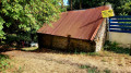
(3) Take the small path on the right after a shed. Once at the end of the path, continue along the road opposite, following the sign for “Les jardins de Kerbellec”.

(4) Pass the houses and continue along a path (not shown on the IGN map) which descends into a small valley. 

(5) At the junction, turn right towards Pont Croac’h and you’ll come out onto the D6. Cross carefully and take the road opposite the path, heading towards Pont Croach.

(6) Just before reaching the hamlet, turn right into a field until you reach a track after passing a house and a shed. At the end of the track, turn right, follow the edge of the field and you’ll reach the track leading to Coat Kerrous. 

(7) Turn left, then immediately right towards Kergoulaouen.

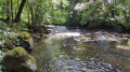
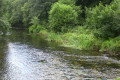
(8) Turn left to reach the banks of the Isole. Then turn right to follow the stream through a steep-sided valley, before veering off to the right and heading up another valley towards Kerbail and Kerdilis. This section does not appear on any map, so the app will be very useful. 

(9) At the end of the track, turn right, go to the end of the road and turn left. Pass the first road on the right towards Kersaint, then take the next one towards Roz-Feunteun. 

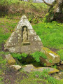
(10) Before reaching the end of the road, turn right at the entrance to the second field. Cross a small stream below, head left, then take a right-hand bend to follow another stream, a tributary of the Isole. You’ll reach the Stang-Feunteun wash house.

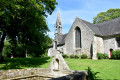
(11) Continue along the road and join the D23 at the entrance to Saint-Thurien. Cross carefully, then make a first turn left then right to enter a narrow lane. Keep to the right at the junction just ahead and head towards the church, then on to the Place du Centre. 

(12) Carry on to the right, continue straight ahead at the junction to return to Place Kilmacow and the car park (S/E). 

Waypoints

  1. S/E : mi 0 - alt. 564 ft - Place Kilmacow in Saint-Thurien
  2. 1 : mi 0.35 - alt. 518 ft - Rostrennec
  3. 2 : mi 0.88 - alt. 505 ft - T-junction
  4. 3 : mi 1.21 - alt. 499 ft - Kerganet
  5. 4 : mi 1.62 - alt. 476 ft - Kerbelec
  6. 5 : mi 2.28 - alt. 276 ft - Junction, turn right
  7. 6 : mi 2.5 - alt. 351 ft - Croac’h Bridge
  8. 7 : mi 2.81 - alt. 459 ft - Coat Kerrous Trail
  9. 8 : mi 3.06 - alt. 466 ft - Kergoulaouen - Isole (rivière)
  10. 9 : mi 4.4 - alt. 463 ft - Kerbail
  11. 10 : mi 4.98 - alt. 394 ft - Roz Feunteun
  12. 11 : mi 5.69 - alt. 427 ft - Stang-Feunteun wash house
  13. 12 : mi 5.96 - alt. 558 ft - Church
  14. S/E : mi 6.09 - alt. 561 ft - Kilmacow Square

Notes

Thanks to the Hentou Coz Sant Turian Association for maintaining and creating paths in the local area.

Please note that the path is poorly signposted. Furthermore, several sections do not appear on any map, so it will be helpful to follow the route on the app. 

The trail features small streams and crosses through fields: please wear waterproof footwear.

Please note: this route features some steep descents.

Reviews and comments

3.8 / 5
Based on 2 reviews

Reliability of the description
4 / 5
Ease of following the route
3 / 5
Route interest
4.5 / 5
le terrien
le terrien

Overall rating : 3.3 / 5

Date of your route : Mar 16, 2026
Reliability of the description : ★★★☆☆ Average
Ease of following the route : ★★★☆☆ Average
Route interest : ★★★★☆ Good
Very busy route : Yes

The route description and map are shown in the opposite direction to the signposts. The signposting is patchy. There are
in some places, particularly at changes of direction.
Otherwise, the route is pleasant, apart from the area around the farm at the moment (water, mud)

Machine-translated

jy caurant
jy caurant

Overall rating : 4.3 / 5

Date of your route : Apr 28, 2025
Reliability of the description : ★★★★★ Very good
Ease of following the route : ★★★☆☆ Average
Route interest : ★★★★★ Very good
Very busy route : No

A lovely walk through the countryside and valleys of Saint Thurien.
There are no signposts, and at times it’s not easy to find the poorly marked path.
Well done to the people who have made certain sections of the path more accessible.

Machine-translated

Other walks in the area

For more walks, use our search engine .

The GPS track and description are the property of this route's author. Please do not copy them without permission.