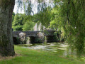
The ‘Du Lain au Verger’ Route in Gestel

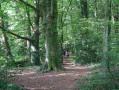
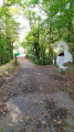
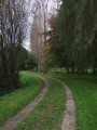
From the Domaine du Lain to the Étang du Verger, along the Scave and the Ruisseau du Moulin de Kerrousseau, wander through the woods and shaded paths. Discover the natural and historical heritage of these protected areas. On your return, take a leisurely stroll through the estate’s park and admire its variety of trees, including remarkable specimens over a century old.

Details

61913477
Creation:
Last update:
Last review:
  • Walking
    Activity: Walking
  • ↔
    Distance: 4.06 mi
  • ◔
    Average duration: 1h 55 
  • ▲
    Difficulty: Easy

  • ⚐
    Back to start: Yes
  • ↗
    Ascent: + 102 ft
  • ↘
    Descent: - 102 ft

  • ▲
    Highest point: 164 ft
  • ▼
    Lowest point: 39 ft
  • ⚐ Country: France
  • ⚐ City: Gestel (56830|56530)
  • ⚑
    Start/End: N 47.80356° / W 3.438222°
  • ❏
    IGN map(s): Ref. 0720ET
  • Hour-by-hour weather

Photos

Description of the walk

Start: the village of Gestel. Domaine du Lain car park (access via Rue de Lesbin and Allée du Lain towards Quéven, near the church).
Starting sign at the entrance to the lane leading to the Domaine du Lain.

(S/E) From the car park, walk up the cobbled lane towards the Domaine du Lain.

(1) Go straight on, cross the courtyard and turn left. Follow the wide beech-lined avenue straight ahead and turn right after the ponds (be sure to take a look at them). At the end, turn left twice and join the road.

(2) Cross the road and take the footpath opposite. Continue straight on until you reach Kergornet.

(3) Take in the view of the chapel (you can turn left after the chapel and back again to see the wash house fountain) and carry on straight ahead, keeping to the verge. Take care.

(4) Turn right onto the farm track. Turn right at the gate and stay on the main track, which bends to the left.

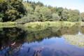
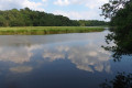
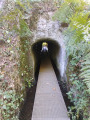
(5) At the end of the sunken track, turn right. Follow the path as close as possible to the Scave and the Étang du Verger. Ignore the turn-offs to the right until you reach the Moulin Neuf.

(6) Admire the reflecting pool. At the car park, turn right, then left. Follow the path which turns right and runs alongside the Ruisseau du Moulin de Kerrousseau.

(7) Carry on straight ahead at the junction, but do feel free to take a detour to the left along the boardwalk to explore the fountain and washhouse complex at the Domaine de Kerrousseau on the Quéven side. As you walk alongside the stream, you’ll also be able to see the remains of Lorient’s old water network (a circular concrete slab, the entrance to a former inspection chamber). At the next junction, cross the stream to the left.

(8) You are now in the commune of Quéven. Turn right and follow the path below the Quéven Golf Course. Cross the stream again to the right and stay on the path that heads right. At the wooden walkway, turn left to enter the Parc du Domaine du Lain.

(9) Continue along the main path which follows the stream. At the next two junctions, turn right, then left. Carry on along the main avenue and turn right after the speed bump. Carry on straight ahead and turn left at the gate to return to your starting point. Before setting off again, take a break in the park opposite the château, in the shade of its remarkable trees (S/E).

Waypoints

  1. S/E : mi 0 - alt. 141 ft - Domaine du Lain
  2. 1 : mi 0.04 - alt. 144 ft - Château du Lain
  3. 2 : mi 0.42 - alt. 128 ft - Route
  4. 3 : mi 0.82 - alt. 164 ft - Kergornet and its chapel
  5. 4 : mi 0.98 - alt. 135 ft - Junction on a farm track
  6. 5 : mi 1.4 - alt. 59 ft - Étang du Verger
  7. 6 : mi 2.33 - alt. 56 ft - Moulin Neuf
  8. 7 : mi 2.67 - alt. 69 ft - Kerrousseau stream and wash house fountain
  9. 8 : mi 3.07 - alt. 89 ft - Stream, Quéven Golf Course
  10. 9 : mi 3.52 - alt. 112 ft - Domaine du Lain Park
  11. S/E : mi 4.06 - alt. 141 ft - Domaine du Lain car park

Notes

This route is organised by Lorient Agglomération

This route is included in the Morbihan Departmental Plan for Walking and Hiking Routes and has been accredited by the French Hiking Federation. You can follow the yellow signposts. There is an information board with a map and details of heritage features at the start.

Worth a visit

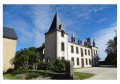
- Domaine du Lain: seat of a seigneury (16th century), outbuildings (17th century), castle (late19th century, burnt down in 1992).
- Heritage orchard
- Fountain and ponds (19th century)
- Notre-Dame de Kergornet Chapel (15th century): rebuilt in 1952, cross (1662), wash house fountain.
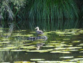
- The River Scave and the Verger Pond, 23 ha of protected land ideal for birdwatching.
- Moulin Neuf (18th century), rebuilt after 1945.
- Fountain and washhouse on the Kerrousseau estate (19th century)
- Remains of the former water supply network of the town of Lorient (1886–1960)
- Kerrousseau Departmental Wood: 32 ha managed by the O.N.F.
- Val Quéven Golf Course: an 18-hole course situated on the former grounds of Kerrousseau Castle
- Park and gardens of the Domaine du Lain: 24 ha laid out in the late19th century and managed sustainably, featuring remarkable trees.
- Saut-de-loup: a walled ditch that frames the garden whilst preventing animals from passing through.

Reviews and comments

4.5 / 5
Based on 2 reviews

Reliability of the description
4.5 / 5
Ease of following the route
4.5 / 5
Route interest
4.5 / 5
User 13377597

Overall rating : 4.7 / 5

Date of your route : Aug 03, 2025
Reliability of the description : ★★★★★ Very good
Ease of following the route : ★★★★★ Very good
Route interest : ★★★★☆ Good
Very busy route : No

A pleasant short hike with varied landscapes

Machine-translated

pierrebzh
pierrebzh

Overall rating : 4.3 / 5

Date of your route : Aug 03, 2025
Reliability of the description : ★★★★☆ Good
Ease of following the route : ★★★★☆ Good
Route interest : ★★★★★ Very good
Very busy route : No

A very pleasant forest hike, with a few sections along the road but this isn't too disruptive. There is little elevation gain. We did it as a family with a baby carrier and two teenagers aged 13 and 16. It took us less than two hours. We really enjoyed it!

Machine-translated

Other walks in the area

For more walks, use our search engine .

The GPS track and description are the property of this route's author. Please do not copy them without permission.