Country:
 City:
City:


Park in the Beg Porz car park, opposite number 63, Rue de Bel Air. The car park is signposted alongside the entrance to the water sports centre and the holiday village.
(S/E) Take the path at the far end of the car park, which very quickly joins theGR®® 34 coastal path.
GR®® red and white markings
Head left and follow this clearly marked and well-maintained path, which is unambiguous.
(1) Cross Kerfany Beach, head up the opposite side and follow the path running alongside the road, then the path that continues from it. You’ll arrive at the car park for Trenez Beach.
(2) At low tide, it is possible to reach Île Percée on foot. Cross the car park and continue along theGR®® 34 coastal path, which heads generally south-east. After just over 3 km, you’ll reach a fairly large car park on a sort of headland.
(3) TheGR®® then turns north-east, still following the coast. 1.5 km further on, the path comes up against a long wall, directly opposite a sea wall that stretches down into the ria and supports the Brigneau lighthouse.
(4) TheGR®®, which is less clearly marked here, descends to the right then runs along the base of this long wall, climbs northwards between a few buildings, then descends again to Brigneau harbour. Follow the road that runs along the coast to the junction with a main road (D216).
YellowPR®® markings
(5) Turn left (leaving theGR®®), then take the first right. At the junction, take the road leading down to the left, then the first right (T-junction). Continue to the end of the tarmac road.
(6) Continue straight ahead (following the low wall on your left), then follow the path as it turns left (due west). You’ll reach a tarmac road (at a Fork in the road); cross it and continue along the path opposite.
You’ll reach the hamlet of Kerglouanou, where the path becomes a tarmac road that bends to the left. You’ll come to a road.
(7) Turn right. Continue along this street, which passes through a valley and enters the hamlet of Kergolaër, where it heads north. At one point, the houses lining the street more or less regularly come to an end: a good path is visible on the left, before what appears to be a wooded area.
No signposting
(8) Take this path heading due north. After 100 m, you’ll reach some houses; turn left, then immediately right. At the crossroads, turn left.
(9) After a hedge, turn right onto a well-marked path running alongside farmland. When you reach a good track, turn left. You’ll come to a tarmac road; follow it to the right until you reach the hamlet of Kerduel.
(10) Cross the D116 with care, walk alongside it on the left for about ten metres, then turn right into the lane (a dead end). After 100 m, past the last house on the right, turn right onto the grassy path. The track becomes a footpath and crosses a stream. Turn right, then left to continue due north, emerging into a hamlet via a narrow passage between two fenced gardens. Continue along the street opposite, turn left, then right downhill, and reach Rue de Bel Air.
(11) Follow this street to the left until you reach the sign for the car park, as indicated at the start of the description (S/E).

 Visorando Member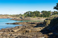

 Easy
Easy