Grand Tour of Rédéné via the fountains

Rédéné is a commune in Finistère. It is situated in the Vannetais region, 8 km from Quimperlé. This grand tour of Rédéné is designed to provide a 10 km route for runners. But it also allows all walkers visiting Rédéné to explore the neighbourhoods of this charming Breton village. Setting out in search of the village’s three fountains adds a little extra interest.

Details

106628288
Creation:
Last update:
Last review:
  • Walking
    Activity: Walking
  • ↔
    Distance: 6.27 mi
  • ◔
    Average duration: 3h 10 
  • ▲
    Difficulty: Moderate

  • ⚐
    Back to start: Yes
  • ↗
    Ascent: + 299 ft
  • ↘
    Descent: - 315 ft

  • ▲
    Highest point: 233 ft
  • ▼
    Lowest point: 102 ft
  • ⚐ Country: France
  • ⚐ City: Rédené (29300)
  • ⚑
    Start/End: N 47.850168° / W 3.466299°
  • ❏
    IGN map(s): Ref. 0720ET
  • Hour-by-hour weather

Photos

Description of the walk

Choose to park outside the town centre, in the Croëziou car park, just past the Lotissement de la Canebière housing estate (see the ‘Practical Information’ section below ).
Bus stop: mainly TBK Line 6.

(S/E) With your back to the car park, cross the road and then walk along the left-hand side of the D68 towards Quimperlé for about 500 metres (take care). You’ll notice a gate on the right at the start of a path. Behind the gate, head due north along the path for a few dozen metres. You’ll reach the junction with the footbridge over the stream, the Scave.

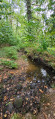
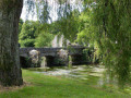
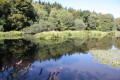
(1) Leave the return path on your left and continue along the main path through the Bois de Rosbigot, on the left bank of the Scave. In the distance, you can see the grassy areas of the former sewage treatment works. NB: the former lagoons are undergoing successive phases of renaturation and ecological restoration to rehabilitate the local natural habitats. See the description in the ‘Things to see’ section .

Leave the flat ground and walk round the lagoons through an orchard on the higher ground to the right. After a short stretch heading east, alongside the Mongardi stream, the path reaches the junction with Rue du Croëziou, in the Mongardi neighbourhood.

(2) Turn left along the street, on the pavement. Continue to the junction by the Marronier State Primary School.

(3) Just before the Espace Jeune, turn right onto the Chemin des Écoliers, which is nicely shaded. You’ll reach the Notre-Dame de Lorette private primary school. Turn right onto Rue des Écoles until you reach a Y-junction.

(4) Turn left onto the path heading east. Cross Rue de la Libération and continue along the path opposite, which runs south of the François Le Roux Sports Complex. Carry on to the final stage on your left. Ignore a path on your right and continue for a few metres until you reach a junction of paths.

(5) Carry on straight ahead through the heathland (vegetation comprising shrubs, small deciduous trees, thorny plants, grasses, etc.). Cross the stream, the Scao, for the first time. Stay on this path for several tens of minutes as it forms a large anti-clockwise circular loop, without ever being distracted by the paths branching off to the right. Cross the Scao a second time, before reaching the Sports Complex area, via an adult fitness trail in the Grenouillère neighbourhood.

(6) Turn right and go round the buildings to the east, then to the north (keeping them on your left). Head towards the junction with Rue du Stade.

(7) With your back to the car park, turn right then left and head towards the village centre, at the foot of the16th-century Church of Saints Peter and Paul (or Notre-Dame de Lorette) in Rédéné. Pass the ‘L’Embuscade’ bar and tobacconist on your right and go round the church to the right. Pass the bakery and patisserie, then the butcher’s and delicatessen on your right. Staying on Place de l’Église, head towards the Yvonne Chauffin Media Centre.

(8) Just past the granite wayside cross, turn right onto Rue de la Fontaine. NB: do not turn onto Rue des Fougères before the cross; on this street, a little past the Salle Jean-Louis Rolland (on the left), the IGN map indicates a ‘Fontaine N.-D. de Lorette’ which does not exist at this location – this is an error on the IGN’s part. Walk a few hundred metres roughly north-west. You’ll reach the junction in the Kerfontaine neighbourhood on Rue Ty Lann, where there’s a house with a red-brick gate. A signpost (rather poorly placed, as it’s very low and situated after the junction, to the left of the gate) reads “Fontaine Notre Dame de Lorette”.

(9) Turn right onto Rue Ty Lann. Walk a good hundred metres until you reach the fountain on the left, directly opposite the sign marking the end of the Rédéné built-up area. See the description in the ‘Things to see’ section below.

(10) Retrace your steps along Rue Ty Lann back to the previous junction.

(9) Turn right along this street and stay on it to leave the built-up area of Rédéné, passing between two radio masts. Shortly before the road crosses the Scave stream at Pont Vaguiérès (barely visible on the ground), you’ll come to a fork with a path on the right.

(11) Turn right onto the path which runs along the left bank of the Scave. Pass under the high-voltage power lines and then cross the Scave. Continue to the right until you reach a complex area with several path junctions.

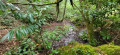
(12) Turn right; the path bends to the right, then to the left, after crossing the Scave. The Ronz-en-Argant Spring is located there on the right. I’ll leave you to find it amongst the thick undergrowth and marshy areas, where several streams cross each other (all dry in August 2026), all flowing into the Scave. NB: personally, I couldn’t find any obvious sign of this fountain...

(13) Head back the way you came until you reach the previous fork.

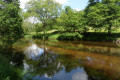
(12) Turn right, this time following the right bank of the Scave. Pass the high-voltage power lines and continue along the right bank until you reach Rue Ty Lann again (which is actually a country road). Cross the road and, opposite, you’ll find a tiny path that continues along the right bank of the Scave. Walk for about 250 m along this path, which widens, and you’ll reach a wooded area where the Scave is on your left, with numerous small paths leading down to its banks, which are quite marshy (except in August 2026). You’ll reach the Fontaine de la Grande Lande.
NB: this is situated slightly below the path on the left; see the description in the ‘Places to see’ section.

(14) Continue along the path southwards; it joins the road, Rue de Rosbigot, at a wide bend in the road. You’ll reach the junction at the Rosbigot housing estate.

(15) Leave the road heading straight up, but turn left into the housing estate, then immediately right up a slight incline. You’ll reach the junction with Rue des Châtaigniers. Turn left until you reach another Y-junction, with a bin on the small square.

(16) Turn right along Rue des Genêts until you reach the end after a left-hand bend. Then take a path that winds down to the banks of the Scave. Follow it until you reach the footbridge seen shortly after setting off.

(1) Then turn right and you’ll soon reach the starting point (S/E).

Waypoints

  1. S/E : mi 0 - alt. 154 ft - Carrefour du Croëziou car park
  2. 1 : mi 0.33 - alt. 108 ft - Junction – Footbridge - Scave (cours d'eau) - Affluent du Scorff
  3. 2 : mi 0.71 - alt. 131 ft - Mongardi bus stop junction – Rue du Croëziou
  4. 3 : mi 0.96 - alt. 194 ft - Crossroads – Chemin des Écoliers
  5. 4 : mi 1.1 - alt. 217 ft - Fork
  6. 5 : mi 1.4 - alt. 203 ft - Junction
  7. 6 : mi 2.26 - alt. 226 ft - Fitness route
  8. 7 : mi 2.41 - alt. 223 ft - Junction with Rue du Stade
  9. 8 : mi 2.72 - alt. 233 ft - Media Centre – Rue de la Fontaine
  10. 9 : mi 2.96 - alt. 217 ft - After No. 3 – turn right onto Rue de Ty Lann
  11. 10 : mi 3.04 - alt. 210 ft - Fontaine Notre-Dame de Lorette (Rédené)
  12. 11 : mi 3.66 - alt. 184 ft - Start of the trail
  13. 12 : mi 4.1 - alt. 200 ft - Junction
  14. 13 : mi 4.18 - alt. 197 ft - Fontaine Ronz en Argant
  15. 14 : mi 4.87 - alt. 184 ft - Grande Lande Fountain
  16. 15 : mi 5.5 - alt. 121 ft - Rue des Hêtres
  17. 16 : mi 5.72 - alt. 177 ft - Junction of Rue des Genêts and Robigot bus stop
  18. S/E : mi 6.27 - alt. 154 ft - Carrefour du Croëziou car park

Notes

This description relates to a solo summer run undertaken in mid-August 2026.

Parking at the start
The official car park, 320 metres further east of the trailhead (towards Pont-Scorff), on the right-hand side of the road, is safer than the area in front of the trail gate. There are 20 spaces available.

Condition of the trails
In August 2026, all the trails were perfectly maintained. The vegetation had even been trimmed in several places.

Estimated time
I completed this route in about 1 hour 45 minutes whilst running, but this included searching for the fountains, which was sometimes difficult. It is best to allow 1 hour without any stops if running, or 2 hours 30 minutes to 3 hours if walking.


difficultyHike classified as ‘Medium’ on the Visorando rating system.
The IBP Index is 40 RNG (running) and 28 HKG (hiking), which corresponds to an ‘Easy’ route for a hiker with average fitness.

Alternatives
- There are several options for extending or shortening the route, particularly within the village.
- Option to start and finish at any other location, such as the village centre.

Water points
There are no drinking water points on the route, except in the village centre (fountain near the Town Hall). Allow at least 0.5 litres per person and/or a filter or purification tablets.

Shelter
There is no other proper shelter along the route apart from the church (if it is open) or the bus stop opposite its entrance (6).

Picnic area
There is a picnic table behind the Yvonne Chauffin media library (6).

Equipment
In summer, bring the usual equipment for a lowland hike: light walking or trainers, suitable clothing, possibly rainwear, sunglasses, a hat, sun cream, UV-protective lip balm, etc.

Footfall
As it’s outside the urban area, the route was completely deserted even in the height of summer. Whatever the season, don’t forget to let your friends and family know your exact route and inform them of any changes by text or phone.

Check the weather forecast.

Maps
The route includes many junctions and forks, which makes the map from the Visorando PDF unreadable; use the Visorando app on your mobile phone instead! If you notice any errors in signposting or place names along your route or on the map you’re using, you can become a contributor and report them:
- signage errors, safety issues, conflicts of use, environmental concerns: click here.
- mapping errors, place names: click here.

Worth a visit

(1) Former lagoons at the Rédéné sewage treatment works

The former sewage treatment site ceased direct treatment operations and was officially closed at the end of 2015, following the connection of the town’s effluent to the Quimperlé network. It is now undergoing successive phases of renaturation and ecological restoration to rehabilitate the local natural habitats, carried out by Lorient Agglomération. The Mongardi stream, which flows for 470 metres to the Scave, a tributary of the Scorff, has been meandered, allowing for an exchange between the wetlands and playing a functional role in flood control and storage across 16,000, thereby preserving amphibians. Sources: Ouest France and Ouest France.

Information board on site, with before, during and after photos.

Notre-Dame de Lorette Fountain (1705)

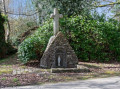
The town hall’s website states: “This fountain, dating from 1705, owes its originality to the reuse of a monolithic cross of medieval origin. Standing alone near the village, this rubble-stone fountain, dated 1705, exemplifies the common style of gable-fronted fountains, featuring a central semi-circular niche. Its originality stems from the reuse, at its summit, of a tall monolithic cross of medieval origin.”

The fountain is under the patronage of Our Lady of Loreto. According to legend, Saint Helena discovered the True Cross and, having travelled to Nazareth, found the House of the Incarnation, above which she had a church built. In the 13th century, following the threat of the Saracens invading the Holy Places and destroying the church built by Helena, God is said to have miraculously had angels transport the Holy House – which contained a statue of the crowned Virgin Mary holding the Baby Jesus in her arms – to Dalmatia. After a brief stay in that region, it was once again carried by angels to Loreto in Italy. This is a town on the Adriatic coast, south of Ancona. This house forms the central core around which the basilica developed. Our Lady of Loreto is the oldest international Marian shrine, dating back to the 12th century. The Roman Catholic liturgical calendar celebrates the Translation of the Holy House of Loreto on 10 December. Devotion to Our Lady of Loreto spread throughout Italy and to many other neighbouring countries. Throughout France, there are shrines and churches dedicated to her.

The Notre-Dame de Lorette Fountain dates from 1705 and is built of rubble stone. It consists of a gabled aedicule with a semicircular opening housing a statue of the Virgin Mary; at the front, a square basin collects water from the spring. The reuse, at the top of the structure, of a tall monolithic cross of medieval origin highlights the distinctive nature of this fountain. We do not know the properties of its waters.

Source: https://www.fontainesdefrance.info/fontaines/la-fontaine-notre-dame-de-lorette/

(11) Ronz-en-Argant Fountain

No information was found in my bibliographical research. Nor did I find any actual trace of the fountain in question on the ground – neither an artificial nor a natural pool, nor a basin that was full or even damp – only numerous small streams (all dry in August 2026).

(12) Grande Lande Spring

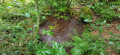
No information was found in my bibliographical research. To see it, you have to go down to the left of the path and then, with some difficulty, go round it to the right. It is a basin 4 or 5 metres long by 1.50 metres wide, showing no signs of having been man-made, as the vegetation has completely taken over the site. The spillway consists of a group of stones covered in thick moss.

Other springs, fountains, pools and ponds in Rédéné (to be added if necessary)

Shown on the IGN map. No information was found in my bibliographical research, apart from that provided by Berluhec (see below).

  • Kerigano Spring, at the end of the Le Clos des Chênes path (near (4)). I do not know whether it is accessible.
  • Kerigano pond, near Rue du Malèze (close to (4)). I do not know if it is accessible.
  • Saint-Bernard Fountain, 90 metres as the crow flies from the Quartier de la Grenouillère, deep in the woods. Probably accessible from the D222, between Arzano and Pont-Scorff.
  • The Berluhec fountain and washhouse (19th century), on private land belonging to the Maison de notable de Berluhec (manor house), date back to the second half of the 19th century. The town hall’s website states: “The unusual structure of this fountain-washhouse is linked to its lack of religious function and its late date of construction. The circular basin, framed by semi-circular steps, feeds two other rectangular basins. This fountain was probably built around 1850 as a domestic washhouse for the neighbouring stately home.” Probably accessible from the public road leading to the manor house.
  • The Sainte-Marguerite Fountain, 3.7 km south-west of Rédéné as the crow flies, at the hamlet of the same name. The town hall’s website states the following about the chapel of the same name: “This rectangular building, flanked by four corner buttresses, appears to have been commissioned shortly after 1500 by the Caric family, the lords neighbouring the Manoir de la Porte. Decorated with fleurs-de-lis at the chancel end and two cherubs above the side door, the small sacristy was added in the early 20th century. Pierced by a shell in September 1944, the chapel was quickly restored. The pardon is celebrated on the second Sunday in July.” Probably accessible via a local track, not far from the chapel.
  • The Kervégant Fountain and Pond (in the commune of Arzano), 2 km north-east of Rédéné as the crow flies, at the hamlet of the same name. Probably accessible, not far from the local track.
  • Gosfoënnec Pond, 1.6 km north of the centre of Rédéné as the crow flies. It may be an irrigation basin.
  • Keriazo Ponds, not far from (10) and (11), to the south-west. These may be irrigation ponds. Probably accessible via the local track, then the agricultural right-of-way, then a footpath,
  • Liminec Pond, not far from (10) and (11), to the west. Accessible via the agricultural access track, which you take at the water tower.
  • Kerdavid Braz Ponds, 2 km west of the centre of Rédéné as the crow flies. Probably accessible via a footpath through woodland, not far from the local road.
  • Kerrouien Fountain, 430 metres as the crow flies from (S). Probably accessible from the edge of the local track.
  • Saint-Laurent Chapel Fountain, 3.7 km south of Rédéné as the crow flies. Probably accessible from the side of the local road.

Unfortunately, the website https://societe-archeologique.du-finistere.org/fontaine/redene.html does not list any fountains in its inventory.

(6) Rédéné Parish Church

The town hall’s website states : “It comprises a nave with seven bays and a north aisle. To the south, near the bell tower and in a side aisle, is the baptismal chapel; and, opposite the last three bays, are the sacristy and a chapel aligned to the east. The bell tower, 35 metres high, with a spire featuring four small pinnacles, was completed in 1901. Between 1904 and 1905, the naves were extended, their external walls rebuilt and the entire nave raised.”

And “The parish church was formerly dedicated to Saint Peter the Apostle, the original patron saint of the parish of Rédéné; it has since been dedicated to Our Lady of Loreto.” However, on the IGN map, it is named Saint Peter and Saint Paul...

Other walks in the area

For more walks, use our search engine .

The GPS track and description are the property of this route's author. Please do not copy them without permission.