


 Country:
 City:
City:


Park in the Terres de Nataé car park (free at present).
(S/E) Start along the car park, join the Route de Kerdoual and follow it to the left. Leave it after 100 m to enter the forest and join the GRP® Scorff-Blavet-Océan.
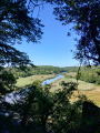
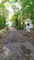
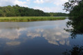
(1) Turn right onto it, heading east, and follow the right bank of the Scorff until you are directly below the Rocher du Corbeau. Here, you can take a detour via the Rocher du Corbeau (staircase, with a steep climb) for a view over the Scorff.
(2) Continue along the GRP®, following the yellow and red markings.
(3) Leave the path and turn left at the next junction, following the yellow PR® markings, and pass the Ferme de Saint-Urchaud. You will reach the D6.
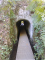
(4) Cross it safely using the pedestrian tunnel beneath the road, but take care as the maximum height is 1.5 m. You’ll need to walk along a curved metal grating footbridge for about ten metres. This section may be impassable in heavy rain. Join the greenway.
(5) Turn left onto it and follow it for 100 m, watching out for cyclists. Then turn right, enter Keryaquel and, at the Saint-Gildas Chapel, turn left. Continue straight on along the PR®, passing through Kerguéris before reaching the D306.
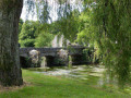
(6) Turn left onto it; it’s a quiet road, but watch out for cars on the bend. Turn left off it at the next junction before the bridge. Now follow the left bank of the Scave. Reach the dam.
(7) Continue straight ahead on the GRP®, until you reach the D6.
(8) Cross this very busy road with the utmost care; although there is a clear view on both sides, cars travel at high speed. Join the cycle path opposite, turning left but taking great care to watch out for cyclists. Return to the Terres de Nataé car park (S/E).
 Visorando Member
 Local authority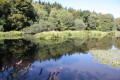
 Easy
Easy 
 Difficult
