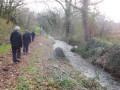
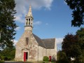
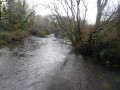
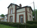
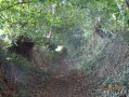
The countryside around Bannalec, starting from the Sainte-Véronique Chapel

A route through the countryside, passing through Rumérou and the Rozhuel mill.

Details

1728596
Creation:
Last update:
Last review:
  • Walking
    Activity: Walking
  • ↔
    Distance: 7.03 mi
  • ◔
    Average duration: 3h 45 
  • ▲
    Difficulty: Moderate

  • ⚐
    Back to start: Yes
  • ↗
    Ascent: + 558 ft
  • ↘
    Descent: - 558 ft

  • ▲
    Highest point: 440 ft
  • ▼
    Lowest point: 184 ft
  • ⚐ Country: France
  • ⚐ City: Bannalec (29380)
  • ⚑
    Start/End: N 47.937077° / W 3.750011°
  • ❏
    IGN map(s): Ref. 0620ET
  • Hour-by-hour weather

Description of the walk

Park at the picnic area by the Sainte-Véronique Chapel.

(S/E) Head left to cross the D765 with care, then follow the road straight ahead to the end. At a place called Kerprima, continue along the path opposite, which runs parallel to the road.

(1) Go under the railway bridge and follow the railway line to the right.

(2) Take the second path on the left, which passes near the sewage treatment plant after Ster Goz. You will reach Troganvel Farm.

(3) Turn onto the main track opposite. Continue until you reach the hamlet of Loretta.

(4) At the Stop sign, take the road opposite (slightly to the right), pass two roads on the left and turn onto the next path branching off to the left. At the road, turn right and, at the junction, follow the road opposite towards Rumérou. You’ll come to a T-junction.

(5) Head to the right. The road will give way to a track. Pass a track on the right and head towards Kergallic.

(6) Follow the road to the left and, at the T-junction, turn right. Continue for about 150 metres.

(7) Continue along the road that bends to the right, pass Rozhuel and follow the track. You can shorten the route by taking the road on the left to reach the next point, at a Fork in the road with the Route de Rozhuel.

(8) At the fork in the road, stay on the road. Head towards the D765.

(9) Turn right, go under the railway line and take the small road to rejoin the D765. Cross the road with care.

(10) Walk alongside the small car park and the D765, taking care at all times. Further on, turn left towards Keromnès.

(11) Follow the path opposite, ignoring the two paths on the right. Pass Kerscouarnec and follow the road.

(12) At the crossroads, turn right and carry on to reach the starting point (S/E).

Waypoints

  1. S/E : mi 0 - alt. 325 ft - St Veronique’s Chapel
  2. 1 : mi 0.89 - alt. 262 ft - Bridge under the railway line
  3. 2 : mi 1.27 - alt. 243 ft - Turn left and cross the - Ster Goz (rivière) - Affluent de l'Aven
  4. 3 : mi 1.42 - alt. 262 ft - Troganvel
  5. 4 : mi 2.46 - alt. 377 ft - Stop sign before Loretta
  6. 5 : mi 2.98 - alt. 384 ft - Rumérou
  7. 6 : mi 3.7 - alt. 322 ft - Kergallic
  8. 7 : mi 4.29 - alt. 364 ft - Kermérour-Boulben
  9. 8 : mi 4.98 - alt. 328 ft - End of the shortcut
  10. 9 : mi 5.2 - alt. 259 ft - On the right at the D765
  11. 10 : mi 5.58 - alt. 213 ft - Small car park
  12. 11 : mi 6.03 - alt. 328 ft - Keromnès
  13. 12 : mi 6.69 - alt. 364 ft - Turn right at the fork
  14. S/E : mi 7.03 - alt. 325 ft - St Veronique’s Chapel

Worth a visit

Reviews and comments

4.8 / 5
Based on 2 reviews

Reliability of the description
5 / 5
Ease of following the route
5 / 5
Route interest
4.5 / 5
Pierre isa
Pierre isa

Overall rating : 5 / 5

Date of your route : Jun 13, 2024
Reliability of the description : ★★★★★ Very good
Ease of following the route : ★★★★★ Very good
Route interest : ★★★★★ Very good
Very busy route : No

A lovely walk in the Banalécois countryside
The only downside is that the paths are a bit untidy in places.
Unfortunately, a great many hiking trails haven’t been cleared. It’s a shame.

Machine-translated

Roger Flao
Roger Flao

A lovely walk in the countryside, though there was a slight downside along the D765 near Bannalec and the Rozhuel mill...

Machine-translated

foyer laique
foyer laique

hike not yet completed

Machine-translated

JRS29140
JRS29140

Thank you for your encouragement.

Machine-translated

moulic
moulic

Overall rating : 4.7 / 5

Date of your route : Feb 11, 2019
Reliability of the description : ★★★★★ Very good
Ease of following the route : ★★★★★ Very good
Route interest : ★★★★☆ Good

a very beautiful, varied course

Machine-translated

Other walks in the area

For more walks, use our search engine .

The GPS track and description are the property of this route's author. Please do not copy them without permission.