


 Country:
 City:
City:


Start in the centre of Quéven, Rue de la Gare, at the former Quéven railway station past the Salle des Arcs, near the Anatole France Primary School. Starting sign near the station. The site is accessible by bus.
(S/E) With your back to the old station, walk up Rue Anatole France. Continue straight ahead, then turn left onto the cycle path along Rue Louis Kermabon until you reach the entrance to Kerzec Park on your right. Cross over and enter via the small path.
(1) In the park, turn right, cross the stream and continue straight on along the wide path. After the low wall, turn left onto the boardwalk. Continue to the right and follow the Ruisseau de Saint-Eloi to the wire fence, ignoring the paths on either side.
(2) Cross the stream and turn left, staying on the path below the plot until you reach a wood.
(3) Enter the woodland on the left to stay close to the stream. On your right, look out for the manhole cover from Lorient’s old water supply network. At the end, cross the footbridge on your left, then turn left and right. Continue straight on along the main path until you reach a crossroads.
(4) Turn right, go straight on, then turn left and head towards Kervégant.
(5) Cross carefully to the right and take the small road towards Le Roze. At the bend, carry on straight ahead and head down towards Les Paluds . Take in the salt marshes and the canals. Follow the boardwalks over the Ruisseau de Saint-Éloi and head back up towards Le Roze.
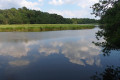
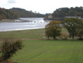
(6) Enjoy the view over the Scorff estuary, the salt meadows, the salt works and the Pont Brûlé. Continue straight on along the road and head towards the town of Le Roze on your right. Before the bend, take the path to the left of the small car park and walk along the edge of the field, ignoring the path on the right. You’ll reach the woods.
(7) At the end, turn right into the Kercadoret Departmental Wood and head down towards the Scorff, following the path as it bends left twice. Stay as close to the river as possible. After the jetty, carry on straight ahead to the Notre-Dame de Bon Secours Chapel, ignoring the paths on the left.
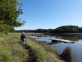
(8) At Bon Secours, take some time to explore the chapel (sign on site). Retrace your steps and continue straight on along the salt meadows and the River Scorff (ignore the paths to the left). Follow the path as it turns left, then the boardwalks and steps. Walk along the meandering River Scorff on the right.
(9) At the confluence of the Scorff and the Scave, head up to the left, then turn right. Cross the meadow and take the path opposite, then turn right onto the path that leads back down. Turn left and walk alongside the Scave.
(10) At Pont Scave, turn left (take care) then right onto the main path which follows the Scave and Terre de Nataé. Continue to an old railway bridge.
(11) Admire the old railway bridge from the Morbihan network and the water pipe beneath its deck, which carries water from the Scorff to the Paradis water treatment plant in Lorient. Head up to the left and continue left towards Quéven. Stay on the greenway until you reach the entrance to Quéven and Croizamus.
(12) Carry on straight ahead along the old railway line running parallel to the main street. At the roundabout, head straight across and continue straight on between the housing estates and the cemetery. At the end, you’ll come to the old Quéven railway station (S/E).

 Visorando Member

 Easy
Easy  Local authority
 Association / Club / Walk leader
