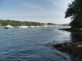
Visit (1) Life in the Ria
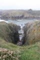
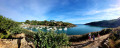
The characteristic landscape of this region is defined by the Breton rias. A ria is a bay formed by the lower reaches of a coastal river valley that has been flooded by the sea. The Merrien ria is ideal for oyster farming; indeed, the right bank is home to several oyster farmers. It was in the 19th century, under Napoleon III, that a study was carried out in our rias on the flat oyster – with its nutty flavour – which was seriously threatened with extinction along the coast. It was in the Arcachon Basin that the Emperor successfully introduced a production technique, brought back from Italy. In 1859, he established the Concarneau marine station.
Permission to establish an oyster bed in the Ria de Merrien was granted in 1873 by the Countess of Tréveneuc, the new owner of Plaçamen Castle.
Between and (1) Wildlife and migration
From the wooded banks of the ria to the coastal areas, numerous migratory species stop over at this site. The extraordinary biodiversity of this natural area provides birds with the food they need to survive and reproduce (fish, berries, small fruits, insects, seaweed, seeds). You’ll see magnificent passerines such as the skylark with its enchanting song, the whinchat, which can be spotted on posts or in tall grass, the highly protected little ringed plover, the little egret with its pure white plumage, the Belon shelduck – a colourful duck – the rock pipit, the European goldfinch, as well as the lesser whitethroat and the black woodpecker, two species of Community interest.
Visit (1) The maritime heritage
From Moulin l’Abbé to the ocean, along the right bank of the Merrien, a series of coves follow one after another. These provided shelter for sardine and tuna fishing boats in heavy weather, as evidenced by this shipwreck. In the 1960s and 1970s, Merrien was home to eight sardine boats, each 10 to 12 metres long.
Each carried a crew of seven to eight men. The decline of this industry began at the end of that decade. After 1980, some continued a small-scale coastal fishing operation, catching whiting, pollack, sea bass, conger eels and so on…
(1) Moulin l’Abbé
The Moulin l’Abbé, situated on the banks of the River Merrien, was once owned by the Abbey of Sainte-Croix in Quimperlé. It was sold for 10,000
écus in 1672. Above the lintel of the front door is a coat of arms bearing a crosier accompanied by the word ‘Pax’. Today, the mill
is occupied by private individuals.
From (2) The History of the Plaçamen Estate
- Origin of the site: This forest and coastal estate is a former property that historically belonged to Plaçamen Castle, having passed from hand to hand since the Revolution (notably to the Mauduit family in the 19th century and then to the Counts of Beaumont in the 20th century).
- A rural and maritime past: The site borders the Merrien ria. In the past, the estate featured ponds used for retting flax and hemp, as well as a thriving sardine fishing and oyster farming industry along the shores.
- Current protection status: Now a protected natural area managed by the Conservatoire du littoral, the Bois de Plaçamen is today a much-loved walking trail.
Between (1) and the Plaçamen Wood
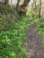
The extraordinary natural diversity of this site offers walkers following the Grande Randonnée trail a landscape of great beauty. This typical coastal woodland is home to numerous tree species such as beech, wild cherry and maple, as well as conifers such as
pine, spruce and the cross fir – traditionally used as a ‘Christmas tree’ – which dominates this forest habitat and can grow to a height of up to 50 metres. The main tree species in this woodland are oak and chestnut.
The giant sequoia is one of two planted by the shopkeepers of Moëlan-sur-Mer in 1962:
-
- The planting: in 1962, the shopkeepers of Moëlan-sur-Mer left their mark on the landscape by planting two giant sequoias in the middle of the undergrowth.
- Significance: this local initiative aimed to enhance the beauty and enrich the plant diversity of this picturesque woodland. These majestic conifers still amaze walkers today as they follow the sentry box route
(4) The Plaçamen Fountain
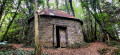
Below the path lies the Plaçamen Fountain, comprising several stone basins. This water, which was used to build
wash houses and fountains, was highly renowned. It was collected in bottles using ivy leaves. Situated above the path and the basins, this oval stone structure houses an old pumping system.
(6) The Plaçamen Orchard
Close to these natural areas, a plot on higher ground within the site is cultivated with the utmost respect for the environment. It
This is the orchard that gave its name to the Kermerrien apple, a fragrant yet bitter variety that ripens in late September or early October; it is productive, fairly hardy and easy to manage once its vigour has been properly controlled in the early years. It should be planted in moderately fertile soils, and its juice is turned into cider. This drink is very popular with crêpes, but also with oysters!
Visit (7) The estuary
The estuarine environment is where the fresh water of the river meets the salt water of the sea. This environment follows the rhythm of the tides and is home to protected plant and animal species. The estuarine area is sought after by various stakeholders, each with their own ecological, economic,
social and tourism-related priorities.
The town of Moëlan-sur-Mer boasts a coastline of approximately 15 km, set against a magnificent landscape. The cliffs indented with coves, the moorland with its palette of colours, the beaches, and the ria with its lush vegetation inspired many painters in the 19th and 20th centuries, such as Victor-Pierre Ménard and Maurice Asselin.
https://www.moelan-sur-mer.bzh/wp-content/uploads/2023/11/parcours-orientation-adulte.pdf
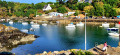
Port Merrien (opposite7)
Merrien is a harbour that can run dry: it is what is known as a ‘beach harbour’. Small slipways and steps were built back when there were many sardine boats in Merrien, which would unload their catch at a fish factory located on the harbour. The sardine fishermen therefore had to wait for the tide to come in to unload their fish. The idea was therefore to ensure that they could do so at any time to supply the factory, regardless of the tide.”
These landing stages and stairways form part of the town’s maritime heritage: they bear witness to the town’s sardine-fishing history. Like all such ageing port infrastructure, they are subject to storm damage, natural erosion and the wear and tear of the concrete.
Speaking of one of them, which has just been repaired, the mayor said: “We felt that, given its heritage value, it was necessary to restore it. It took a little time, but it’s been done.”
Between (7) and Cale de Porz ar Zant
This harbour was built in 1929. It served as a refuge for sardine and tuna boats seeking shelter in heavy weather. In the 1960s, Merrien had eight sardine boats, each 10 to 12 metres long.
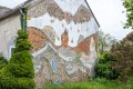
The “Maison Louis XV” is the ruined building (though currently under renovation). It was built in 1883 (well after the reign of Louis XV!). It was inhabited by several families in the service of the Count of Beaumont. The Count had an oyster reserve below this house, in a cove nicknamed “La Plage du Comte”. This oyster bed was maintained right up until the 1930s. The last family to live in this house was the Pennecs, a family of fifteen children, the youngest of whom was godson to Vincent Auriol. The Pennec family arrived around 1931 and left the house in 1963; it has stood derelict ever since.
Off the beaten track, heading south-west (after ) along the customs officers’ path
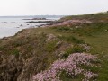
It is at the mouth of the River Merrien that the customs officers’ paths begin. In the 18th century, the suspicious movements of rowing boats and vessels, which frequently delivered contraband from England and Spain, required increased surveillance. The guards were stationed in the customs officers’ house, this granite building of exceptional architectural design. Here, the deciduous trees of the Plaçamen wood give way to moorland, a remarkable open landscape facing the ocean, whose vegetation consists mainly of blackthorn, heather, ferns and gorse – the thorny shrub with golden-yellow flowers.
Off the trail: the town of Moëlan-sur-Mer
https://www.moelan-sur-mer.bzh/
Off the trail: the other rias of southern Finistère
https://www.quimperle-lesrias.bzh/les-rias/



 Country:
 City:
City:


 Visorando Member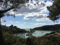
 Moderate