Country:
 City:
City:


Start from the town of Pont-Scorff. Stadium car park, heading towards Arzano (near the Strapontin). The start sign is on the left, at the car park entrance. Pont-Scorff can be reached via the bus network.
(S/E) Leave the car park and turn left onto Rue du Docteur Rialland, until you reach the junction of Rue de la Libération and Rue Terrien.
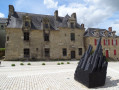
(1) Carry on straight ahead. At the end of the street, take a look at the Atelier d’Estienne, a contemporary art space, on your right. Head across to Place de la Maison des Princes. Carry on straight ahead and walk around the square. “Be sure to take a look at the Maison des Princes and the church”.
(2) Turn left. “Take a look at the houses around the square and the former town hall (Espace Pierre de Grauw).”
At the end, go down the Casse-Cou steps and along Rue du Vieux Pont to reach the Bas Pont-Scorff.
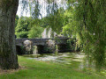
(3) Head to the Pont Saint-Jean to enjoy the view of the Scorff and the Pont Neuf.
(4) Retrace your steps.
(3) Turn left onto the Chemin du Ronce. Follow the Scorff and stay on the path that runs past the old port of La Cale and the footbridge. On the uphill stretch, turn left, then left again to rejoin the Scorff. Follow it and head up to the right until you reach the Saint-Urchault estate.
(5) Turn left, then right to pass in front of the farm, then the Manoir de St-Urchaut. Turn left at the orchard, then straight on. After the stream, head slightly left onto the boardwalks, then left at the next junction. (Note: a less steep route is available to the right – turn left twice, then right and left).
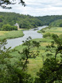
(6) Climb the steps to the viewpoint and enjoy the view over the Scorff estuary from the Rocher du Corbeau.Head back down towards the Scorff and turn right, walking alongside the ponds. Continue alongside the Scave, a tributary of the Scorff. At the gate, turn right, then left onto the road to reach a junction.
(7) Carry on to the right, then turn left onto the old railway line, just past the entrance to the Terres de Nataé wildlife park. Turn right before the old railway bridge and cross the D6.
(8) Danger! Head straight ahead and follow the road, then the small path. At the junction, turn left, then continue to the right, near the Scave. You’ll see the old Frémeur Mill embankment on your left. Stay on the main path until you reach a road at the Étang du Verger.
(9) Cross over and head up the path opposite. Don’t miss the Moulin Neuf on your right, or the inspection chambers and pipes of Lorient’s old water network along the path. Walk alongside the pond until you reach the road at Le Verger.
(10) At the D306, turn right (Caution!). Opposite, you can see the private manor house and castle of the former seigneury of Le Verger. Turn right towards Kermérien, then left onto the footpath to reach Kergueris.
(11) In the village, turn right, then left. Carry on straight ahead to Keryaquel, ignoring the roads on the right.
(12) Enter the village of Keryaquel on the right, passing the Saint-Gildas chapel. Carry on straight ahead until you reach the greenway, then turn left. At the road, carry on straight ahead along the old railway line, then you’ll reach the junction of Rue Xavier Grall and Rue François Mauriac.
(13) Carry on to the left. Cross the road and continue straight ahead, before returning to your starting point on the right (S/E).

 Visorando Member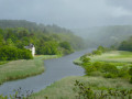
 Difficult
 Local authority
 Easy
Easy