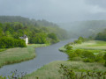
The Golf Course Route in Quéven

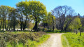
Close to the town of Quéven, this walk takes you along paths around the Val Quéven Golf Course, through woods and fields and alongside streams. You’ll be able to explore the former seigneury of Kerrousseau, situated on a promontory overlooking the lush Scave Valley.

Details

62754441
Creation:
Last update:
Last review:
  • Walking
    Activity: Walking
  • ↔
    Distance: 3.69 mi
  • ◔
    Average duration: 1h 55 
  • ▲
    Difficulty: Easy

  • ⚐
    Back to start: Yes
  • ↗
    Ascent: + 230 ft
  • ↘
    Descent: - 226 ft

  • ▲
    Highest point: 174 ft
  • ▼
    Lowest point: 36 ft
  • ⚐ Country: France
  • ⚐ City: Quéven (56530)
  • ⚑
    Start/End: N 47.8089° / W 3.416907°
  • ❏
    IGN map(s): Ref. 0720ET
  • Hour-by-hour weather

Photos

Description of the walk

Starting point: Quéven, car park in the village of Kerrousseau. Access via the D6 Quéven–Pont-Scorff road. Head towards the golf course and continue to the far end of the village of Kerrousseau. The car park is on the right; the route’s starting sign is on the left-hand side of the car park.

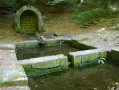
(S/E) At the car park, take the narrow path leading downhill between the forest gate and the trail start sign, down to the fountain and washhouse.

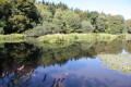
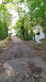
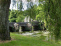
(1) Visit the Kerrousseau fountain and washhouse complex and continue to the right. Carry on to the left, then straight ahead along this wide forest track running parallel to the rivers of the Kerrousseau mill (ruins below) and the Scave. You’ll reach a junction with a wide avenue.

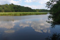
(2) Turn left to explore the old Frémeur Mill pond and the River Scave. Return to the previous junction.

(3) Retrace your steps to return to the junction with the wide avenue.

(2) Follow it straight on for about fifty metres and turn left. Walk along the edge of the meadow, then turn right. Continue straight on until you reach the gate. Go through it and join the road leading to the golf course.

(4) Walk a few metres up to the right, cross the road and turn left onto the path before the blocks of flats. Follow this path through woods and meadows, first to the right, then to the left. After the footbridge, continue to the right along the path that runs alongside the Val Quéven Golf Course until you reach the Kerroc’h roundabout.

(5) Turn right for a round trip towards Kerroc’h to explore the burial mound on your left.

(6) Return to the roundabout.

(5) Turn right into the meadow onto the path leading back to the town. Turn right towards the golf course and follow the path downwards, crossing the stream to reach the Kerlébert equestrian centre.

(7) Turn right and follow the path which leads left into the woods. Continue along this path. It branches off to the right, then to the left into the sunken lane as far as Kerguestenen.

(8) You are now in the parish of Gestel. Turn right, then left onto the street before turning right onto the sunken lane. At the end, continue right into the housing estate and, at the far end, take the path on the left. Turn right twice onto the path that leads to the golf course. At the crossroads, turn left onto the main avenue.

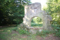
(9) After crossing the Moulin de Kerrousseau stream, you’ll be back in Quéven. Turn left straight away into the departmental woodland before the golf courses. Continue along this path, ignoring the junctions. Leave the stream and head uphill to the right, then left. Pass by the last remains and the well of the former Kerrousseau Castle to return to the starting point (S/E).

Waypoints

  1. S/E : mi 0 - alt. 128 ft - Kerrousseau car park
  2. 1 : mi 0.14 - alt. 66 ft - Kerrousseau fountain and washhouse
  3. 2 : mi 0.55 - alt. 46 ft - Grande Allée
  4. 3 : mi 0.62 - alt. 36 ft - Frémeur Mill - Scorff (fleuve)
  5. 4 : mi 1.06 - alt. 79 ft - Val Quéven Golf Course
  6. 5 : mi 1.6 - alt. 135 ft - Kerroc’h roundabout
  7. 6 : mi 1.73 - alt. 157 ft - Tumulus et dolmens de Kerroc'h
  8. 7 : mi 2.33 - alt. 121 ft - Kerlébert
  9. 8 : mi 2.74 - alt. 157 ft - Kerguestenen
  10. 9 : mi 3.13 - alt. 98 ft - Kerrousseau Departmental Wood
  11. S/E : mi 3.69 - alt. 128 ft - Kerrousseau car park

Notes

This route is organised by Lorient Agglomération

This route is included in the Morbihan Departmental Plan for Walking and Hiking Routes and has been accredited by the French Hiking Federation. You can follow the yellow markings. There is an information board with a map and details of heritage sites at the start.

Worth a visit

- Fountain and washhouse (19th century) on the Kerrousseau estate
- Site of the former Kerrousseau mill (17th–20th centuries)
- Pond and site of the former Frémeur mill on the River Scave, near Pont-Scorff
- Kerrousseau departmental forest
- Val Quéven Golf Course, situated in the grounds of the former Kerrousseau estate
- Kerroc’h burial mounds and dolmens: Neolithic burial site
- Kerlebert: a 16th-century seigneury with a manor house, later a country house and now an equestrian centre
- Ruins of Kerrousseau Castle (late 18th century): a manor house, chapel and dovecote in the 15th century; a country house in the late 18th century; requisitioned by the Germans and destroyed by fire in 1944.

Reviews and comments

4.2 / 5
Based on 3 reviews

Reliability of the description
4.3 / 5
Ease of following the route
4.3 / 5
Route interest
4 / 5
martine.morel36 @ orange.fr

Overall rating : 4.7 / 5

Date of your route : May 30, 2026
Reliability of the description : ★★★★★ Very good
Ease of following the route : ★★★★★ Very good
Route interest : ★★★★☆ Good
Very busy route : No

A pleasant walk, mainly through woodland. It’s a shame, though, that the burial mound is hidden by vegetation and can’t be seen.

Machine-translated

dragon fougueux
dragon fougueux

Overall rating : 5 / 5

Date of your route : Feb 28, 2025
Reliability of the description : ★★★★★ Very good
Ease of following the route : ★★★★★ Very good
Route interest : ★★★★★ Very good
Very busy route : No

A lovely walk in the woods, which was still accessible despite the heavy rain over the last few days. Easy and enjoyable 👍 – definitely worth doing again

Machine-translated

Lorient Agglomération

Could you provide specific details regarding the location and nature of the damage?
Thank you in advance,
Kind regards,

Machine-translated

novygab
novygab

Overall rating : 3 / 5

Date of your route : Oct 21, 2024
Reliability of the description : ★★★☆☆ Average
Ease of following the route : ★★★☆☆ Average
Route interest : ★★★☆☆ Average
Very busy route : No

This path has fallen into disrepair since the last storm

Machine-translated

Other walks in the area

For more walks, use our search engine .

The GPS track and description are the property of this route's author. Please do not copy them without permission.