In the heart of the Carnoët Forest

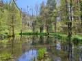
Walk through the heart of the Carnoët Forest, taking in the Tailors’ Pond, the Kerguéguen Stele, the Frout and Fontaine au Loup streams, and the Devil’s Bridge.

Details

32339765
Creation:
Last update:
Last review:
  • Not specified
    Activity: Not specified
  • ↔
    Distance: 3.68 mi
  • ◔
    Duration according to the author: Duration unknown 
  • ▲
    Difficulty: Easy

  • ⚐
    Back to start: Yes
  • ↗
    Ascent: + 220 ft
  • ↘
    Descent: - 226 ft

  • ▲
    Highest point: 180 ft
  • ▼
    Lowest point: 13 ft
  • ⚐ Country: France
  • ⚐ City: Quimperlé (29300)
  • ⚑
    Start/End: N 47.840992° / W 3.548958°
  • ❏
    IGN map(s): Ref. 0620ET, 0720ET
  • Hour-by-hour weather

Photos

Description of the walk

To reach the starting point from Quimperlé, follow the D49 southwards, enter the forest and then, at the junction with the column, turn left onto the Route Forestière du Château and park in the car park a few metres further on.

(S/E) Continue along the road and, at the 90° left-hand bend, go straight on along the Route Forestière de l’Abbaye Saint-Maurice.

(1) At the three-way junction, turn right towards the Étang des Tailleurs.

(2) At the pond, cross the bridge then head up the Frout valley on the right. At the Ligne de la Fontaine Oliveau, continue to the left until you reach a three-way junction with a small car park.

(3) Turn right towards the Kerguéguen Stele, cross a clearing, reach the low Iron Age stele, then head for the Ligne des Grands Buis.

(4) Head down to the left towards the Fontaine au Loup (Feteun ar Bleiz). Ignore a path branching off to the right, then continue along the valley floor until you reach a fork at the Pont de Pierre (formerly the Pont du Diable).

(5) Cross the bridge and continue along the Ligne de la Fontaine Oliveau until you rejoin the route you have already taken.

(1) Go straight on and head for the car park on the edge of the Route Forestière du Château (S/E).


Waypoints

  1. S/E : mi 0 - alt. 180 ft - Car park, Route Forestière du Château
  2. 1 : mi 0.59 - alt. 135 ft - Three-Way Junction
  3. 2 : mi 0.82 - alt. 72 ft - Étang des Tailleurs
  4. 3 : mi 1.51 - alt. 144 ft - Fork in the road
  5. 4 : mi 1.76 - alt. 177 ft - The Grands Buis railway line
  6. 5 : mi 2.24 - alt. 23 ft - Stone Bridge - Laïta (fleuve)
  7. S/E : mi 3.68 - alt. 180 ft - Car park, Route Forestière du Château

Worth a visit

Reviews and comments

4 / 5
Based on 4 reviews

Reliability of the description
4.3 / 5
Ease of following the route
4 / 5
Route interest
3.8 / 5
EdwigePe
EdwigePe

Overall rating : 3.7 / 5

Date of your route : May 13, 2024
Reliability of the description : ★★★★☆ Good
Ease of following the route : ★★★☆☆ Average
Route interest : ★★★★☆ Good
Very busy route : No

A lovely walk through this forest, though the storms have certainly left their mark. After the pond at point 2, the bridge is no longer accessible. We had to cross that section using a fallen tree trunk. There are also a few places where you have to go round. We were right in the undergrowth; the light was magnificent and we were sheltered from the sun.

Machine-translated

Bernard Maugiron
Bernard Maugiron

Overall rating : 4.7 / 5

Date of your route : Sep 14, 2023
Reliability of the description : ★★★★★ Very good
Ease of following the route : ★★★★★ Very good
Route interest : ★★★★☆ Good
Very busy route : No

A pleasant walk through a lovely forest; the return journey is a bit monotonous.

Machine-translated

Malik-Emmanuel Le Roux

Hello and thank you for your feedback. It’s true that the forest track to St Maurice can seem long and a bit too straight. However, the track isn’t tarmac-surfaced and can’t really be described as a tarmac road. What’s more, we’re right in the heart of the forest, with no noise...
The aim is to offer a route taking less than 2 hours; there is a demand for circular routes lasting between half an hour and two hours for those who do not always have enough time available...
On the way back, it is possible to follow the Laïta river as far as Carnoët Castle (junction of the GR®38 and GR®34).
Perhaps there’s a change to be made, or a different, more varied circular loop to suggest?
Kind regards

Machine-translated

Veronique Castelain
Veronique Castelain

Overall rating : 4 / 5

Date of your route : Aug 25, 2023
Reliability of the description : ★★★★☆ Good
Ease of following the route : ★★★★☆ Good
Route interest : ★★★★☆ Good
Very busy route : No

There’s a long straight stretch at the start and on the way back to the car park, which isn’t actually part of the ‘circular’ route itself. It feels quite long towards the end…
Otherwise, a lovely forest – quiet and peaceful.

Machine-translated

rossemario
rossemario

Overall rating : 3.7 / 5

Date of your route : Jun 17, 2023
Reliability of the description : ★★★★☆ Good
Ease of following the route : ★★★★☆ Good
Route interest : ★★★☆☆ Average
Very busy route : No

A lovely walk through a beautiful forest
a bit too much tarmac on the way back

Machine-translated

For more walks, use our search engine .

The GPS track and description are the property of this route's author. Please do not copy them without permission.