Country:
 City:
City:


Park in the car park alongside the D49, Route du Pouldu.
(S/E) Opposite the car park, cross the road with care, head straight ahead (south-east) into the forest, following the bridle path, and cross the Ligne du Grand Buis. Continue straight ahead and, at the junction with a straight forest track, turn right (red and white markings) for about 250 m.
(1) Continue straight on along a fairly steep, downhill path, cross the Ruisseau de la Fontaine au Loup, and take the road to the right, as far as the Fontaine aux Loups.
(From point (1), it is possible to avoid the steep descent by following the red and white markings, which take a circular detour around the difficult section. This alternative route is recommended in wet weather, when crossing the stream may be difficult).
(2) Just before reaching the pond, near a sign indicating a reforestation project, take the small path on the left which runs along the eastern bank of the pond and winds its way deeper into the forest.
(3) At a junction of paths, ignore the track heading straight ahead to the right and continue straight on, south-east, along a route that is now more straightforward. Descend (fairly steep slope – take care, or take the bypass path to the left) onto a forest track, follow it to the right until you reach a junction, and then turn left.
(4) After about twenty metres, at a wooden marker post, head down to the left into the forest (red and white markings), and follow the marked path to the Pont de Pierre.
(5) After crossing the bridge, turn right onto the narrow path that runs along the left bank of the stream, then head uphill to a crossroads (bench).
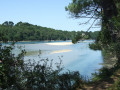
(6) Head down the path to the right and follow the right bank of the Laïta for about 1 km (most visible from halfway along the route). Continue to Carnoët Castle.
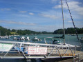
(7) At Port du Passage, head back up the road and, shortly afterwards, turn off onto the track leading up to the left towards the Route de Saint-Maurice.
(8) At the junction with a forest track, carry on straight ahead and, at the bottom of the slope, take the small path on the left.
(9) When the path begins to curve to the right, take the less marked track to the left, which leads to the left bank of a stream. Follow the stream for a while, then head back up to the road. Take the road to the right until you reach the first Fork in the road.
(10) Head down to the right towards the Étang des Tailleurs, a lovely spot, ideal for a picnic and/or a nap, before setting off on the return journey.
(11) Cross the footbridge and follow the track as it climbs. At the junction with a lane, take the lane on the left, then, shortly afterwards, a small path to the right. At the next junction, this time take the lane on the right, then, shortly afterwards, a small path on the left which leads back to the car park (S/E).

 Visorando Member

 Difficult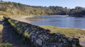
 Moderate