Around the Val Quéven Golf Course

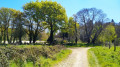
A short, easy walk with no significant elevation gain, suitable for everyone, around the Val Quéven Golf Course.

Details

7938584
Creation:
Last update:
Last review:
  • Walking
    Activity: Walking
  • ↔
    Distance: 4.12 mi
  • ◔
    Average duration: 2h 00 
  • ▲
    Difficulty: Easy

  • ⚐
    Back to start: Yes
  • ↗
    Ascent: + 141 ft
  • ↘
    Descent: - 154 ft

  • ▲
    Highest point: 174 ft
  • ▼
    Lowest point: 92 ft
  • ⚐ Country: France
  • ⚐ City: Quéven (56530)
  • ⚑
    Start/End: N 47.791607° / W 3.415215°
  • ❏
    IGN map(s): Ref. 0720ET
  • Hour-by-hour weather

Photos

Description of the walk

Park in the car park opposite Quéven Cemetery.

(S/E) Head towards the roundabout and go round it on the right, using the pedestrian crossing. Continue along Rue du 7ème Bataillon FFI until you reach the junction. Cross at the pedestrian crossing and follow the Greenway path opposite. This path runs alongside the D6 and leaves it at the wayside cross. You’ll reach the access path to a housing estate on your left.

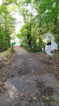
(1) Turn onto this small path, then walk through the housing estate to the roundabout. Go round the roundabout on the right to take the small road opposite, above Kerroc’h. At the end of this small road, follow the dirt track on the right. Walk between two fairways to reach a T-junction.

(2) Turn right and walk through the hamlet of Kerrousseau.

(3) As you leave the hamlet, turn left onto the “Ruisseau du Moulin de Kerrousseau” trail, as shown on a sign. From there, follow the yellow-marked trail.

(4) After crossing over the stream, turn right and then immediately take the small (rather steep) path on the left which leads uphill towards a pretty little housing estate. Follow the yellow markings on the trees carefully, as they are somewhat faint.

(5) Before you reach the end of the housing estate, take the dirt track on the left and follow it to the end (see yellow markings).

(6) Turn left, following the sign. Walk through the hamlet of Kergusténen. As you leave the hamlet, follow the path – still marked in yellow – cross a stream and you’ll arrive at the riding centre.

(7) When you reach the riding centre, head up the path on the left. At the top of the hill running alongside the golf course (very steep slope), take the track on the left. You’ll come back to the roundabout you passed at the start of the route.
Retrace your steps, passing through the housing estate.

(1) Return to the Voie Verte to get back to the cemetery car park (A/D).

Waypoints

  1. S/E : mi 0 - alt. 164 ft - Cemetery car park
  2. 1 : mi 0.6 - alt. 125 ft - Crossing the housing estate
  3. 2 : mi 1.38 - alt. 112 ft - End of the course
  4. 3 : mi 1.57 - alt. 128 ft - Kerrousseau hamlet
  5. 4 : mi 2.13 - alt. 98 ft - Slope towards Rue Galilée
  6. 5 : mi 2.28 - alt. 135 ft - Rue Galilée
  7. 6 : mi 2.39 - alt. 164 ft - Kerguesténen
  8. 7 : mi 2.92 - alt. 125 ft - Equestrian centre
  9. S/E : mi 4.12 - alt. 164 ft - Cemetery car park

Reviews and comments

4.1 / 5
Based on 4 reviews

Reliability of the description
4 / 5
Ease of following the route
4.8 / 5
Route interest
3.5 / 5
Gilbounet
Gilbounet

Overall rating : 4.7 / 5

Date of your route : Jan 09, 2025
Reliability of the description : ★★★★★ Very good
Ease of following the route : ★★★★★ Very good
Route interest : ★★★★☆ Good
Very busy route : No

best avoided when it’s raining, as there’s a bit of mud in the undergrowth

Machine-translated

pierrebzh
pierrebzh

Overall rating : 4.7 / 5

Date of your route : Apr 15, 2024
Reliability of the description : ★★★★★ Very good
Ease of following the route : ★★★★★ Very good
Route interest : ★★★★☆ Good
Very busy route : No

I quite like this walk, which I’ve done several times. I didn’t really see the point of the first 1.5 kilometres, apart from being able to park there. You might as well start near the 16th hole on the golf course.

Machine-translated

Tipanie
Tipanie

Overall rating : 3.7 / 5

Date of your route : Jun 14, 2021
Reliability of the description : ★★★☆☆ Average
Ease of following the route : ★★★★★ Very good
Route interest : ★★★☆☆ Average
Very busy route : No

Hello,

I’d like to share our thoughts on the walk we did yesterday.
Based on the directions provided, we got lost halfway through the route; luckily, we met a couple who put us back on the right track, and we also ended up going back and forth a few times as we couldn’t find our way – as proof, we ended up walking 8 km 200.
This route is simply a walk through the woods with very little to catch the eye.
Kind regards
Mr and Mrs FRANCOIS

Machine-translated

louisdelorient
louisdelorient
• Edited:

Overall rating : 3.3 / 5

Date of your route : Apr 25, 2021
Reliability of the description : ★★★☆☆ Average
Ease of following the route : ★★★★☆ Good
Route interest : ★★★☆☆ Average
Very busy route : Yes

Hello
The yellow markings on the route are barely visible or have faded in places.
Furthermore, point 4 is problematic; there is no bridge and the route is very confusing after that; it’s hard to find your way. There is a risk of confusion with the Gestel footpath.

Machine-translated

Other walks in the area

For more walks, use our search engine .

The GPS track and description are the property of this route's author. Please do not copy them without permission.