Country:
 City:
City:


Park in the arboretum car park near the Kerisole campsite.
(S/E) Head towards the far end of the car park and take a path on the left leading to the greenway. Follow it to the left, then turn right onto a downhill path just before the bridge over the Isole.
(1) Continue along this path, which gradually veers to the right and joins a small road called Chemin de Rouzigou, which leads to Rue Louis Bourvic. Follow this street to the left via a designated path, ignore a dead end on the right and reach another junction.
(2) Turn right onto a small road towards the village of Créménet and follow it to the junction with a tarmac track called Hent Kozh Créménet. Continue along this track, which climbs steadily, pass a farm, ignore a track on the right and head down the path to reach a junction.
(3) Turn left and continue along a small road called Hent Nevez Créménet, ignoring the turn-offs to the left and right, until you reach a T-junction.
(4) Turn right, then left at the next junction to reach the village of Kerzonas (or Kerzonnars).
(5) Turn right at the junction in the centre of the village and continue along a small road which turns into a footpath (beautiful views of the countryside and the hamlet of Scaër). Continue straight on along this path, ignoring the farm tracks branching off to the left and right, until you reach another T-junction.
(6) Turn left onto a footpath which leads to the road to Kervalaen Farm. Follow it to the left for a few metres until you reach a crossroads marked by a telecoms mast.
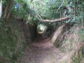
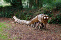
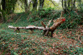
(7) Turn right, then immediately left after the mast onto a path running along the edge of the fields. Follow it, passing the hamlet of Loj Lanic and coming to a small road. Cross it and continue straight on down a sloping path (this path is a section of a Roman road). Continue downhill, passing the hamlet of Touldu (admire the strange wooden creatures along the way: centipedes, a dragon, a giant, etc.) and reach the Stêr Coulennec stream (there is an information board about the Roman road just before the stream).
(8) Cross the stream over a very old stone bridge and turn right at the first path you come to, which climbs steadily and leads onto a small road. Follow this road, ignoring a small road branching off to the left and then to the right, until you reach a disused road running parallel to the D4.
(9) Follow it to the right, cross the D4 with care and turn left towards the village of Loch Brout. Continue along this small road, ignore a dead end on the left and reach another junction. Carry on to the left, pass the Toul ar C’hoat bar and turn right for a few metres.
(10) Take a path immediately on the right at the edge of the forest. Follow it until you reach one of the main forest tracks in the Coatloc’h State Forest. Turn left, continue straight on along this wide, undulating track through the forest until you reach a small road. Turn right to join the greenway.
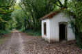
(11) Follow it to the right, passing the villages of Guéroué and Drolou (note an old roadmenders’ shelter on the left), until you reach Rue du Général de Gaulle.
(12) Cross it carefully and continue straight ahead on the greenway. Follow it as far as the old Scaër railway station.
(13) Continue along the greenway, pass under two successive bridges, cross Rue Louis Pasteur with care and turn left to return to the starting car park (S/E).


 Visorando Member

 Easy
Easy