Loc Yvi – Saint-Diboan Chapel and fountain – Ellé Valley

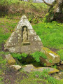
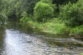
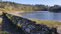
The walk first takes you from the Chapel of Saint-Diboan (in the hamlet of Loc Yvi) to the consecrated fountain of the same name. The shaded path then winds its way into the unspoilt Ellé valley, the natural boundary between the regions of Cornouaille and Vannes, with its striking rocky outcrops and boulder fields shaped by erosion, and its steep-sided valleys carved out by small rapids (known as ‘froud’ in Breton).

Details

n°32622320
Creation:
Last update:
–
Last review:
  • Walking
    Activity: Walking
  • ↔
    Distance: 1.97 mi
  • ◔
    Average duration: 1h 05 
  • ▲
    Difficulty: Easy

  • ⚐
    Back to start: Yes
  • ↗
    Ascent: + 240 ft
  • ↘
    Descent: - 240 ft

  • ▲
    Highest point: 240 ft
  • ▼
    Lowest point: 23 ft

Photos

Description of the walk

From Quimperlé, take the D790 towards Le Faouët. At the Croix Loc Yvi crossroads, turn right towards the village of the same name, then park near the Saint-Diboan Chapel.

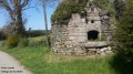
(S/E) Walk through the hamlet towards Kerfourcher and, at the bottom of the valley on the left, you will see the consecrated fountain of Saint-Diboan (Sant Tu pe Du) with a converted washhouse enclosing an Iron Age Gallic stele, discovered by chance by a farmer working the adjoining field in the mid-19th century, thus likely confirming the sacred nature of the site prior to the advent of the Christian era.

(1) Take the path opposite the fountain on the right-hand side of the village road. At the confluence of the Loc Yvi and Kerfourcher streams, turn right and continue down towards the River Ellé. You will reach the rocky outcrop known as ‘Lo(ñ)ch Louarn’ (the fox’s lair).

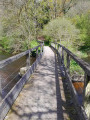
(2) Turn right, follow the Ellé downstream, cross the small wooden bridges provided to help you cross the “frouds” and climb towards Roche Pempic, a rocky promontory overlooking the Ellé: take care, as the path is narrow in places and the drop-off is as steep as a cliff.

(3) Head back down towards the Ruisseau de Pempic, then turn left again towards the Ellé. Follow the river, keeping to the right.

(4) Turn right to begin the climb up onto the plateau towards the hamlet of Kermec, then head left towards “Toull Bahadoù”, a former café-theatre known for its “rixes” (hence the place name), popular with revellers, paper-makers from Kerisole and other farmers returning from Quimperlé.
Turn right onto Rue de Kerluandre, then right again towards Pempic / Loc Yvi. Head straight for the Chapel of Saint-Diboan (S/E).

Waypoints

  1. S/E : mi 0 - alt. 240 ft - Saint-Diboan Chapel
  2. 1 : mi 0.15 - alt. 207 ft - Saint-Diboan Fountain
  3. 2 : mi 0.64 - alt. 46 ft - Lo(ñ)ch Louarn, the Fox’s Lair - Ellé (fleuve) à finaliser
  4. 3 : mi 0.77 - alt. 85 ft - La Roche Pempic
  5. 4 : mi 1.14 - alt. 108 ft - Turn right at the fork
  6. S/E : mi 1.97 - alt. 240 ft - Saint-Diboan Chapel

Worth a visit

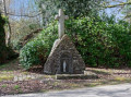
Saint-Diboan Chapel, village of Loc Yvi.
(Sources: Inventory of Heritage in Brittany, Brittany Region/Rannvro Breizh)

Saint Diboan, or Sant Diboan / Sant Tu pe Du in Breton, is invoked to relieve suffering and pain, whether through healing or death. A pilgrimage is held in his honour every year, fifteen days after Easter. A procession leads the faithful to the fountain. In days gone by, this pilgrimage attracted hundreds of people from the surrounding area. The relatives of the sick would come to place a lock of the patient’s hair or a piece of their clothing there, in order to seek the saint’s intercession.
Some believe that Saint Diboan is none other than Saint Abibon.

Three Iron Age stelae were unearthed from the plot of land adjoining the fountain. One is set into the washhouse next to the fountain, a second in Saint-Diboan’s Chapel and the third in Saint-Méen’s Church in the village of Tréméven.
(Sources: Dastumedia)

Reviews and comments

4.2 / 5
Based on 2 reviews

Reliability of the description
4 / 5
Ease of following the route
4 / 5
Route interest
4.5 / 5
User 3679895

Overall rating : 3.3 / 5

Date of your route : Jul 28, 2026
Reliability of the description : ★★★☆☆ Average
Ease of following the route : ★★★☆☆ Average
Route interest : ★★★★☆ Good
Very busy route : No

A very pleasant route in summer. The signposting is sometimes a bit vague, particularly on the last part of the route. Without Google Maps, I wouldn’t have known which way to go.

Machine-translated

Maby01
Maby01

Overall rating : 5 / 5

Date of your route : Apr 28, 2025
Reliability of the description : ★★★★★ Very good
Ease of following the route : ★★★★★ Very good
Route interest : ★★★★★ Very good
Very busy route : No

A really lovely route, but best avoided after it’s rained as some sections can be slippery.

Machine-translated

Other walks in the area

For more walks, use our search engine .

The GPS track and description are the property of this route's author. Please do not copy them without permission.