Country:
 City:
City:


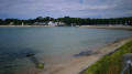
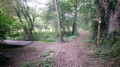
Start at Bas Pouldu, on the square opposite the bars and restaurants.
(S/E) Head towards the harbour master’s office by taking the path that runs to the left of the bars, towards the marina. Turn right towards the car park (a slight climb) and take the first path on the left.
Follow this path and head uphill until you reach a cross path.
(1) Take the dirt car park, which is easier to walk on than the stones on the path, and at the end turn left. Carry on straight ahead, ignoring the side paths. Walk alongside a wood on your left and arrive at Kerhop.
(2) Continue to the left and, via a lovely descent, reach the Beg Nénez Mill after crossing the stream.
(3) Turn right (follow the path) at the wooden gate.
(4) Please note: the path is narrow and, after a left-hand bend, a very steep climb of about ten metres means you’ll have to dismount. Cross Beg Nénez, keeping to the right as you pass through the centre of the hamlet.
(5) At the road (D162), immediately take the path on the right and continue straight on. Follow the wide path down a long descent to the fork on the left.
(6) Immediately after turning left, there is a steady climb of about a hundred metres, which poses no problem for mountain bikes (except for younger riders, who may need to dismount at some point).
(7) At Brunénant, follow the road to the left for about ten metres, then turn right, staying on the road, and continue along a forest track that presents no particular difficulty, heading downhill. You’ll reach a fork just before the edge of the woods.
(8) Take a sharp right onto the path, which is blocked by a gate; go round the gate and continue in the shade of the trees before rejoining the wide path. Turn right and you’ll reach the Saint-Fiacre roundabout.
(9) Cross the road linking Guidel-Plages to Guidel, walk a few metres to the left, then follow the path to the right which leads through the woodland alongside the Saudraye stream. Cross a road and continue straight ahead on the path.
(10) Caution! There are two hairpin bends on a downhill section, but these are no particular problem for mountain bikes. Carry on straight ahead until you reach a car park on your left.
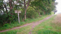
Immediately after, turn left onto a grassy path at the edge of the woods. Cross a stream and you’ll come to some wooden steps at the corner of a field.
(11) Watch out for the steep descent over about ten metres; this is rideable on a mountain bike (keeping well to the right of the steps).
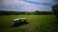
(12) At the hedgerow, turn right, leaving the forest to reach the Pointic, passing by an orientation table as you head up through the meadow. Leave the Pointic on your right and continue left, following the main path to the top of Guidel-Plages, Route des Bisquines.
(13) Turn right onto the footpath and cycle path that runs alongside the road. After the roundabout, at the left-hand bend in Avenue des Bons Amis, cross the road and then pass between the housing estate and the tennis courts. Follow the Pouldu valley downhill, avoiding the fitness trail. Continue along Rue de Kerbernes; at the end, turn right and head for the car park opposite the bars and restaurants (S/E).

 Visorando Member