Le Pont du Verger via Kerousseau

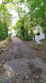
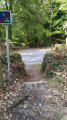
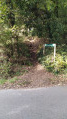
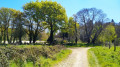
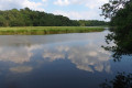
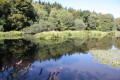
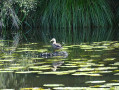
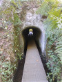
A beautiful walk through the woods along a stream and around a small pond, with no particular difficulties.

Details

3851228
Creation:
Last update:
Last review:
  • Walking
    Activity: Walking
  • ↔
    Distance: 6.99 mi
  • ◔
    Average duration: 3h 25 
  • ▲
    Difficulty: Moderate

  • ⚐
    Back to start: Yes
  • ↗
    Ascent: + 243 ft
  • ↘
    Descent: - 269 ft

  • ▲
    Highest point: 164 ft
  • ▼
    Lowest point: 39 ft
  • ⚐ Country: France
  • ⚐ City: Quéven (56530)
  • ⚑
    Start/End: N 47.791465° / W 3.415306°
  • ❏
    IGN map(s): Ref. 0720ET
  • Hour-by-hour weather

Photos

Description of the walk

Park in the car park opposite the cemetery in Quéven.

(S/E) Head towards the roundabout and go around it on the right using the pedestrian crossing. Continue to the next crossroads. Cross at the pedestrian crossing and take the Voie Verte path opposite, which runs alongside the D6.

(1) Cross the road to rejoin the path opposite. Cross the bridge over the Scave and walk along the right-hand side of the Pont-Scorff Animal Park.

(2) Turn left and cross the D6 with caution. Pass Kerrousseau and turn left onto a path that runs alongside a small stretch of water formed by the river.

(3) Turn left and follow the Scave to a small road near the Moulin Neuf dam.

(4) Cross the road and take the small path opposite that goes uphill. Continue to the Pont du Verger bridge.

(5) Turn left to cross the bridge and then left again immediately afterwards to follow the Scave on the other bank.

(6) At Moulin Neuf, follow the road to the right for a few dozen metres, then turn left onto the path. Shortly afterwards, turn right away from the river to climb up to the Sainte-Flamine Chapel.

(7) Continue along the path that descends towards a tributary of the Scave. Once you reach the stream, turn right to follow it and then cross it via a footbridge.

(8) Immediately turn left to rejoin the Scave. Walk along the stretch of water you saw on the way out, turn right and walk about 50 metres.

(9) Turn left to walk along a meadow, then turn right onto the path to reach the road leading to Kerrousseau at a housing estate.

(10) Cross the road and take the path opposite, slightly to the left. You will arrive at the Kerroc'h roundabout.

(11) Ignore the first exit and take the small path on the right, which joins Rue du Général Delestraint further on. Continue to the right, turn left into Rue de Kerdelan, then take a path on the right that crosses a housing estate and eventually leads to Rue de Kermainguy.

Turn left onto this street, then left again onto Rue Alain Lesage to reach the cemetery car park (S/E).

Waypoints

  1. S/E : mi 0 - alt. 164 ft - Cemetery car park
  2. 1 : mi 0.43 - alt. 138 ft - Cross the road.
  3. 2 : mi 1.45 - alt. 82 ft - Cross the D6
  4. 3 : mi 1.82 - alt. 69 ft - Intersection at the edge of the woods
  5. 4 : mi 2.22 - alt. 56 ft - Le Moulin Neuf
  6. 5 : mi 3.14 - alt. 59 ft - Pont du Verger
  7. 6 : mi 4.15 - alt. 56 ft - Moulin Neuf
  8. 7 : mi 4.37 - alt. 154 ft - Chapelle Sainte-Flamine (Gestel)
  9. 8 : mi 4.97 - alt. 66 ft - Footbridge
  10. 9 : mi 5.4 - alt. 62 ft - Fork
  11. 10 : mi 5.75 - alt. 75 ft - Path opposite
  12. 11 : mi 6.3 - alt. 135 ft - Roundabout
  13. S/E : mi 6.99 - alt. 164 ft - Cemetery car park

Reviews and comments

4.4 / 5
Based on 7 reviews

Reliability of the description
4.3 / 5
Ease of following the route
4.4 / 5
Route interest
4.3 / 5
bernard coulomb
bernard coulomb

Overall rating : 4.5 / 5

Date of your route : Sep 21, 2025
Reliability of the description : Not used / Not applicable
Ease of following the route : ★★★★★ Very good
Route interest : ★★★★☆ Good
Very busy route : No

A lovely walk through the countryside and forest, perfect for stretching your legs when you come to spend a few days in the region.
Don't miss the spring and its two intact 19th-century wash houses at point 8 after the bridge, or the tumulus without a cover but with clearly visible corridors and circular rooms 100 metres to the right of point 11.

Machine-translated

Joël Bars
Joël Bars

Overall rating : 4.3 / 5

Date of your route : Jun 29, 2024
Reliability of the description : ★★★★★ Very good
Ease of following the route : ★★★★☆ Good
Route interest : ★★★★☆ Good
Very busy route : No

Caution: risk of mud in case of rain

Machine-translated

novygab
novygab

Overall rating : 3.7 / 5

Date of your route : May 18, 2024
Reliability of the description : ★★★★☆ Good
Ease of following the route : ★★★★☆ Good
Route interest : ★★★☆☆ Average
Very busy route : No

Very muddy path with poor signage. It suffered extensive damage during the last storm.

Machine-translated

renato 56
renato 56

Overall rating : 4 / 5

Date of your route : Aug 03, 2023
Reliability of the description : ★★★★☆ Good
Ease of following the route : ★★★★☆ Good
Route interest : ★★★★☆ Good
Very busy route : No

Beautiful hike, varied and quite hilly. Could do with a few more signposts.

Machine-translated

jgvisorando87
jgvisorando87

Overall rating : 4.7 / 5

Date of your route : Jun 23, 2022
Reliability of the description : ★★★★★ Very good
Ease of following the route : ★★★★☆ Good
Route interest : ★★★★★ Very good
Very busy route : No

A very beautiful hike, easy and best done in warm weather as there is plenty of shade along the entire route...

Machine-translated

JeanBe2feu
JeanBe2feu

Overall rating : 4.3 / 5

Date of your route : Dec 06, 2021
Reliability of the description : ★★★☆☆ Average
Ease of following the route : ★★★★★ Very good
Route interest : ★★★★★ Very good
Very busy route : No

A very pleasant hike without too much difficulty.

Machine-translated

pima56
pima56

Overall rating : 5 / 5

Date of your route : May 17, 2021
Reliability of the description : ★★★★★ Very good
Ease of following the route : ★★★★★ Very good
Route interest : ★★★★★ Very good
Very busy route : No

A very beautiful hike to do in different seasons to enjoy the vegetation; easy access for people on foot and not very crowded.

Machine-translated

Other walks in the area

For more walks, use our search engine .

The GPS track and description are the property of this route's author. Please do not copy them without permission.