Country:
 City:
City:


To reach the starting point from Quimperlé, take the D790 towards Le Faouët. Halfway up the hill, turn left towards Beg ar Roz, heading for the village centre, then continue to the village of Tréméven. Park in the church car park, near Saint-Méen Church, the town hall (the former vicarage) and the media library (formerly Tréméven’s town hall and school, recently refurbished).
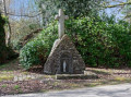
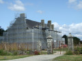
(S/E) Walk past the town hall, head down towards the Yann-Fañch Kemener state school, then take the small road on the left towards the hamlet of Roscado. Walk past the manor house and continue down the track towards the Croix de Roscado, also known as the Croix du Chouan.
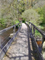
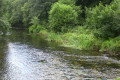
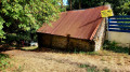
(1) At the cross, turn right, take the shaded path and then head down to the River Isole to see the bridge and the ruined mill at Pontégan.
(2) Turn back for about thirty metres and turn left at the three-way junction. Cross the small bridge towards the hamlet of Kervéadou on the plateau. Halfway up the slope, on the left, you’ll reach the Roche des Braconniers: take care not to get too close to the steep edge of the rocky cliff.
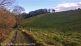
(3) Continue on to Kervéadou. On leaving the hamlet, take a farm track on the right, running diagonally and flanked by embankments, to rejoin the village road near the Rest.
(4) Turn right. At the junction with the road leading to Rospiriou, leave the road you have been following and take the path on the right leading to the foot of the Lost Er Hocq hill.
(5) Follow the road to the right (a section of a Roman road) towards the village of Tréméven. Once you reach the sports grounds, take the sharp right-hand bend, go round the state school and then turn left to reach the church square (S/E).

 Visorando Member

 Moderate