Country:
 City:
City:


Park in the stadium car park, north of Rue du Docteur Rialland.
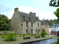
(S/E) From the car park, take Rue du Docteur Rialland eastwards, then, at the junction, carry on straight ahead onto Rue Terrien. When you reach Place de la Maison des Princes (town hall, church), cross the car park to the left and continue eastwards. Walk round the north side of the building, at the far end of the square, until you reach No. 40 Place de la Maison des Princes.
(1) Go down the long flight of steps on the left. At the bottom of the steps, continue straight ahead along the street until you reach the start of a narrow passageway between two houses, about 100 metres before the Roman bridge, known as the Chemin du Ronce.
Markings: YellowPR® and often also Red-Yellow GRP®.
(2) Turn right and follow the signposted path which runs alongside the River Scorff. When you reach a small road, turn left and head for the Château de Saint-Urchaud.
(3) The path turns right, then, at the crossroads, turn left along the apple orchard. Continue due south for about 400 m. At the junction, leavethe PR® path which branches off to the right and continue straight ahead along the River Scorff.
Further on, at the fork, turn right towards “Rocher du Corbeau – steep climb”.
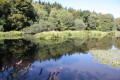
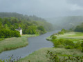
(4) Enjoy a superb view. Continue along the Scorff through a marshy valley (but the path is well-maintained), veer right at the confluence with the Scave and arrive at a crossroads.
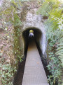
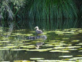
(5) Turn left, reach a road, follow it to the left past the zoo (gibbon and pelican enclosures) and cross the Pont Scave. A few dozen metres further on, take the path on the right. It goes round the zoo, passes under the aqueduct and joins a tarmac road; this is a busy road with a narrow verge – Danger.
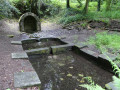
(6) Follow the road to the left for about 50 metres, then cross carefully to take a barely visible path on the right which starts where the wooden crash barrier ends. It forms a long circular loop, following the right bank of the Ruisseau de Kerrousseau. You’ll reach the spring/fountain of the same name.
(7) With your back to the fountain, cross the footbridge and take the path on the right, along the right bank of the stream. You’ll reach a road; follow it to the left for about a hundred metres, until you reach a Christianised fountain.
Unmarked
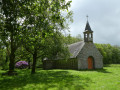
(8) Look out for a narrow path on the other side of the road which climbs towards the Sainte-Flamine Chapel. You’ll see two picnic tables. Continue straight ahead, behind the chapel, where several paths lead back to the footbridge you passed earlier, and then to the fountain.
YellowPR® markings
(7) Head up to the right of the fountain. When you reach the tarmac, go straight ahead, follow the bend to the left, and walk past a holiday village on your right. Look out for the first path on the right, which is closed to cars by a barrier.
(9) Take this path as far as the Kerroc’h roundabout.
(10) Turn right, cross the Kerroc’h road, then leave the roundabout on the right to take the footpath that runs alongside the golf course on your right. Further on, cross a small stream; about a hundred metres after that, turn right onto a path. You’ll come to a bridge over the Ruisseau du Moulin.
(11) Cross the bridge, head uphill on the other side, and arrive at the hamlet of Kerguesténen. Turn right onto the tarmac road. After a left-hand bend, turn right into Rue Galilée. Follow it to the end. Continue along the path opposite, then turn left before crossing the thalweg. Be careful: there are several paths here; stay fairly close to the stream on your right. You’ll reach a crossroads of paths at a footbridge.
(12) Cross the footbridge and take the path on the right. Cross a road, then reach and follow the D306. Continue due north to Kergornet Chapel.
(13) Carry on straight ahead. After leaving the village, when the D306 makes a first turn right then left, take the path opposite. After about 300 metres, at the junction, take the path on the right which descends along the hillside. Keep to the left and rejoin the D306.
(14) Follow it to the right, crossing a bridge over the Scaff; further on, the D306 bends to the right and then to the left.
(15) Just before this left-hand bend, leave the D306 and turn right. After about a hundred metres, before the houses, take the path on the left. You’ll reach a road at a place called Kergeris; continue to the right to enter Keryaquel. Carry on to the crossroads near the Keryaquel chapel.
(16) Turn right until you reach the wide left-hand bend. As you come out of the bend, you’ll find the greenway (a former railway line). Follow it to the end, where you’ll come to a Fork in the road.
(17) Keep left onto Rue François Mauriac, then continue via the7th FFI Battalion Square. At the junction with Rue du Docteur Rialland, turn right; the car park entrance is about a hundred metres away (S/E).


 Local authority
 Moderate
 Easy
Easy  Visorando Member