A circular route between Merrien and Saint-Thamec, Portec and Porz Bali

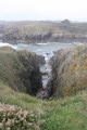
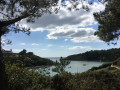
A lovely little route through wild valleys, woods and cliffs.

Details

28269213
Creation:
Last update:
Last review:
  • Walking
    Activity: Walking
  • ↔
    Distance: 2.77 mi
  • ◔
    Average duration: 1h 20 
  • ▲
    Difficulty: Easy

  • ⚐
    Back to start: Yes
  • ↗
    Ascent: + 108 ft
  • ↘
    Descent: - 115 ft

  • ▲
    Highest point: 118 ft
  • ▼
    Lowest point: 16 ft

Description of the walk

The walk starts at the entrance to the hamlet of Merrien, on the road coming from the village of Moëlan-sur-Mer. You can park here or drive on towards Kercarn (a dead-end street). However, these aren’t really designated parking spaces, so you’ll need to find a spot where you’re least likely to cause a hindrance. You can continue 300 m towards the centre of the hamlet, where there is a proper car park, and walk back to the starting point.

(S/E) Take a wide track heading north-east. Please note: the turn to the right is not where it is shown on most IGN maps, but a little further on, in the fields.

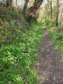
(1) Once you’ve entered the woods, you’ll soon come to a lovely path marked in yellow (the path can be very muddy, or even flooded, where it crosses the stream after heavy rain) and arrive at the small hamlet of Saint-Thamec.

(2) On leaving the hamlet, take a small, very wild path that descends to Anse de Portec (there are several possible routes through the hamlet; I’ve marked my favourite one on the map).

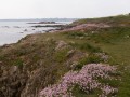
(3) Turn right and take the coastal path westwards (GR®34andGRP®) to Anse de Porz Bali

(4) Turn north onto another very wild path that climbs back up towards Kercarn (S/E).

Waypoints

  1. S/E : mi 0 - alt. 105 ft - Kercarn at the entrance to Merrien
  2. 1 : mi 0.45 - alt. 95 ft - Junction with the signposted path
  3. 2 : mi 0.85 - alt. 89 ft - The hamlet of Saint-Thamec
  4. 3 : mi 1.38 - alt. 26 ft - Anse de Portec
  5. 4 : mi 2.29 - alt. 16 ft - Anse de Porz Bali
  6. S/E : mi 2.77 - alt. 105 ft - Kercarn at the entrance to Merrien

Always be cautious and plan ahead when you're outdoors. Visorando and the author of this route cannot be held responsible for any accidents occurring on this route.

The GR® and PR® markings are the intellectual property of the Fédération Française de Randonnée Pédestre.

Reviews and comments

4.3 / 5
Based on 2 reviews

Reliability of the description
4.5 / 5
Ease of following the route
4.5 / 5
Route interest
4 / 5
Queau
Queau

Overall rating : 4 / 5

Date of your route : May 06, 2025
Reliability of the description : ★★★★☆ Good
Ease of following the route : ★★★★☆ Good
Route interest : ★★★★☆ Good
Very busy route : No

A relatively short route, longer than stated in the description. The first part is through woodland and the second part runs alongside the sea. Nice

Machine-translated

Maby01
Maby01

Overall rating : 4.7 / 5

Date of your route : Apr 06, 2024
Reliability of the description : ★★★★★ Very good
Ease of following the route : ★★★★★ Very good
Route interest : ★★★★☆ Good
Very busy route : No

A walk that should be easy and pleasant, through woodland and then along the coast.
Unfortunately, we did it after heavy rain: the wooded section was very muddy and slippery.

Machine-translated

Other walks in the area

For more walks, use our search engine .

The GPS track and description are the property of this route's author. Please do not copy them without permission.