


LAURENT FRANCOIS

 Visorando Member
 Premium user
 - Location: Fléville-devant-Nancy (54710)
- Gender: man
Sign up:
Published route(s)
 The Buttes de Mousson and Xon
 8.89 mi
 +1,224 ft
 -1,217 ft
 5h 10
5h 10
 Average
 Departure from Pont-à-Mousson (Meurthe-et-Moselle)
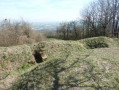
Pass by the summit of Butte de Mousson, with its castle ruins, and Butte de Xon, with its trenches dating from the First World War.
Between the Saintois and the Moselle
11.69 mi
+512 ft
-492 ft
5h 50
Average
Departure from Benney (Meurthe-et-Moselle)
A walk through the rolling countryside and woods on the edge of the Saintois region, passing through the villages of Benney, Crévechamps and Saint-Remimont.
Author’s note, 2 January 2020: Access to this private woodland is permitted subject to certain conditions. See practical information below
South-east of Saintois
 12.33 mi
+673 ft
-673 ft
6h 15
Average
Departure from Lemainville (Meurthe-et-Moselle)
12.33 mi
+673 ft
-673 ft
6h 15
Average
Departure from Lemainville (Meurthe-et-Moselle)
Discover the castles of the Saintois region in Haroué and Tantonville, the moulded lintels in the villages, the churches and the 360° views.
The Lausfer lakes and the Italian border from Isola 2000
 13.67 mi
+3,724 ft
-3,707 ft
10 hrs
13.67 mi
+3,724 ft
-3,707 ft
10 hrs
 Very difficult
Departure from Isola (Alpes-Maritimes)
Very difficult
Departure from Isola (Alpes-Maritimes)
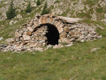
Starting from the Isola 2000 resort, hike towards the Lausfer lakes and, following the French-Italian border, return via the Col de la Lombarde.
Between Saint-Martin-de-Pallières and Ubac via Esparron and Artigues
 13.53 mi
+1,152 ft
-1,152 ft
7h 15
13.53 mi
+1,152 ft
-1,152 ft
7h 15
 Difficult
Departure from Saint-Martin (Var) (Var)
Difficult
Departure from Saint-Martin (Var) (Var)
A walk through the forest, passing through the beautiful villages of Saint-Martin-de-Pallières, Esparron, Artigues and Ubac. Return to the valley via an old railway line.
On the outskirts of Rians
 8.63 mi
+974 ft
-948 ft
4h 50
Average
Departure from Rians (Var) (Var)
8.63 mi
+974 ft
-948 ft
4h 50
Average
Departure from Rians (Var) (Var)
A circular walk between La Grande Bastide and the village of L'Ubac, on the outskirts of the town of Rians, passing by its church.
Moderator's warning on 08/02/2021: Changes to the starting point of the hike; see notices.
From Gréoux-les-Bains to Saint-Martin-de-Brômes
 11.88 mi
+1,152 ft
-1,152 ft
6h 30
Difficult
Departure from Gréoux-les-Bains (Alpes-de-Haute-Provence)
11.88 mi
+1,152 ft
-1,152 ft
6h 30
Difficult
Departure from Gréoux-les-Bains (Alpes-de-Haute-Provence)
From Gréoux-les-Bains to Saint-Martin-de-Brômes via the plateau for views of the mountains, and back via the viewpoint for views of Gréoux-les-Bains and the Esparron-de-Verdon Lake dam.
Saint-Martin-de-Pallières circular route via La Verdiére
 9.84 mi
+702 ft
-676 ft
5h 10
Average
Departure from Saint-Martin (Var) (Var)
9.84 mi
+702 ft
-676 ft
5h 10
Average
Departure from Saint-Martin (Var) (Var)
This circular walk takes you up to La Verdiére via the road for the views, and back through the woods for peace and quiet.
From Gréoux-les-Bains to Vinon-sur-Verdon via the ridge and back via the plain
 11.69 mi
+689 ft
-686 ft
6h 00
Average
Departure from Gréoux-les-Bains (Alpes-de-Haute-Provence)
11.69 mi
+689 ft
-686 ft
6h 00
Average
Departure from Gréoux-les-Bains (Alpes-de-Haute-Provence)
From Gréoux-les-Bains to Vinon-sur-Verdon, a circular walk with a section along the ridges offering views of the Durance and Verdon valleys through gaps in the forest, a walk through the old village of Vinon-sur-Verdon
and a return journey through the Verdon Valley.
Boucles de la Moselle: between Messein and Neuves-Maisons
7.84 mi
+102 ft
-112 ft
3h 40
Average
Departure from Messein (Meurthe-et-Moselle)
Start from Messein and return via the village of Méréville. A circular route with easy conditions, mostly on cycle paths.
Moselle circulars: between Neuves-Maisons and Maron
 10.25 mi
+26 ft
-23 ft
4h 45
Average
Departure from Neuves-Maisons (Meurthe-et-Moselle)
10.25 mi
+26 ft
-23 ft
4h 45
Average
Departure from Neuves-Maisons (Meurthe-et-Moselle)
Start between the canal and the Moselle, then follow the right bank to the Maron. Return along the left bank via Sexey-aux-Forges and Pont-Saint-Vincent. Discover how iron ore was transported from the old mines at Sexey-aux-Forges.
Circular Moselle between Villey-le-Sec and Pierre-la-Treiche
 5.77 mi
+269 ft
-259 ft
2h 55
5.77 mi
+269 ft
-259 ft
2h 55
 Easy
Departure from Villey-le-Sec (Meurthe-et-Moselle)
Easy
Departure from Villey-le-Sec (Meurthe-et-Moselle)
Walk along the circular loops of the Moselle between Villey-le-Sec and Pierre-la-Treiche or the 'cave route'.
Start at the Villey-le-Sec dam car park, hike through the woods of Villey-le-Sec and along the old railway line to see the caves.
Return on flat ground via the cycle path.
Circular route between Fléville-devant-Nancy and Laneuveville-devant-Nancy
6.40 mi
+141 ft
-154 ft
3h 05
Easy
Departure from Fléville-devant-Nancy (Meurthe-et-Moselle)
Start at the L’Orée du Bois housing estate, walk a short distance along the diversion canal, then take a short climb towards the Bois des Convers for the view of Nancy, and descend into Laneuveville-devant-Nancy to reach the Marne-Rhine Canal.
Return via the cycle path along the diversion canal.
Circular Moselle route between Maron and Villey-le-Sec
 11.84 mi
+709 ft
-728 ft
6h 05
Difficult
Departure from Maron (Meurthe-et-Moselle) (Meurthe-et-Moselle)
11.84 mi
+709 ft
-728 ft
6h 05
Difficult
Departure from Maron (Meurthe-et-Moselle) (Meurthe-et-Moselle)
Follow the circular course of the Moselle between Maron and Villey-le-Sec.
Starting from Maron, at the car park by the old station, the route takes you through the Maron Forest and the Gondreville Forest, then down towards the Moselle via the Bois L’Évêque. The paths are in good condition and, at times, you might feel as though you’re in the Hautes Vosges.
Cross the Moselle via the dam and the large-capacity lock.
Return on flat ground via the cycle path along the Moselle.
Circular route of the Moselle between Pierre-la-Treiche and Toul
 9.43 mi
+135 ft
-135 ft
4h 25
Average
Departure from Pierre-la-Treiche (Meurthe-et-Moselle)
9.43 mi
+135 ft
-135 ft
4h 25
Average
Departure from Pierre-la-Treiche (Meurthe-et-Moselle)
Explore the Moselle circular loops between Pierre-la-Treiche and Toul. Starting from the car park at Pierre-la-Treiche, head towards Chaudeney along a small path through the woods on the right bank of the Moselle. Visit the Chaudeney dam and the two locks at Toul. Return along the narrow-gauge canal, then via the hamlet of Gare-le-Cou and the Château de la Rochotte.
Circular Moselle route between Dommartin-lès-Touls and Gondreville
 10.93 mi
+407 ft
-404 ft
5h 25
Average
Departure from Dommartin-lès-Toul (Meurthe-et-Moselle)
10.93 mi
+407 ft
-404 ft
5h 25
Average
Departure from Dommartin-lès-Toul (Meurthe-et-Moselle)
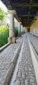
Follow the circular course of the Moselle between Dommartin-lès-Toul and Gondreville. Visit the Dommartin redoubt and the Chaudeney battery. Walk through the old village of Gondreville, passing the Maison des Dîmes and along a short stretch of a small road to reach the Marne–Rhine Canal. Return to the car park along the canal.
A circular bend in the Moselle between Gondreville and Villey-Saint-Etienne
 11.93 mi
+148 ft
-148 ft
5h 35
Difficult
Departure from Gondreville (Meurthe-et-Moselle) (Meurthe-et-Moselle)
11.93 mi
+148 ft
-148 ft
5h 35
Difficult
Departure from Gondreville (Meurthe-et-Moselle) (Meurthe-et-Moselle)
Explore the circular bends of the Moselle between Gondreville and Villey-Saint-Etienne, passing through:
- the old Marne–Rhine Canal,
- part of the fortifications at Villet-Saint-Etienne: Shelter No. 1, the Mordant Battery, the Bas du Chêne fortification and the East Vieux Canton fortification,
- a wayside shrine with an orientation board above Villey-Saint-Etienne,
- the bridges over the Terrouin,
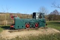
Return along the Moselle, the wide-gauge canal and the Fontenoy lock.
The circular Moselle between Villey-le-Sec and Pierre-le-Treiche.
 6.27 mi
+384 ft
-384 ft
3h 15
Average
Departure from Villey-le-Sec (Meurthe-et-Moselle)
6.27 mi
+384 ft
-384 ft
3h 15
Average
Departure from Villey-le-Sec (Meurthe-et-Moselle)
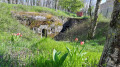
Explore the circular loops of the Moselle between Villey-le-Sec and Pierre-la-Treiche, passing by old military structures and caves.
From the car park at the Villey-le-Sec dam, hike through the woods of Villey-le-Sec and Pierre-la-Treiche to discover the military structures, then return along the old railway line and the Moselle to visit the caves.
A circular walk around Saint-Paul-lès-Durance
 11.19 mi
+820 ft
-840 ft
5h 50
Difficult
Departure from Saint-Paul-lès-Durance (Bouches-du-Rhône)
11.19 mi
+820 ft
-840 ft
5h 50
Difficult
Departure from Saint-Paul-lès-Durance (Bouches-du-Rhône)
A circular walk starting from La Castellane, above Saint-Paul-lès-Durance.
Descent towards the village alongside the Abeou stream, passing the orientation table for views of the village and the Durance valley.
Climb up into the mountains along a track. On the plateau, walk through the vineyards and along a road lined with pruned trees, taking a detour to a memorial stone.
Descend along a path towards the Mirabeau Bridge.
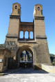
At the bridge, enjoy the view of the piers of the old bridge, the River Durance and the Sainte-Madeleine Chapel.
A circular walk starting from the Mirabeau bridge
 12.59 mi
+1,437 ft
-1,437 ft
7h 00
Difficult
Departure from Jouques (Bouches-du-Rhône)
12.59 mi
+1,437 ft
-1,437 ft
7h 00
Difficult
Departure from Jouques (Bouches-du-Rhône)
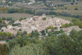
This circular walk, starting from the Mirabeau Bridge, takes in:
- the Chapel of Sainte-Madeleine,
- the Chapel of the Heath and its statue of the Virgin Mary,
- Mirabeau with its fountain, church and castle,
- a path overlooking the village of Beaumont-en-Pertuis,
- the Chapel of Sainte-Croix and its viewpoints.
Circular walk between Beaumont-de-Pertuis and La Bastide-des-Jourdans
 12.22 mi
+1,273 ft
-1,270 ft
6h 45
Average
Departure from Beaumont-de-Pertuis (Vaucluse)
12.22 mi
+1,273 ft
-1,270 ft
6h 45
Average
Departure from Beaumont-de-Pertuis (Vaucluse)
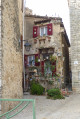
A circular walk between Beaumont-de-Pertuis and La Bastide-des-Jourdans, winding through forests and vineyards. Make the most of it by visiting these two beautiful villages with their chapels, castle and fountains.
A circular walk between La Bastide-des-Jourdans and Vitrolles-en-Lubéron
 13.63 mi
+1,608 ft
-1,604 ft
7h 40
Difficult
Departure from La Bastide-des-Jourdans (Vaucluse)
13.63 mi
+1,608 ft
-1,604 ft
7h 40
Difficult
Departure from La Bastide-des-Jourdans (Vaucluse)
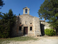
A circular walk starting from La Bastide-des-Jourdans towards Vitrolles-en-Lubéron, mostly through woodland. A stroll through the pretty village of Vitrolles-en-Lubéron and, on the way back, views of the surroundings of La Bastide-des-Jourdans.
A double circular starting from Gréoux-les-Bains.
 14.13 mi
+1,759 ft
-1,745 ft
8h 00
Difficult
Departure from Gréoux-les-Bains (Alpes-de-Haute-Provence)
14.13 mi
+1,759 ft
-1,745 ft
8h 00
Difficult
Departure from Gréoux-les-Bains (Alpes-de-Haute-Provence)
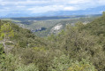
This double circular starting from Verdon allows you to discover:
- Notre Dame des Œufs,
- the small port along Lake Esparron,
It continues with a walk along the old canal with a passage over the rocks.
Then a small beach and a path along the lake shore to the entrance to the lower Verdon Gorge.
The return journey is through the mountains with distant views of the mountains.
A circular route between Quinson and Lac d'Artignosc.
 10.56 mi
+1,253 ft
-1,227 ft
5h 55
Difficult
Departure from Quinson (Alpes-de-Haute-Provence)
10.56 mi
+1,253 ft
-1,227 ft
5h 55
Difficult
Departure from Quinson (Alpes-de-Haute-Provence)
A circular route between Quinson and Lac d'Artignosc, passing on both sides of the Verdon.
Walk along tracks and small paths with views of the Verdon at various points and of the villages of Quinson and Artignosc.
Return via the Baume Bonne cave and the view of the Quinson dam.
A circular route around the hills above Gréoux-les-Bains
 11.35 mi
+1,063 ft
-1,047 ft
6h 10
Average
Departure from Gréoux-les-Bains (Alpes-de-Haute-Provence)
11.35 mi
+1,063 ft
-1,047 ft
6h 10
Average
Departure from Gréoux-les-Bains (Alpes-de-Haute-Provence)
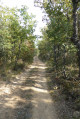
A circular route through the hills above Gréoux-les-Bains towards Rousset Castle, passing through the Verdon valley, the woods, the vineyards and Rousset Castle. Return via more vineyards and woods, Gréoux-les-Bains Castle and the town centre.
Between Boussenois and Rivière-les-Fosses
 9.41 mi
+787 ft
-758 ft
5h 00
Difficult
Departure from Boussenois (Côte-d'Or)
9.41 mi
+787 ft
-758 ft
5h 00
Difficult
Departure from Boussenois (Côte-d'Or)
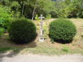
A walk between Boussenois and Rivière-les-Fosses via La Montagne and the woods of Grand Maisonnais
Pic de Boussolenc circular route
 8.76 mi
+3,871 ft
-3,891 ft
7 hrs
Very difficult
Departure from Les Orres (Hautes-Alpes)
8.76 mi
+3,871 ft
-3,891 ft
7 hrs
Very difficult
Departure from Les Orres (Hautes-Alpes)
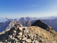
A circular route between Les Orres 1850 and the Pic du Boussolenc via the Terre Rouge valley, suitable for experienced hikers.
The Les Orres orientation table and Lake Sainte-Marguerite
 9.11 mi
+3,491 ft
-3,471 ft
7h 15
Difficult
Departure from Les Orres (Hautes-Alpes)
9.11 mi
+3,491 ft
-3,471 ft
7h 15
Difficult
Departure from Les Orres (Hautes-Alpes)
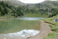
Starting from Les Orres 1850 resort, a lovely circular route that passes by the orientation table at 2,769 m and Lake Sainte-Marguerite.
Circular route of the Moselle via the Meurthe between Jarville and Malzeville
 7.83 mi
+43 ft
-43 ft
3h 40
Average
Departure from Jarville-la-Malgrange (Meurthe-et-Moselle)
7.83 mi
+43 ft
-43 ft
3h 40
Average
Departure from Jarville-la-Malgrange (Meurthe-et-Moselle)
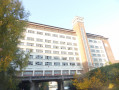
On the Moselle circular route, along the Meurthe between Jarville-la-Malgrange and Malzéville.
A hike mainly on cycle paths or specially designed trails to discover the meanders of the tranquil Meurthe with its birds, passing by the Old Mills of Nancy and the historic monument "La Douera" in Malzéville.
The Moselle circular route between Malzéville and Bouxières
 7.83 mi
+118 ft
-118 ft
3h 40
Average
Departure from Malzéville (Meurthe-et-Moselle)
7.83 mi
+118 ft
-118 ft
3h 40
Average
Departure from Malzéville (Meurthe-et-Moselle)
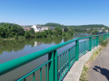
The circular bends in the Moselle as you cycle along the Meurthe cycle paths between Malzéville and Bouxières-aux-Dames.
The Clos Cardinal circular walk via the canal and the Roman bridge
 9.09 mi
+243 ft
-259 ft
4h 25
Average
Departure from Fléville-devant-Nancy (Meurthe-et-Moselle)
9.09 mi
+243 ft
-259 ft
4h 25
Average
Departure from Fléville-devant-Nancy (Meurthe-et-Moselle)
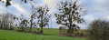
A circular walk starting from the Orée du Bois housing estate in Fléville-devant-Nancy, heading to the hamlet of Clos Cardinal via the connecting canal, the Roman bridge and the hamlet of Gerardcourt, and returning via the plain.
The circular bends in the Moselle between Champigneulles and Frouard
 8.88 mi
+36 ft
-36 ft
4h 05
Average
Departure from Champigneulles (Meurthe-et-Moselle)
8.88 mi
+36 ft
-36 ft
4h 05
Average
Departure from Champigneulles (Meurthe-et-Moselle)
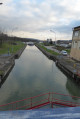
Setting off from Champigneulles, a circular route that follows the Meurthe for its final few kilometres to see where the Moselle and the Meurthe meet at Frouard. Return via the Marne–Rhine Canal, passing by the beautiful graffiti under the Bow String Bridge at Frouard.
Circular of the Moselle between Liverdun and Lock No. 5 at Aingeray.
 7.43 mi
+387 ft
-387 ft
3h 45
Average
Departure from Liverdun (Meurthe-et-Moselle)
7.43 mi
+387 ft
-387 ft
3h 45
Average
Departure from Liverdun (Meurthe-et-Moselle)
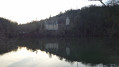
A circular route starting from Liverdun, passing through the communal woods of La Fourasse, then in front of Château de la Flie, continuing along the Moselle to Aingeray Lock No. 5. Crossing the Moselle and returning via a cycle path along the river.
On the heights of Gréoux-les-Bains
 9.79 mi
+1,253 ft
-1,257 ft
5h 35
Difficult
Departure from Gréoux-les-Bains (Alpes-de-Haute-Provence)
9.79 mi
+1,253 ft
-1,257 ft
5h 35
Difficult
Departure from Gréoux-les-Bains (Alpes-de-Haute-Provence)
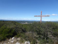
A circular route to see both sides of Gréoux-les-Bains – the hills and the plain – passing through the mountains to reach Notre-Dame des Œufs. Further on, reach the viewpoint at Pas du Verré and the cross at Vallée Obscure. For the return journey, head back via the plain and the Aurabelles equestrian centre.
Between Manosque and Gréoux via the Grand Devançon and Château Rousset
 10.75 mi
+732 ft
-728 ft
5h 35
Average
Departure from Gréoux-les-Bains (Alpes-de-Haute-Provence)
10.75 mi
+732 ft
-728 ft
5h 35
Average
Departure from Gréoux-les-Bains (Alpes-de-Haute-Provence)
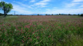
A circular walk between Manosque and Gréoux-les-Bains, passing through the lavender fields with views of the mountains, the forest, the derelict Grand Devançon building overlooking Manosque, and Château Rousset.
The Grand Devançon circular walk from Château Laval
 10.47 mi
+1,198 ft
-1,201 ft
5h 50
Average
Departure from Gréoux-les-Bains (Alpes-de-Haute-Provence)
10.47 mi
+1,198 ft
-1,201 ft
5h 50
Average
Departure from Gréoux-les-Bains (Alpes-de-Haute-Provence)
A walk in the hills above Gréoux-les-Bains, starting from Château Laval, along signposted paths through the woods and lavender fields.
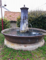
A circular route to the north of the Saintois region via Voinemont, Benney and Lemainville
 9.72 mi
+525 ft
-512 ft
4h 55
Average
Departure from Voinémont (Meurthe-et-Moselle)
9.72 mi
+525 ft
-512 ft
4h 55
Average
Departure from Voinémont (Meurthe-et-Moselle)
A circular walk to visit the villages in the north of the Saintois region: Voinémont, Benney and Lemainville, passing through the Benney forest, the plain between Benney and Lemainville and following the Madon river on the return journey.
Between Les Cades and Esparron-de-Verdon
 9.27 mi
+1,243 ft
-1,253 ft
5h 20
Average
Departure from Esparron-de-Verdon (Alpes-de-Haute-Provence)
9.27 mi
+1,243 ft
-1,253 ft
5h 20
Average
Departure from Esparron-de-Verdon (Alpes-de-Haute-Provence)
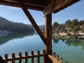
A circular walk starting from the road between Gréoux-les-Bains and Esparron-de-Verdon, a stretch through the heath, a visit to the village of Esparron-de-Verdon and a return route through the mountains.
Between Saint-Martin-de-Brômes and Allemagne-en-Provence
 10.10 mi
+866 ft
-869 ft
5h 25
Average
Departure from Saint-Martin-de-Brômes (Alpes-de-Haute-Provence)
10.10 mi
+866 ft
-869 ft
5h 25
Average
Departure from Saint-Martin-de-Brômes (Alpes-de-Haute-Provence)
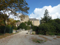
A circular route between Saint-Martin-de-Brômes, passing by the Clock Tower and the church, then along the Chemin de la Crête de Saint-Pierre, with views of the mountains behind Moustiers, a descent along a lovely path towards Allemagne-en-Provence, passing by the Château de Castellane, and back down to the plain via the cycle path.
A circular walk starting from Flavigny and passing through Burthécourt and Azelot
 10.96 mi
+558 ft
-558 ft
5h 30
Average
Departure from Flavigny-sur-Moselle (Meurthe-et-Moselle)
10.96 mi
+558 ft
-558 ft
5h 30
Average
Departure from Flavigny-sur-Moselle (Meurthe-et-Moselle)
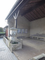
Starting from Flavigny-sur-Moselle, the route follows the Canal de l’Est, climbs through the woods towards Burthécourt-aux-Chênes, crosses the plain to reach Azelot and the railway line, then returns through the woods
Double circular loop starting from Frolois
 7.77 mi
+371 ft
-394 ft
3h 55
Average
Departure from Frolois (Meurthe-et-Moselle) (Meurthe-et-Moselle)
7.77 mi
+371 ft
-394 ft
3h 55
Average
Departure from Frolois (Meurthe-et-Moselle) (Meurthe-et-Moselle)
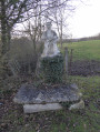
A double circular route through the Madon valley to visit the villages of Frolois, Pierreville, Autrey-sur-Madon and Pulligny.
Around Richardméil
 5.63 mi
+361 ft
-371 ft
2h 55
Easy
Departure from Flavigny-sur-Moselle (Meurthe-et-Moselle)
5.63 mi
+361 ft
-371 ft
2h 55
Easy
Departure from Flavigny-sur-Moselle (Meurthe-et-Moselle)
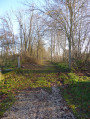
A hike around the village of Richardménil, passing through the Bois Leleau, the Bois Impérial, the Tombouctou plateau with a view of Ludres and Nancy, a visit to the Saint Georges Church before returning via the Canal des Vosges.
Around Flavigny-sur-Moselle
 8.02 mi
+499 ft
-502 ft
4h 05
Average
Departure from Flavigny-sur-Moselle (Meurthe-et-Moselle)
8.02 mi
+499 ft
-502 ft
4h 05
Average
Departure from Flavigny-sur-Moselle (Meurthe-et-Moselle)
Walk around the village of Flavigny-sur-Moselle, passing through the village, along the Canal de l'Est and through the Bois de Benney.
Route des villages starting from Ceintrey
 9.29 mi
+453 ft
-440 ft
4h 40
Average
Departure from Ceintrey (Meurthe-et-Moselle)
9.29 mi
+453 ft
-440 ft
4h 40
Average
Departure from Ceintrey (Meurthe-et-Moselle)
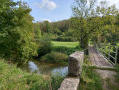
A tour of the villages of the Saintois region, in the canton of Vézelise.
A walk across the plains with scenic views.
Places of interest: chapels, wayside crosses, churches, wash houses
From Boussenois to Vernois-lès-Vesvres in the Chamberceau Forest
 10.09 mi
+787 ft
-791 ft
5h 20
Average
Departure from Boussenois (Côte-d'Or)
10.09 mi
+787 ft
-791 ft
5h 20
Average
Departure from Boussenois (Côte-d'Or)
A circular walk starting from Boussenois and heading to Vernois through the woods.
Foncegrive and Selongey as seen from Boussenois
 10.98 mi
+869 ft
-866 ft
5h 50
Average
Departure from Boussenois (Côte-d'Or)
10.98 mi
+869 ft
-866 ft
5h 50
Average
Departure from Boussenois (Côte-d'Or)
From Boussenois, head towards Foncegrive, partly through the woods; pass through Foncegrive and continue to Selongey, also via a small woodland path; pass through Selongey and head back up via the Sainte-Anne Chapel to return to Boussenois.
L’Orée du Bois, l’Embanie, le Fond de Chanot, Hauts de Fléville, the canal
 7.06 mi
+253 ft
-253 ft
3h 30
Average
Departure from Fléville-devant-Nancy (Meurthe-et-Moselle)
7.06 mi
+253 ft
-253 ft
3h 30
Average
Departure from Fléville-devant-Nancy (Meurthe-et-Moselle)
A circular route around Fléville starting from L’Orée du Bois, towards Parc d’Embanie, up to the heights of Fond de Chanot with views of Ludres and Fléville, and a return via the Hauts de Fléville and the connecting canal.
Following the trail of the 1914–18 trenches in the Bois de Champenoux
 6.86 mi
+236 ft
-243 ft
3h 20
Difficult
Departure from Laneuvelotte (Meurthe-et-Moselle)
6.86 mi
+236 ft
-243 ft
3h 20
Difficult
Departure from Laneuvelotte (Meurthe-et-Moselle)
The Battle of the Grand Couronné in September 1914 in the Bois de Champenoux. On the lookout for shell holes and trenches at the edge of the woods.A walk partly along paths and partly off-track through the heart of the forest; best undertaken with a GPS or a good sense of direction.This walk can be complemented by exploring other remains from the Battle of the Grand Couronné.
The Chapelle des Pauvres and the Parc de Brabois.
 8.63 mi
+1,040 ft
-1,037 ft
4h 50
Average
Departure from Houdemont (Meurthe-et-Moselle)
8.63 mi
+1,040 ft
-1,037 ft
4h 50
Average
Departure from Houdemont (Meurthe-et-Moselle)
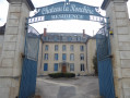
Starting from Houdemont, head towards the Chapelle des Pauvres and its orientation table, passing through the Bois Le Duc.
Walk through the paths and viewpoint of the Parc de Brabois and take a tour of the Jardin du Montet with its chapel.
Then return via the orientation table above the cemetery, descend into the old village and walk through the gardens of Vandœuvre-lès-Nancy.
Return to Houdemont via the Château de la Ronchère.
Passing through Pont Saint-Vincent, Bainville and Frolois from Méréville
 9.99 mi
+548 ft
-551 ft
5h 05
Average
Departure from Méréville (Meurthe-et-Moselle)
9.99 mi
+548 ft
-551 ft
5h 05
Average
Departure from Méréville (Meurthe-et-Moselle)
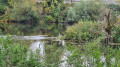
Starting from Méréville, a circular walk to see the does in the Bois du Moulin woods, a short stroll along the Madon before it joins the Moselle.
A stretch beneath Fort Pelissier with views over the Madon valley and the hillsides of Messein and Ludres
On Rue de la Gare in Bainville-sur-Madon, a stop at the Saint-Martin Fountain.
Return along the Madon before the climb up to Frolois and back to Méréville.