Circular route between Amance, Bouxières-aux-Chênes, Écuelle and the Amance Forest

A circular route to visit the hilltop village of Amance, then on to Bouxières-aux-Chênes and the small hamlet of Écuelle. Return via the Amance State Forest, where you can see the remains from the First World War and an old railway line.

Details

n°68446292
Creation:
Last update:
Last review:
  • Walking
    Activity: Walking
  • ↔
    Distance: 11.08 mi
  • ◔
    Average duration: 5h 50 
  • ▲
    Difficulty: Moderate

  • ⚐
    Back to start: Yes
  • ↗
    Ascent: + 853 ft
  • ↘
    Descent: - 843 ft

  • ▲
    Highest point: 1,260 ft
  • ▼
    Lowest point: 738 ft

Photos

Description of the walk

The walk starts at the car park on Rue Saint-Jean, next to Amance Church.

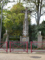
(S/E) With your back to the car park, take the road uphill to the left, passing the war memorial. At the first junction, turn left onto Rue Saint-Joseph until you reach thefirst road on the left.

(1) Take this street to reach the entrance to the grounds of the old château; if it is open, walk around the grounds to the viewpoint and then retrace your steps.

(1) Turn left again to head down Rue Saint-Joseph. At the end of the street, turn left onto Rue Saint-Charles and continue to the junction after the left-hand bend.

(2) Turn right and carry on straight ahead. At the Stop sign, continue straight across, taking the small path that runs alongside Rue de la Porte du Bas. At the end of the path, turn right, walking alongside the road (take care), leave Amance and walk along the cemetery wall to the end.

(3) Take the track on the left, follow the GR®5 signposts and join the D913.

(4) Cross the road with care and head left for a few dozen metres, then turn right to climb the track through the meadow at the edge of the woods. After about 300 m, leave the GR®5 by continuing straight on and join a small road near a cemetery.

(5) Turn right to reach Bouxières-aux-Chênes via Rue de la Paix. At the ‘Stop’ sign, carry on straight ahead; then, at the roundabout, head left via Place du Chêne, then Rue de l’Armée Patton. Walk past the church and the fountains and reach a junction after a right-hand bend, followed by a left-hand bend.

(6) Keep left onto the uphill road, Chemin des Noisetiers, until you reach thefirst junction.

(7) Head downhill to the right onto Chemin de l’Aulny. The road turns into a track which begins to climb, leading to Rue du Fort in Écuelle.

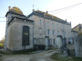
(8) Turn right; at the end of the street, turn left onto Rue du Général de Gaulle. Walk past the château and continue to the fountain.

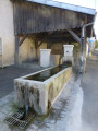
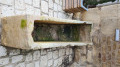
(9) Just after that, pass between the Chapelle Saint-Étienne and the fountain, turn right, then left to go down Rue du Château to the washhouse.

(10) Continue downhill to the left along Rue du Cheval Rouge, then turn right onto Rue des Vergers and join the D913 at the ‘Stop’ sign.

(11) Cross it carefully and carry on along the small road opposite, Chemin de la Justice, until you reach the end.

(12) Turn 90° to the left onto Chemin de Fontenis and, after passing under a power line, you’ll reach a Y-junction.

(13) Carry on along the small road on the right, ignoring the turnings on either side, and rejoin the GR®5 at a T-junction

(14) Take this path to the left for about 300 m until you reach the edge of the forest.

(15) At the T-junction where the two gravel tracks meet, carry straight on into the Brin Forest for about a hundred metres; a small path is on the left.

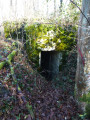
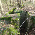
(16) Take this path to visit an area with three World War I shelters and earth mounds – these are former bunkers – then retrace your steps.

(16) Continue along the dirt track opposite for a few tens of metres to visit another shelter. Retrace your steps to exit the forest and return to the edge of the woodland.

(15) Turn left onto the Route de Bouxières. Atthe first junction , leave the GR®5 and carry on straight ahead until thesecond junction at a place called Rond Bouteiller.

(17) Turn right and follow the path for about a hundred metres until you reach the cycle path. Continue to the right along this path, pass thefirst junction and then thesecond, and carry on for about 200 metres. 

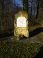
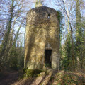
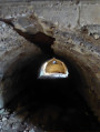
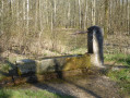
(18) Where the barrier is open, turn left down the embankment to visit another WWI shelter, then return and continue along the cycle path. After passing under the high-voltage power line, keep left down the embankment; you’ll notice a wall – this may be an old railway branch line leading to a tunnel. Carry on for a few hundred metres to reach a picnic area near the old Bouzule station and a memorial stone. 

(19) Carry on to the right, heading due north, along the straight, ascending track. As you emerge from the woods at a place called Grand Pâquis, take the 90° right-hand bend and pass under the high-voltage power line. The path turns north-east and leads to a bend in the track.

(20) Follow it to the left. The track turns into a road. Pass under the high-voltage power line again and continue past the SPA to the junction near the silos.

(21) Turn left, rejoin the GR®5, walk past the Château de Fleur Fontaine and continue uphill, then enter Amance.

(22) Carry on straight ahead along Rue du Faubourg Saint-Jean, then keep left onto Rue Saint-Jean and head towards the church and the car park (S/E).


Waypoints

  1. S/E : mi 0 - alt. 1,234 ft - Car park - Eglise Saint Jean Baptiste
  2. 1 : mi 0.07 - alt. 1,250 ft - Rue Saint-Joseph
  3. 2 : mi 0.26 - alt. 1,188 ft - Junction
  4. 3 : mi 0.51 - alt. 1,122 ft - Amance Cemetery
  5. 4 : mi 1.37 - alt. 801 ft - D 913
  6. 5 : mi 1.71 - alt. 1,001 ft - Bouxières aux Chênes Cemetery
  7. 6 : mi 2.17 - alt. 951 ft - Rue des Noisetieres
  8. 7 : mi 2.27 - alt. 981 ft - Chemin de l’Aulny
  9. 8 : mi 2.66 - alt. 1,066 ft - Rue du Fort
  10. 9 : mi 2.78 - alt. 1,024 ft - Chapelle Saint Etienne à Ecuelle
  11. 10 : mi 2.84 - alt. 1,004 ft - Rue du Général De Gaulle
  12. 11 : mi 3.13 - alt. 886 ft - Chemin de la Justice
  13. 12 : mi 3.33 - alt. 876 ft - Chemin de Fontenis
  14. 13 : mi 4.24 - alt. 899 ft - The Voie de Brin
  15. 14 : mi 5.02 - alt. 928 ft - Monaire
  16. 15 : mi 5.25 - alt. 896 ft - Bouxières Road – Brin Forest
  17. 16 : mi 5.32 - alt. 892 ft - Remains from the First World War
  18. 17 : mi 6.82 - alt. 774 ft - Rond Bouteiller
  19. 18 : mi 7.55 - alt. 764 ft - World War I shelter
  20. 19 : mi 8.19 - alt. 741 ft - Prés Moisis. Near the - Amezule (rivière)
  21. 20 : mi 9.07 - alt. 768 ft - Grand Paquis
  22. 21 : mi 10 - alt. 942 ft - Crossroads – Silos - Château de Fleur Fontaine
  23. 22 : mi 10.68 - alt. 1,152 ft - Crossroads – Entrance to Amance
  24. S/E : mi 11.08 - alt. 1,227 ft - Car park - Eglise Saint Jean Baptiste

Worth a visit

Before setting off or on your return, visit the church – a listed building – and the viewpoint at the far end of the park.

There is also a viewpoint at the junction of Rue Saint-Joseph and Rue Saint-Charles.

There is also a viewpoint on the track after the cemetery, on the descent. 

In Bouxières-aux-Chênes, the wash house at the roundabout, the church, the three fountains and a few lintels.

In Écuelle, the château, Saint-Étienne Chapel, the fountain and the wash house.

On entering the Amance State Forest, there are a number of remains from the First World War.

On the cycle path, which is a former railway line, there are further remains from the First World War. If you could provide me with any information about what appears to be a railway junction and a tunnel, I’d be grateful.

The memorial stone at a place called Prés Moisis.

On the way back, Fleur Fontaine Castle.

Always be cautious and plan ahead when you're outdoors. Visorando and the author of this route cannot be held responsible for any accidents occurring on this route.

The GR® and PR® markings are the intellectual property of the Fédération Française de Randonnée Pédestre.

Reviews and comments

3.8 / 5
Based on 2 reviews

Reliability of the description
4 / 5
Ease of following the route
4 / 5
Route interest
3.5 / 5
Christelle1488
Christelle1488

Overall rating : 4 / 5

Date of your route : May 26, 2025
Reliability of the description : ★★★★☆ Good
Ease of following the route : ★★★★☆ Good
Route interest : ★★★★☆ Good
Very busy route : Yes

There’s quite a bit of cycling on the last part of the walk; I can confirm there’s a lot of tarmac, but that said, it’s still a pleasant and easy walk.

The road is indeed cut off after point 21. There’s very little shade, so I wouldn’t recommend it in hot weather.

Machine-translated

franchie
franchie

Overall rating : 3.7 / 5

Date of your route : Apr 03, 2025
Reliability of the description : ★★★★☆ Good
Ease of following the route : ★★★★☆ Good
Route interest : ★★★☆☆ Average
Very busy route : No

The first part of the walk was very pleasant, taking us through Bouxières-aux-Chênes with its many fountains, as well as Ecuelle. From point 12 onwards, there was a bit too much tarmac, then in the Brin Forest, long, straight and slightly monotonous paths – and I found this detour unnecessary, unless you’re passionate about First World War monuments. At point 21, in front of Fleur Fontaine Castle, the road was closed to all traffic due to roadworks. I kept a low profile and went round the tower through the private grounds to continue and complete my walk.
I think there must be a way to avoid the road by heading up from Monrepentir Farm, crossing the Bois du Grand Mont and rejoining the route just after point 13...

Machine-translated

Other walks in the area

For more walks, use our search engine .

The GPS track and description are the property of this route's author. Please do not copy them without permission.