Greater Nancy between Pulnoy and Dommartin-sous-Amance

Part of the ‘Tour du Grand Nancy’ route, a circular route between Pulnoy and Dommartin-sous-Amance.
The route passes through the towns of Pulnoy and Seichamps, then climbs up to the Haut de Baxa plateau for some stunning views, before reaching the village of Dommartin-sous-Amance via a stony track, passing by the Monteux farm.
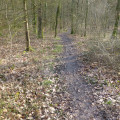
Return via a section of cycle path, a stony track and field paths, passing the underground gas storage facilities. The route finishes with a stretch through the Pulnoy woods, running alongside the golf course.

Details

43818144
Creation:
Last update:
Last review:
  • Walking
    Activity: Walking
  • ↔
    Distance: 9.79 mi
  • ◔
    Average duration: 4h 50 
  • ▲
    Difficulty: Moderate

  • ⚐
    Back to start: Yes
  • ↗
    Ascent: + 420 ft
  • ↘
    Descent: - 407 ft

  • ▲
    Highest point: 932 ft
  • ▼
    Lowest point: 699 ft

Photos

Description of the walk

Start from the car park on Chemin du Haut des Vignes in Pulnoy, accessible via Route de Saulxures.

(S/E) Head down towards the Route de Saulxures and take the first stony track on the right, the Chemin Communal du Bois de Pulnoy. Turn onto the second small track on the left, cross the Rue de Lorraine and continue straight on along the Rue du Tir, passing to the left of the water tower.

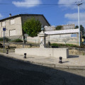
(1) At the end of the street, turn right onto the Route de Saulxures, walk past the church and turn into the second street on the right, Rue de la République.

(2) At the next junction, turn left onto Rue de Seichamps, cross Avenue Charles de Gaulle on the right via the cycle path and carry on straight ahead, still on Rue de Seichamps, then onto Route de Pulnoy, staying on the cycle path.

(3) Before the roundabout, at Parc du Jardin Roussel, take the street on the left which runs alongside the garden.

(4) At the 90° bend in this street, carry on straight ahead onto Chemin des Bonnetons. Cross Rue du Puits Losey and carry on straight ahead along Rue de la Prairie.

(5) Turn right to go past the church, then left onto the Grande Rue.

(6) At the junction with the standpipe, carry straight on along Grande Rue until you reach the end.

(7) Turn right onto Route de Sarreguemines and immediately left onto the uphill street, Rue du Chanois, until you reach the top of the hill.

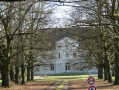
(8) Turn left onto a stony track, the Chemin de la Côte du Chanois, and follow this lovely path (GRP®) to reach the Route de Dommartin-sous-Amance, passing through the Monteux farm.

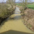
(9) At the Dommartin road, turn right, cross over the Amezule, cross the cycle path and continue uphill into the village via Rue Louis Pasteur.

(10) Take the first street on the left to visit the church and then return.

(10) Head downhill to the right along Rue Louis Pasteur and immediately turn left into Rue Jules Vernes. Cross over the Ruisseau des Étangs.

(11) Turn into the first street on the right (a cul-de-sac) to rejoin the cycle path, passing alongside a wire-mesh fence, and head left towards the sewage treatment works.

(12) Turn right onto the gravel track Les Grandes Fauchées, cross over the Amezule at Pont Voiré and, at the junction, carry on straight ahead. The track turns into a field path leading to the D674.

(13) Cross with care and continue straight on along the uphill track. Pass a telecoms mast, then the underground gas storage facility, and arrive at a small road.

(14) Turn right, pass under the two high-voltage power lines, enter the town of Seichamps and turn onto the track on the left which runs behind the detached houses. The track turns into a field path and joins a small road.

(15) Directly opposite the two high-voltage power lines, turn right. At the D83, keep to the right on the verge between the ditch and the fence.

(16) Between the two property entrances, cross the small ditch and carefully cross the D83 to join a small woodland path marked by a round iron post, continuing until you reach a T-junction where two small paths meet.

(17) Turn right and continue straight on along the golf course fence. Join a track and turn right, cross a small path and continue straight on along the wide track to reach the car park (S/E).


Waypoints

  1. S/E : mi 0 - alt. 801 ft - Pulnoy Wood Local Path
  2. 1 : mi 0.5 - alt. 738 ft - Rue du Tir
  3. 2 : mi 0.75 - alt. 741 ft - Rue de la République
  4. 3 : mi 1.6 - alt. 787 ft - Roussel Garden
  5. 4 : mi 1.72 - alt. 771 ft - Chemin des Bonnetons
  6. 5 : mi 1.87 - alt. 755 ft - Church Square
  7. 6 : mi 1.98 - alt. 758 ft - Fountain marker
  8. 7 : mi 2.13 - alt. 784 ft - Route de Sarreguemines
  9. 8 : mi 2.3 - alt. 873 ft - Chemin de la Côte du Chanois
  10. 9 : mi 3.99 - alt. 699 ft - Amezule (river) – a tributary of the Meurthe
  11. 10 : mi 4.29 - alt. 745 ft - Rue Louis Pasteur
  12. 11 : mi 4.59 - alt. 702 ft - Rue Jules Vernes
  13. 12 : mi 5.1 - alt. 705 ft - The Pont Voiré
  14. 13 : mi 6.37 - alt. 804 ft - Le Saulcy
  15. 14 : mi 6.88 - alt. 869 ft - Les Sablons
  16. 15 : mi 8.1 - alt. 873 ft - Coin du Cendrier
  17. 16 : mi 8.48 - alt. 797 ft - The round iron post
  18. 17 : mi 8.68 - alt. 840 ft - Vervau Woods – Nancy-Pulnoy Golf Course
  19. S/E : mi 9.79 - alt. 801 ft - Pulnoy Wood Local Path

Notes

In the built-up area, use the pedestrian crossings at every junction.
This walk is best done in dry weather.

Worth a visit

Churches and fountains in the two towns and the village you pass through.
Views of Amance and Laitre-sous-Amance, as well as Pulnoy and Seichamps.
On the way back, enjoy a pleasant walk along a narrow path through the Pulnoy woods, running alongside the golf course.

Reviews and comments

4.7 / 5
Based on 2 reviews

Reliability of the description
5 / 5
Ease of following the route
5 / 5
Route interest
4 / 5
Alison54
Alison54

Overall rating : 4.7 / 5

Date of your route : Feb 22, 2025
Reliability of the description : ★★★★★ Very good
Ease of following the route : ★★★★★ Very good
Route interest : ★★★★☆ Good
Very busy route : No

A lovely walk; some sections are very muddy, so it might be best to avoid it in wet or rainy weather. I didn’t come across anyone. The countryside is lovely, the villages picturesque, and it’s an easy walk.

Machine-translated

er6661re
er6661re

Overall rating : 4.7 / 5

Date of your route : Mar 10, 2024
Reliability of the description : ★★★★★ Very good
Ease of following the route : ★★★★★ Very good
Route interest : ★★★★☆ Good
Very busy route : No

We only did part of the walk starting from Seichamps Espace des Parapluies.
Unfortunately, it was raining.

Machine-translated

Other walks in the area

For more walks, use our search engine .

The GPS track and description are the property of this route's author. Please do not copy them without permission.