Country:
 City:
City:


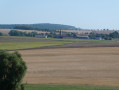
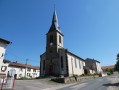
The walk starts at Saint-Nicolas Church on Grande Rue in Hoéville. Parking is available near the church.
(S/E) Facing the church entrance, set off along the Grande Rue (D84) on the left-hand side of the church. On leaving the village, take the road leading uphill to the right towards Bezange-la-Grande.
(1) Take the track on the right, at the top of the hill before the orientation board, at the wooden signpost. At the 313-metre mark, continue straight on towards the woods.
(2) At the entrance to the woods, at the Y-junction where two small paths meet, turn right, following the ‘Red Circle’ markings. Join the Tranchée de Ranzey track and continue straight on.
(3) At the X-junction of two stony tracks, turn left. At the T-junction of two tracks, turn right towards Ferme de Ranzey.
(4) At the end of the stony track, which forms a small clearing, continue straight on along the woodland track, following the Red Circle markings. Please note: shortly afterwards, there is a tricky section (in 2026); forestry work has created numerous tracks not shown on the map. At the Y-junction, turn left, then continue straight on.
(5) At the Y-junction where two tracks meet, turn right. At the next Y-junction where two tracks meet, turn left; then, at the Y-junction two tracks further on, turn right.
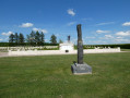
(6) At the next Y-junction of two tracks, continue to the right and, at the following junction, take the path on the right to leave the woods , passing an area of trenches dating from the 1914–1918 War.
(7) Walk through the hamlet of Ferme de Ranzey and continue along the small road marked ‘Ferme de Ranzey’.
(8) Pass the resurgence and the Athienville stream. Join the Grande Rue d’Athienville (D123).
(9) Turn left to cross the village, passing the church. At the cemetery, turn right onto the Chemin du Sorbier. Join the D123.
(10) Turn right, then immediately left onto the D72. At the junction, continue to the right (D72).
(11) At the start of the hairpin bend on the D72, take the small road leading downhill to the right, towards Ferme Saint-Jean. Continue along the first track on the left; at the bend to the right, continue along the small road leading uphill.
(12) At the T-junction, follow the track to the left. Before the high-voltage power line, take the grassy track on the right, which turns into a narrow woodland path.
(13) At the wide stony track, turn left. Join the D84 and turn right. Enter the village of Hoéville and carry on straight ahead to reach the church (S/E).
 Visorando Member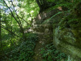

 Easy
Easy