A circular walk from Bagnères-de-Bigorre to Beaudéan

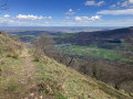
Set off along the Grand Allée Maintenon, then walk along a small, ascending path below the Petit Monné, with some lovely views, before descending towards the village of Beaudéan through a boxwood copse. Before reaching the village, take a short detour via Le Serris

Details

n°109412390
Creation:
Last update:
Last review:
–
  • Walking
    Activity: Walking
  • ↔
    Distance: 8.07 mi
  • ◔
    Average duration: 5h 15 
  • ▲
    Difficulty: Moderate

  • ⚐
    Back to start: Yes
  • ↗
    Ascent: + 1,795 ft
  • ↘
    Descent: - 1,762 ft

  • ▲
    Highest point: 2,835 ft
  • ▼
    Lowest point: 1,818 ft

Photos

Description of the walk

The walk starts at the public car park in front of the Le Maintenon block of flats, 11 Rue des Pyrénées in Bagnères-de-Bigorre.

(S/E) Facing the front of the building, turn left and head up Rue des Pyrénées. After the small car park, go up the steps on the right.

(1) At the top of the steps, continue straight on along Allée de Maintenon, then Chemin de Médous. Almost at the end of the small road, turn sharply right at the junction.

(2) Take the first small path leading uphill to the left until you reach a junction of three paths at the edge of a woodland.

(3) At the end of the track, head up to the right onto the Tour du Serris path.

(4) Join the small Route de Serris Darre, then turn right onto the descending road.

(5) At the junction, turn onto the small road on the left, take the sharp bend to the right and continue straight down the hill.

(6) At the end of the road, take the Camis de Serris Daouan on the left and continue downhill.

(7) At the Y-junction, turn left onto Rue du Pouey and continue to the cemetery.

(8) After the low wall by the church, take the small path leading down to the left and walk past the church.

(9) At the end of the path, by the fountain, turn left onto Rue de la Fontaine.

(10) At the junction, turn left, passing in front of the town hall and the wash house.

(11) At the end of the street, turn left.

(12) After a few metres, take the path leading uphill to the right, Chemin du Serris, and head towards a fork in the path you passed on the way there.

(3) Continue to the right along the path in the opposite direction to the outward journey and head for the car park (S/E).

Waypoints

  1. S/E : mi 0 - alt. 1,818 ft - Public car park
  2. 1 : mi 0.07 - alt. 1,827 ft - Allée de Maintenon
  3. 2 : mi 1.52 - alt. 2,044 ft - Dessus Médous
  4. 3 : mi 2.45 - alt. 2,385 ft - Dusturons. Junction where the circular loop branches off
  5. 4 : mi 3.35 - alt. 2,779 ft - Serris Darre
  6. 5 : mi 3.46 - alt. 2,664 ft - Côte d’Esquiou
  7. 6 : mi 3.98 - alt. 2,421 ft - Cami Serris Daouan
  8. 7 : mi 4.94 - alt. 2,116 ft - Pouey Road
  9. 8 : mi 5.11 - alt. 2,080 ft - At the end of the wall
  10. 9 : mi 5.16 - alt. 2,057 ft - Rue de la Fontaine
  11. 10 : mi 5.19 - alt. 2,054 ft - Town hall
  12. 11 : mi 5.26 - alt. 2,067 ft - Rue du Château
  13. 12 : mi 5.27 - alt. 2,073 ft - Tour du Serris
  14. S/E : mi 8.07 - alt. 1,821 ft - Public car park

Worth a visit

From the narrow path, there are lovely views of Asté and the Campan valley.

Views of the mountains around Beaudéan.

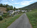
Views of the isolated houses of Le Serris.

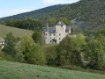
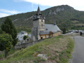
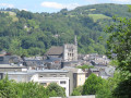
The village of Beaudéan with its church, castle and fountains.

Other walks in the area

For more walks, use our search engine .

The GPS track and description are the property of this route's author. Please do not copy them without permission.