Greater Nancy, between Coyviller and Rosières-aux-Salines

Part of the Tour du Grand Nancy route, a circular stage between Coyviller and Rosières-aux-Salines.
A walk mainly along gravel tracks, except in the Bois de la Blanche Croix.
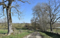
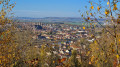
Setting off from the village of Coyviller along a lovely track, the route arrives above Rosières-aux-Salines with a view of the salt pans, then descends into the village to visit these three monuments: the church, the fountain and the fortified tower.
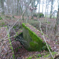
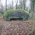
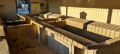
Climb back up onto the plateau to reach the Bois de la Blanche Croix, where you’ll find a blockhouse with its shelter and trenches – a remnant of the First World War – offering a stunning view over the Meurthe valley.
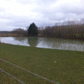
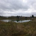
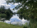
Return via tracks and a short stretch of road to reach the two ponds at Coyviller.

Details

43155753
Creation:
Last update:
Last review:
  • Walking
    Activity: Walking
  • ↔
    Distance: 9.04 mi
  • ◔
    Average duration: 4h 50 
  • ▲
    Difficulty: Moderate

  • ⚐
    Back to start: Yes
  • ↗
    Ascent: + 735 ft
  • ↘
    Descent: - 741 ft

  • ▲
    Highest point: 994 ft
  • ▼
    Lowest point: 686 ft
  • ⚐ Country: France
  • ⚐ City: Coyviller (54210)
  • ⚑
    Start/End: N 48.587105° / E 6.281257°
  • ❏
    IGN map(s): Ref. 3416E, 3416O
  • Hour-by-hour weather

Photos

Description of the walk

The walk starts at Coyviller Church, on Rue de l’Église. Parking is available on Rue de Manoncourt.

(S/E) With your back to the church door, head towards Rue de Manoncourt and turn left. At the end of the street, turn left onto Grande Rue until you reach a Y-junction.

(1) Turn right onto Route de Rosières and, at the Y-junction on the outskirts of the village, turn left and stay on this track. At the crossroads where two tracks meet, carry on straight ahead for a further 450 m until you reach the next junction (elevation 277).

(2) Turn right onto Route du Chalet, then take the first street on the left for 60 m.

(3) Go down the first street on the right, Sentier Haute Chappe, and, at the end of the street, carry on straight ahead along the small path. Cross Rue Victor Hugo and continue downhill along the Sentier de la Basse Chappe. You’ll come out onto Rue Saint Urbain.

(4) Turn left, cross Rue Joliot Curie and carry on straight ahead until you reach Rue des Écoles.

(5) Turn right onto this street and, at the car park, turn left, walk past the church and across the square with its fountain. Continue straight on along Rue Gambetta.

(6) Head towards the fortified tower.

(7) After viewing both sides, retrace your steps.

(6) Turn right onto Rue de Nancy, opposite the town hall. Walk past the fountain and, at the junction with Rue de Metz, continue up the road opposite Place d’Alsace. Keep straight on; the road becomes a track, Chemin de la Grande Taye. You will then reach a fork in the road.

(8) Keep left and carry on straight ahead to reach the junction you passed on the way out.

(2) Take the track on the right (GRP®).

(9) At the next fork, continue straight on (GRP®) to reach the Bois de la White Cross.

(10) Leave theGRP® and turn right onto a grassy track; after 30 m, turn left to enter the woods and follow the track along the edge of the woods. At the Y-junction, turn left and follow this new track. Take the 90° bend. The track disappears, but carry on straight ahead for 100 m to reach the edge of the woods and the clearly visible blockhouse.

(11) Turn back and rejoin the GRP®.

(10) Turn left onto the GRP® and follow it to the junction you passed on the way out.

(9) Leave theGRP®, turn right onto the track and follow it to the end.

(12) Turn left, cross over the Petit Rhône stream and join the D1a.

(13) Follow it to the left until you reach the first grassy track on the right.

(14) Turn right onto this track, then at the next junction, turn left and pass in front of the two ponds.

(15) At the end of the track, turn left to rejoin the D1a.

(16) Follow it to the right towards the village and, after the cemetery, take the first street on the right. Then turn left to reach the church and the car park (S/E).

Waypoints

  1. S/E : mi 0 - alt. 892 ft - Coyviller Church
  2. 1 : mi 0.09 - alt. 922 ft - Route de Rosières
  3. 2 : mi 2.32 - alt. 909 ft - Saint Simon hilltop. Junction of the first circular loop
  4. 3 : mi 2.65 - alt. 823 ft - Haute Chappe Trail
  5. 4 : mi 2.82 - alt. 692 ft - Basse Chappe Trail
  6. 5 : mi 2.89 - alt. 692 ft - The schools
  7. 6 : mi 3.09 - alt. 689 ft - Junction. Return trip to the fortified tower
  8. 7 : mi 3.16 - alt. 689 ft - Fortified tower
  9. 8 : mi 3.64 - alt. 886 ft - Chemin de la Grande Taye
  10. 9 : mi 4.06 - alt. 909 ft - Crossroads: 2nd circular loop
  11. 10 : mi 4.62 - alt. 958 ft - White Cross. Fork in the path. Return to the blockhouse
  12. 11 : mi 5.14 - alt. 915 ft - The Blockhouse
  13. 12 : mi 7.12 - alt. 761 ft - Noire Corvée
  14. 13 : mi 7.43 - alt. 761 ft - D 1a
  15. 14 : mi 8.3 - alt. 814 ft - The Petit Rhône
  16. 15 : mi 8.67 - alt. 837 ft - The ponds
  17. 16 : mi 8.8 - alt. 860 ft - Return via the CD 1a
  18. S/E : mi 9.04 - alt. 892 ft - Coyviller Church

Worth a visit

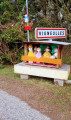
A visit to the village of Coyviller, its church and its wayside cross.
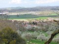
On arriving above Rosières-aux-Salines, the view over the Meurthe valley.
A visit to Rosières-aux-Salines, including the church, the fountain and the Banban, a listed monument.
The blockhouse, along with its shelter and the access trenches still visible in the Bois de la White Cross, a remnant of the First World War, offering a stunning view of Dombasle-sur-Meurthe.

Reviews and comments

4.8 / 5
Based on 2 reviews

Reliability of the description
5 / 5
Ease of following the route
5 / 5
Route interest
4.5 / 5
yatonie
yatonie
• Edited:

Overall rating : 4.7 / 5

Date of your route : Apr 12, 2025
Reliability of the description : ★★★★★ Very good
Ease of following the route : ★★★★★ Very good
Route interest : ★★★★☆ Good
Very busy route : No

A lovely walk through the fields of the Lorraine countryside.
The route is very easy to follow apart from point no. 11 (the bunker); the path through the forest isn’t very easy to follow, so you could get lost if you don’t use the GPS map to find your way. It would therefore be easier to walk along the edge of the forest on the right rather than going into it.
The road section is a bit long but actually goes by quite quickly in the end.

Machine-translated

rgo54
rgo54

Overall rating : 5 / 5

Date of your route : Jul 14, 2024
Reliability of the description : ★★★★★ Very good
Ease of following the route : ★★★★★ Very good
Route interest : ★★★★★ Very good
Very busy route : No

A very varied route taking you through orchards (where you can pick fruit!), sheep fields, and pastures with ponies and horses… from where you can admire the beautiful rolling countryside.
Only the section on the road is a bit long…

Machine-translated

Other walks in the area

For more walks, use our search engine .

The GPS track and description are the property of this route's author. Please do not copy them without permission.