Between Dolcourt and Favières, returning via the Croix du Capitaine

A circular walk starting from Dolcourt to Favières, offering a stunning view at Le Dahout, passing through Saulxerotte and returning via the Bois de Selaincourt to the Croix du Capitaine, ending at the Saint-Jean de Cotance Chapel.

Details

31201823
Creation:
Last update:
Last review:
  • Walking
    Activity: Walking
  • ↔
    Distance: 8.48 mi
  • ◔
    Average duration: 4h 30 
  • ▲
    Difficulty: Moderate

  • ⚐
    Back to start: Yes
  • ↗
    Ascent: + 692 ft
  • ↘
    Descent: - 692 ft

  • ▲
    Highest point: 1,411 ft
  • ▼
    Lowest point: 1,079 ft

Photos

Description of the walk

The walk starts at the wash house/fountain on Grande Rue in Dolcourt: parking available.

(S/E) Continue up the Grande Rue, then take the second street on the left, Rue du Gueoir, and at the fountain, turn right onto Rue Haute. At the end of the street, continue straight on along the stony track and then the grassy track until you reach a junction where several paths meet.

(1) Turn right onto a stony track and, at the next junction, turn left onto Chemin du Thiant until you reach the start of a track on the left.

(2) Carry on straight ahead, go round the back of the chapel and continue along Rue de la Viacelle.

(3) At the end of the street, head up to the right onto Rue du Docteur Liebault, and at the Y-junction, turn left onto Rue de Saulxerotte. Cross Rue du Saintois (D12) with care and continue straight ahead on the small road towards Saulxerotte.

(4) At a wide bend in the road, turn left and carry on straight ahead along the grass track. Join Rue de Tarveau and turn left.

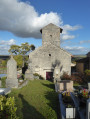
(5) At the end of the street, by the church, turn right onto Rue François Mendes. Continue straight on along Rue de Colombey to leave the village via the small road, which further on becomes a stony track and reaches a Y-junction at a place called La Croisette.

(6) Keep left and, at the next X-junction, turn right onto the old railway line.

(7) At the three-way junction that follows, turn right and continue along the ascending stony track to join the forest road known as Tranchée du Pied Cornu.

(8) Turn left onto the forest track. Before the climb, at no. 26, turn left onto a wide forest track, then at no. 30, take a path to the right.

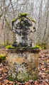
(9) At an X-shaped junction between the clearly visible path and a barely marked path, turn left for 5 metres to see the Croix du Capitaine. Turn back until you reach the left-hand bend on the Tranchée du Pied Cornu.

(8) Ignore the route you have already taken and continue along the forest road to the D12.

(10) Cross with care and head to the right. Take the first field path on the left to join a small road.

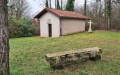
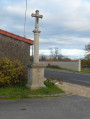
(11) Head left towards the copse to see the small wayside cross, then retrace your steps and take the stony track on the left. Before entering the woods, at the signpost, turn left towards the Chapelle Saint-Jean de Cotance.

(12) At the chapel, continue straight on down to the village along the small forest track. You’ll emerge at the monument; turn left onto Grande Rue and head down towards the wash house/fountain (S/E).


Waypoints

  1. S/E : mi 0 - alt. 1,115 ft - Washing house/fountain on Grande Rue
  2. 1 : mi 0.94 - alt. 1,332 ft - Multiple junctions
  3. 2 : mi 1.84 - alt. 1,198 ft - Thiant
  4. 3 : mi 2.06 - alt. 1,207 ft - Rue de la Viacelle
  5. 4 : mi 2.46 - alt. 1,220 ft - Rue de Saulxerotte
  6. 5 : mi 2.64 - alt. 1,155 ft - Rue François Mendes
  7. 6 : mi 3.43 - alt. 1,106 ft - La Croisette
  8. 7 : mi 3.78 - alt. 1,096 ft - Former railway line, turn right
  9. 8 : mi 4.51 - alt. 1,217 ft - Pied Cornu Trench
  10. 9 : mi 5.04 - alt. 1,224 ft - La Croix du Capitaine
  11. 10 : mi 7.05 - alt. 1,335 ft - Ramblanchamp, D12
  12. 11 : mi 7.46 - alt. 1,381 ft - Road junction
  13. 12 : mi 8.16 - alt. 1,388 ft - Chapelle Saint Jean de Cotance
  14. S/E : mi 8.48 - alt. 1,115 ft - Washing house/fountain on Grande Rue

Notes

Alternative route:
(2) You can take a short detour via the leisure centre by turning left, crossing the leisure centre, then turning right onto Rue du Vallon Derrière Jouve, and walking up Rue du Docteur Liebault.

Worth a visit

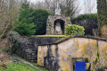
The fountains and washhouses of Dolcourt.

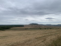
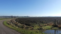
In Dahout, a panoramic view of Sion Hill, the Bois d’Anon and, in the distance, the Bainville hillside overlooking Mâdon

(2) In Favières, at the Thian crossroads, you can head down towards the leisure centre and rejoin the route by walking back up into the village via Rue du Docteur Liebault.

Pass through the centre of Saulxerotte to see its church.

(9) Walk through the Bois de Selaincourt to reach the Croix du Capitaine: whilst there is indeed a stone cross in honour of a woodcutter, the ‘Capitaine’ is actually a remarkable tree nearby.

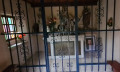
(12) Saint-Jean de Cotance Chapel.

Reviews and comments

3.9 / 5
Based on 3 reviews

Reliability of the description
4 / 5
Ease of following the route
4 / 5
Route interest
3.7 / 5
User 30158828

Overall rating : 3 / 5

Date of your route : Aug 03, 2026
Reliability of the description : ★★★★☆ Good
Ease of following the route : ★★☆☆☆ Disappointing
Route interest : ★★★☆☆ Average
Very busy route : No

There are a lot of road signs missing… where have they gone? Without the Visorando app on my phone, it would have been impossible to follow the route…
Choose a day with little sun and not too much heat, as there’s very little shade… you walk alongside the woods… or along forest paths where the trees are too young to provide shade…
Best avoided when it’s 30° 🥵🥵😅😅

Machine-translated

François VERNIER
François VERNIER

Overall rating : 4.3 / 5

Date of your route : Apr 06, 2025
Reliability of the description : ★★★★☆ Good
Ease of following the route : ★★★★★ Very good
Route interest : ★★★★☆ Good
Very busy route : No

All the paths are wide and clearly marked. Only the final section of the route, after the Saint-Jean de Cotance chapel, follows a sloping path that turns into a stream towards the end (watch your step to avoid slipping). The scenery is beautiful around the Bois d’Anon and Sion Hill.

Machine-translated

Christecol
Christecol

Overall rating : 4.5 / 5

Date of your route : Feb 11, 2025
Reliability of the description : Not used / Not applicable
Ease of following the route : ★★★★★ Very good
Route interest : ★★★★☆ Good
Very busy route : No

A pleasant afternoon walk without any particular difficulties, which I went on after a good downpour the day before. Some of the paths were very muddy, and the return journey past the chapel took me through a stream.

Machine-translated

Other walks in the area

For more walks, use our search engine .

The GPS track and description are the property of this route's author. Please do not copy them without permission.