The two Drouvets and the Twin Lakes, Estaris, Sirènes and Jujal

Ascent via the tracks and path to Drouvet 1, then on to Drouvet 2 via the Pointe de Méollion.
Junction on the mountainside between Drouvet 2 and Lac des Estaris.
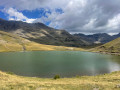
Return via the Lacs des Jumeaux, Lac des Sirènes and Lac Jujal.

Details

30843338
Creation:
Last update:
Last review:
  • Walking
    Activity: Walking
  • ↔
    Distance: 9.88 mi
  • ◔
    Average duration: 7h 10 
  • ▲
    Difficulty: Difficult

  • ⚐
    Back to start: Yes
  • ↗
    Ascent: + 2,999 ft
  • ↘
    Descent: - 2,999 ft

  • ▲
    Highest point: 8,819 ft
  • ▼
    Lowest point: 5,978 ft

Photos

Description of the walk

Start from the Orcières Merlette resort in the car park between the tourist office and the Espace Écrins.

(S/E) Take the road uphill towards the Espace Écrins, walk past the Drouvet 1 Télémix building and continue along the track. At the Y-junction, carry on straight ahead. At the small clearing, continue along the track.

(1) At the next junction, take the track on the right and follow it to the crossroads.

(2) Turn left towards “Les Croze” and carry on straight ahead along the narrow path to reach the two Télémix stations.

(3) Pass between the two stations, then continue along a grassy track, turning left twice. At the next Y-junction, turn right to pass under the Méollion ski lift several times and continue to a Y-junction.

(4) Take the steep grassy slope on the left to reach the Pointe du Méollion, staying below the ski lift, and arrive at the Pointe du Méollion.

(5) At the top of the ski lift, turn onto the wide track on the right and head towards the top of the Drouvet 2.

(6) Cross the summit of Drouvet 2, follow the descending track to the left and continue along the ascending path to Lac des Estaris.

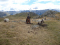
(7) At the lake, turn right to reach a signpost near the stone building.

(8) At the signpost, head down the track towards the Lacs les Jumeaux. At the bottom of the descent, join a track, turn right, and at the next junction turn left onto a grassy track to pass between the two lakes.

(9) After the two lakes, turn right and follow the stream; continue straight on to join a track and pass to the right of Lac des Sirènes. Continue down the track to reach the Roche Rousse resort.

(10) At the resort, at the Chalet de Roche Rousse signpost, turn left towards Lac de Jujal, then take the path branching off to the right which leads down to a track.

(11) Head left. At the next junction with a signpost, follow the signs for Lac de Jujal and carry on straight ahead along the narrow path to pass to the right of the lake, then continue straight down the slope until you reach a fork.

(12) Turn right, heading south-west, and you’ll reach a bridge.

(13) Cross the bridge, take the track on the left, then turn onto the small path leading down to the left alongside the stream. Pass a flight of steps and join a track

(14) Turn left onto it, join a road and follow it to the right, then continue straight on along the Route du Forest to reach a small clearing.

(15) Cross the clearing diagonally, continue down Rue des Écrins and reach the car park (S/E).

Waypoints

  1. S/E : mi 0 - alt. 5,978 ft - Tourist Office car park
  2. 1 : mi 0.27 - alt. 6,132 ft - Montagnou junction
  3. 2 : mi 0.71 - alt. 6,496 ft - Baniols Forest
  4. 3 : mi 1.21 - alt. 6,873 ft - Drouvet 1
  5. 4 : mi 1.91 - alt. 7,589 ft - Junction with a steep climb
  6. 5 : mi 2.25 - alt. 8,068 ft - Pointe de Méollion
  7. 6 : mi 3.15 - alt. 8,655 ft - Tête du Drouvet 2 - Sommet Drouvet (2654m)
  8. 7 : mi 4.9 - alt. 8,442 ft - Lac des Estaris - Grand lac des Estaris
  9. 8 : mi 5.14 - alt. 8,468 ft - Stone chalet - Col de Freissinières
  10. 9 : mi 5.61 - alt. 8,110 ft - Les Jumeaux - Lacs Jumeaux
  11. 10 : mi 6.93 - alt. 7,474 ft - Chalet de Roche Rousse - Lac des Sirènes
  12. 11 : mi 7.54 - alt. 7,287 ft - Track junction - Lac Jujal
  13. 12 : mi 8.15 - alt. 7,139 ft - South-west fork
  14. 13 : mi 8.6 - alt. 6,663 ft - Bridge (Chalet Joubert)
  15. 14 : mi 8.94 - alt. 6,447 ft - Track (Forest des Estaris)
  16. 15 : mi 9.6 - alt. 6,037 ft - Placette
  17. S/E : mi 9.88 - alt. 5,978 ft - Tourist Office car park

Notes

Alternative route: after the Jumeaux, you can turn right towards Lac Profond and Lac Long. Please take care when heading down to Lac des Sirènes, as the descent is very steep.
At Lac des Sirènes, you can also go round it on the left and take the small path on the left at the far end of the lake to reach Lac Jujal. The descent is quicker than via the track but interesting.

Worth a visit

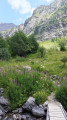
Views of the resort on the way up and down.
At Pointe de Méollion, a view over the Ubac de Méollion valley.
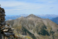
The summit of the Drouvet.
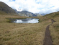
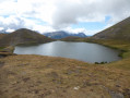
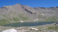
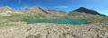
Lakes Estaris, des Jumeaux, des Sirènes and Jujal

Reviews and comments

4.5 / 5
Based on 2 reviews

Reliability of the description
5 / 5
Ease of following the route
4.5 / 5
Route interest
4 / 5
guy. a
guy. a

I set off from the village of Papric; the walk is more enjoyable this way as the descent down the slopes and on the chairlifts, which isn’t particularly interesting, comes at the end of the walk
I found the walk very enjoyable

Machine-translated

User 2297422

Overall rating : 4.3 / 5

Date of your route : Aug 31, 2026
Reliability of the description : ★★★★★ Very good
Ease of following the route : ★★★★☆ Good
Route interest : ★★★★☆ Good
Very busy route : Yes

The climb up to the chairlifts was very steep, along a stony ‘road’ – not at all pleasant – then we lost the path further up and just headed straight up. The whole climb was a bit of a slog, but luckily it was late August and the lifts were closed, so there weren’t many people about. After that, the descent was lovely, with all the lakes. I think I would have preferred to go up via the lakes and finish with the less pleasant part.

Machine-translated

guy. a
guy. a

Overall rating : 4.7 / 5

Date of your route : Oct 13, 2025
Reliability of the description : ★★★★★ Very good
Ease of following the route : ★★★★★ Very good
Route interest : ★★★★☆ Good
Very busy route : No

Superb hike in glorious sunshine

Machine-translated

Other walks in the area

For more walks, use our search engine .

The GPS track and description are the property of this route's author. Please do not copy them without permission.