From Senones towards La Roche Mère Henry and the Malfosse Chapel

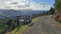
A circular walk starting from Senones, climbing up Rue de Lauviot, passing the ruins from the First World War. Passing the Fontaine de la Loge des Gardes, then arriving at the Quatre Bancs crossroads to climb towards the Roche Mère Henry, with a beautiful viewpoint and ruins from the First World War.

The route continues along the “Chemin de la Roche Mère Henry” memorial trail, passing German and French remains from the First World War, then the Croix du Pelé and the Sartorio Monument, before reaching the Croix de Malfosse crossroads. We then head towards the Chêne de la Vierge and the Malfosse Chapel. We return to the Quatre Bancs crossroads and descend along a small path, passing a blockhouse and the Source des Oiseaux.

Details

88409607
Creation:
Last update:
Last review:
  • Walking
    Activity: Walking
  • ↔
    Distance: 9.62 mi
  • ◔
    Average duration: 6h 00 
  • ▲
    Difficulty: Moderate

  • ⚐
    Back to start: Yes
  • ↗
    Ascent: + 1,827 ft
  • ↘
    Descent: - 1,818 ft

  • ▲
    Highest point: 2,201 ft
  • ▼
    Lowest point: 1,112 ft

Photos

Description of the walk

The walk starts at Place Clémenceau in Senones, where free parking is available.

(S/E) Pass under the portico of Salm Castle to walk round Place Charles Thuman and exit left onto a small street to cross over the Rabodeau. Join Rue de la République.

(1) Cross at the pedestrian crossing and turn left.

(2) At the junction, continue to the right, still on Rue de la République.

(3) Take the first uphill street on the right and, at the Y-junction, carry straight on along Rue de Lauviot, which turns into a track and then back into a small street. At the junction with Rue Jean Aurange, turn right.

(4) Go round Clos Malpré on the right. At the Y-junction at a place called La Combe, turn left towards the Loge des Gardes.

(5) Turn left, continue uphill and arrive at the Les Quatre Bancs junction.

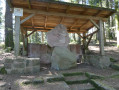
(6) Take the track leading uphill to the left towards Roche Mère Henry and visit the site.

(7) Carry on, passing to the right of the command post on the path signposted “Roche Mère Henry”. Pass in front of the Croix du Pelé and arrive at a junction of small paths.

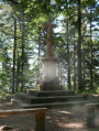
(8) Turn right and walk past the Sartorio Monument. At the next junction, turn left then right to rejoin the signposted path, reach the junction at the Croix de Malfosse and visit the site.

(9) Ignore a track completely and a path branching off to the right at a 90° angle, and continue along the stony track to the right, heading north-west. Carry on straight ahead, following the Yellow Cross markings, until you reach the Chêne de la Vierge junction and visit the site.

(10) Retrace your steps for about twenty metres and turn left twice to reach a stony track.

(11) Follow it to the right, off the marked route, until you reach a small path on the left.

(12) Continue along the descending path, pass the Malfosse Chapel and carry on downhill until you reach another stony track.

(13) Turn right and follow this track until you reach another stony track at elevation 442.

(14) Take this track to the left until you reach a left-hand bend.

(15) Continue to the right along a steeply ascending grass track until the next junction.

(16) Take a sharp right-hand hairpin bend onto the small ascending path which joins another stony track at elevation 557.

(17) Continue to the right. At the three-way junction, carry on straight ahead and rejoin the Quatre Bancs junction, which you passed on the way out.

(6) Continue along the rocky path, marked with a Red Triangle. Head due south and join a small road at Clos Malpré, which you have already passed on the way out.

(4) Follow it straight ahead and downhill to the bend, then follow the route in the opposite direction to the outward journey, which leads to Rue de la République; turn left here and follow it to a road junction.

(2) Turn right and then left into Rue Constant Verlot, above the Rabodeau, to reach Place Clémenceau (S/E).

Waypoints

  1. S/E : mi 0 - alt. 1,115 ft - Place Clémenceau. Towards the - Second châteaux des princes de Salm-Salm (Senones)
  2. 1 : mi 0.25 - alt. 1,115 ft - Rue de la République - Rabodeau (rivière)
  3. 2 : mi 0.34 - alt. 1,112 ft - Junction for the A/R route
  4. 3 : mi 0.44 - alt. 1,125 ft - Rue de Lauviot
  5. 4 : mi 0.88 - alt. 1,427 ft - Le Clos Malpré
  6. 5 : mi 1.9 - alt. 1,755 ft - Loge des Gardes
  7. 6 : mi 2.43 - alt. 1,903 ft - Les Quatre Bancs
  8. 7 : mi 2.77 - alt. 2,162 ft - Roche Mère Henry
  9. 8 : mi 3.41 - alt. 2,060 ft - Sartorio Monument
  10. 9 : mi 4.34 - alt. 1,942 ft - Croix de Malfosse (Senones)
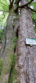
  11. 10 : mi 4.62 - alt. 1,857 ft - The Virgin’s Oak
  12. 11 : mi 4.86 - alt. 1,772 ft - Two paths forming a Y-shape
  13. 12 : mi 5.28 - alt. 1,713 ft - Towards the Malfosse Chapel
  14. 13 : mi 5.77 - alt. 1,342 ft - Malfosse Stream
  15. 14 : mi 6.1 - alt. 1,453 ft - Elevation 442
  16. 15 : mi 6.41 - alt. 1,493 ft - Uphill grassy track
  17. 16 : mi 6.58 - alt. 1,614 ft - Short uphill path
  18. 17 : mi 6.87 - alt. 1,834 ft - Elevation 557
  19. S/E : mi 9.62 - alt. 1,115 ft - Place Clémenceau

Notes

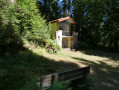
(6) At the ‘Quatre Bancs’ crossroads, there is a shelter with a picnic table.

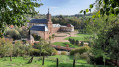
After (12), at the Malfosse Chapel, there are picnic tables and a spring 20 metres further on where you can top up your water supply.

Worth a visit

At the start, the route passes beneath Salm Castle, followed by a visit to Place Charles Thuman.

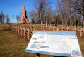
Climb up to the Roche Mère Henry, passing successively by the remains from the First World War, with information panels.

Pass by the Loge des Gardes crossroads with its fountain.

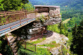
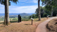
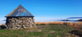
Arrival at Roche Mère Henry, offering a stunning view and featuring World War I remains.

The walk continues along the ridge path of the “Roche Mère Henry”, taking in the German and French remains from the First World War, the Croix du Pelé, the Sartorio Monument, the Croix de Malfosse and the Chêne de la Vierge, before finishing at the Malfosse Chapel.

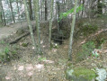
On the path leading down after the Quatre Bancs crossroads, there are further remains and the Fontaine des Oiseaux.

Other walks in the area

For more walks, use our search engine .

The GPS track and description are the property of this route's author. Please do not copy them without permission.