Country:
 City:
City:


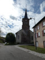
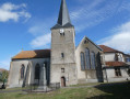
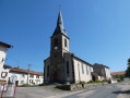
The walk starts at Hénaménil church; parking is available next to the church.
(S/E) Turn your back on the church entrance and head down Grande Rue; at the war memorial, turn left then right to leave the village via Rue du Faubourg. Cross over the Sanon.
(1) Before the bridge over the canal, turn left, head towards the Marne–Rhine Canal and take the cycle path on the right.
(2) At Lock No. 16 in Hénaménil, turn left, cross over the canal, join the D2 and turn right.
(3) At the first road junction, turn left towards Bures, crossing the D2 with care.
(4) After the car park, take the gravel track on the right; this turns into a small path signposted ‘Sentier du Sanon’. When you reach the leisure centre, go round it on the right, following the edge of the pond. You’ll come to a small road, the D2L.
(5) Follow this and, much further on, turn left onto the D2L.
(6) Carry on along the first small road on the right.
(7) At the end of the small road, turn left onto another road
(8) At the junction, carry on straight on towards the village of Bathelémont, passing the Chemin des Américains and its information sign.
(9) At the junction, turn right onto Rue Jean Nicolas Stofflet, pass the Fontaine Saint-Jean, then the First World War blockhouse and the church, and leave the village via Rue de Lorraine.
(10) At the end of the long wall, at the junction with the war memorial, take the stony track on the left to walk past the cemetery.
(11) At the junction, carry on straight ahead, passing the cemetery. Join the D2.
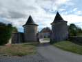
(12) Follow it to the right, through the village. At the end of the village, take the small street on the right for a glimpse of the castle.
(13) Turn round and retrace your steps back towards the village. Turn into the second small street on the right, continue along the narrow lane down the steps; you can take a short detour via the church if you wish. When you reach Grande Rue, turn right, then left into Rue du Moulin.
(14) After crossing over the canal at Bauzemont Lock No. 17, turn left onto the cycle path. Return to the junction you passed at the very start of the walk.
(1) Turn right and, following the route in reverse to the one taken on the way there, head back to the car park at the foot of the church (S/E).
 Visorando Member



 Easy
Easy