The grand tour of the village of Crépey

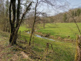
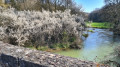
The grand tour of the village of Crépey via the Bois des Cotes, the Bois de Charme, the Bois de la Champelle, the Bois Corrot, the village of Germiny, the Prairie de Souvraincourt, Sainte-Lucie with its viewpoint over part of the Saintois region and, in the distance, the Vosges mountains.

Details

32692670
Creation:
Last update:
Last review:
  • Walking
    Activity: Walking
  • ↔
    Distance: 10.97 mi
  • ◔
    Average duration: 5h 40 
  • ▲
    Difficulty: Moderate

  • ⚐
    Back to start: Yes
  • ↗
    Ascent: + 689 ft
  • ↘
    Descent: - 656 ft

  • ▲
    Highest point: 1,352 ft
  • ▼
    Lowest point: 1,010 ft

Photos

Description of the walk

The walk starts behind Crépey church, in the cemetery car park at the end of Rue Poiron.

(S/E) Leave the car park on the right. Take Rue Poiron and continue to Rue de l’Eglise. Turn left onto this street to leave the village.

(1) On leaving the village, at the T-junction with the fountain and the wayside cross, turn right onto Rue du Ponce, join Rue Jeanne d’Arc and continue straight on.

(2) Take the first street on the left, at the fountain – Rue du Bois des Cotes – which turns into a stony track, and carry on straight ahead. Cross the Bois des Cotes, then the fields, and enter the Bois de Charme.

(3) At the end of the track, in a small clearing, take the stony track to the right and, immediately afterwards, the grassy track to the right. At the T-junction, carry on straight ahead, then immediately turn right onto a barely visible path.

(4) Join a grassy track in the woods and turn right; follow this track to reach the Croix Creusot.

(5) When you reach the road, do not look for the Croix Creusot, as it no longer exists; turn right onto the D4, then take the first stony track on the left at marker 3. Carry on straight ahead along this track.

(6) At the 361-metre mark, in a slight bend in the track, where there is an X-junction and a sign marked No. 16, take the woodland track on the right. At the end of the track, take another grass track on the left and join the D904.

(7) Turn right onto it and follow the road alongside the military installations. Before reaching the building, take the small road on the left, which becomes an uphill track, and enter the Bois Corrot.

(8) On leaving the woods, carry on straight ahead, join a stony track and turn right (the map is not entirely accurate).

(9) After a small copse, at an X-junction, carry on straight ahead to join a small road. At the small road, turn left to enter the village of Germiny.

(10) At the entrance to the village, at the Y-junction, turn right.

(11) At the first junction, turn onto the small road on the right, Rue de la Ferme. At the T-junction, continue to the right, passing under the high-voltage power line, then over the stream and past the La Tuilerie farm.

(12) At the farm, carry on straight ahead along the field track until you reach a T-junction in front of the pond, then turn right.

(13) At the T-junction in Gouhapré, take the stony track on the right and start the climb. In Sainte-Lucien, take a moment to admire the view and continue along the track.

(14) At the top of the second hill, at the T-junction, follow the track down to the left. Turn right onto the first street to reach the cemetery car park (S/E).


Waypoints

  1. S/E : mi 0 - alt. 1,148 ft - Crepey Cemetery
  2. 1 : mi 0.23 - alt. 1,093 ft - Rue du Ponce
  3. 2 : mi 0.46 - alt. 1,050 ft - Rue du Bois des Cotes
  4. 3 : mi 2.04 - alt. 1,345 ft - A small clearing
  5. 4 : mi 2.75 - alt. 1,329 ft - Bois de Charme
  6. 5 : mi 3.36 - alt. 1,240 ft - Croix Creusot
  7. 6 : mi 5.02 - alt. 1,178 ft - Bois de la Champelle
  8. 7 : mi 5.9 - alt. 1,010 ft - D904
  9. 8 : mi 6.72 - alt. 1,204 ft - Bois Corrot
  10. 9 : mi 7.24 - alt. 1,047 ft - On the Giron
  11. 10 : mi 7.88 - alt. 1,033 ft - Route de Crépey
  12. 11 : mi 7.95 - alt. 1,063 ft - Rue de la Ferme
  13. 12 : mi 8.83 - alt. 1,050 ft - La Tuilerie
  14. 13 : mi 9.74 - alt. 1,106 ft - Gouhapré
  15. 14 : mi 10.73 - alt. 1,280 ft - The Gospel
  16. S/E : mi 10.97 - alt. 1,155 ft - Crepey Cemetery

Worth a visit

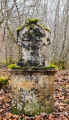
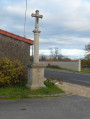
On leaving the village of Crépey, the old drinking trough, the fountain and the wayside cross.
The Bois de la Cote, Bois de Charme, Bois de la Champelle and Bois Corrot.
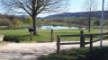
The villages of Crépey and Germiny.
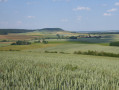
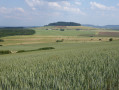
A field at the Tuilerie farm.
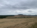
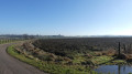
And finally, in Sainte-Lucie, a magnificent panorama, with the Vosges mountains in the distance.

Reviews and comments

4.8 / 5
Based on 2 reviews

Reliability of the description
5 / 5
Ease of following the route
5 / 5
Route interest
4.5 / 5
User 11878029

Overall rating : 4.7 / 5

Date of your route : Sep 13, 2026
Reliability of the description : ★★★★★ Very good
Ease of following the route : ★★★★★ Very good
Route interest : ★★★★☆ Good
Very busy route : No

A long and lovely walk to enjoy whilst taking a picnic with you.
The paths are very well maintained.
There is a small picnic area at the entrance to the village of Germiny at point 11.

Machine-translated

Christelle1488
Christelle1488

Overall rating : 5 / 5

Date of your route : Apr 27, 2025
Reliability of the description : ★★★★★ Very good
Ease of following the route : ★★★★★ Very good
Route interest : ★★★★★ Very good
Very busy route : No

There are a few gentle climbs, though nothing too strenuous – accessible to everyone – with superb views.
The only thing to bear in mind is to bring a cap and plenty of water, as there’s not much shade, so it might be best to avoid it in very hot weather.

Machine-translated

Other walks in the area

For more walks, use our search engine .

The GPS track and description are the property of this route's author. Please do not copy them without permission.