


 Country:

 City:
City:


The walk starts in front of the entrance to the Bagnères-de-Bigorre thermal baths. Paid parking is available in front of the thermal baths, or free parking on Avenue Prosper Nogues.
(S/E) Opposite the thermal baths, turn left onto Boulevard Rolland Castells. At the roundabout, continue right onto Avenue Prosper Nogues.
(1) Take Chemin Bouget on the right and, at the junction, keep left to follow Chemin du Bédat. At the junction, turn left onto the small uphill road, Chemin de la Croix Manse, and navigate the two hairpin bends.
(2) Ignore the return path on the left and carry on straight ahead, staying on Chemin de la Croix Manse.
(3) Turn slightly to the right onto the path leading uphill, towards the Vierge du Bédat.
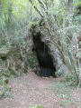
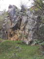
(4) At the junction, turn right and, after a few metres, head up to the left to see the first cave. Then return to the path to continue the gentle climb and reach a four-way junction.
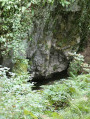
(5) Take the small path on the right leading downhill; you’ll come to a small clearing where you can see the second cave in the hollow to the left.
(6) After your visit, return to the fork in the path.
(5) Carry on straight ahead along the ascending track.
(7) At the junction with a small path, carry on to the right along the track, then take the first path leading uphill to the left. Join another path and turn left.
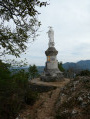
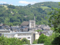
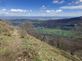
(8) Walk past the orientation board, which is slightly higher up. Carry on to reach the Vierge du Bédat: a viewpoint overlooking Bagnères-de-Bigorre.
(9) Set off again along the small path on the right which winds round the base of the statue. Pass through two hairpin bends and reach an inverted Y-junction.
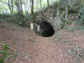
(10) Continue along the path leading down to the left, then take the first path leading up to the left to visit the third cave.
(11) Return to the junction and continue down the path to the left. You’ll come back to the junction you passed on the way there.
(4) Turn right, join a small road and follow it uphill to the right.
(12) Take the first track leading down to the left. Before reaching the private property, follow the path down to the left which leads onto the Chemin de la Croix Manse, the route you took at the start.
(2) Turn right and follow the route in the opposite direction to return to the spa car park (S/E).
 Visorando Member
 Easy
Easy 
 Difficult
